Rough Trail Plus Gray's Arch, The Veranda, Hanson's Point, and Angel Windows

Map of Rough Trail with Martin's Fork Overlook, Gray's Arch, The Veranda, Hanson's Point, and Angel Windows, Red River Gorge
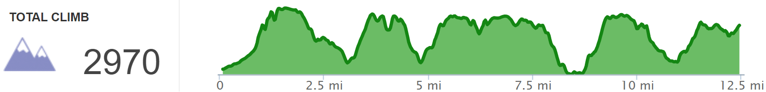
Elevation Profile of Rough Trail with Martin's Fork Overlook, Gray's Arch, The Veranda, Hanson's Point, and Angel Windows, Red River Gorge
Overview. This route is a rite of passage for Kentucky Hikers, and those who travel this path won’t soon forget it. The route described here is the ‘hard way’ moving from west to east and features five steep climbs, four overlooks, four arches, and some truly magnificent forest scenes. Check the notes below for some tips to make this easier.
Route Type | Point to Point
Total Distance | 12.46 miles
Eastbound Elevation Gain | 2,970 feet
Westbound Elevation Gain | 2,622 feet
Overall Difficulty | Strenuous with Three Easy Sections and a Few Class 2 Scrambles
GPS Waypoints
Martin’s Fork Parking Lot | 37.820247, -83.666886
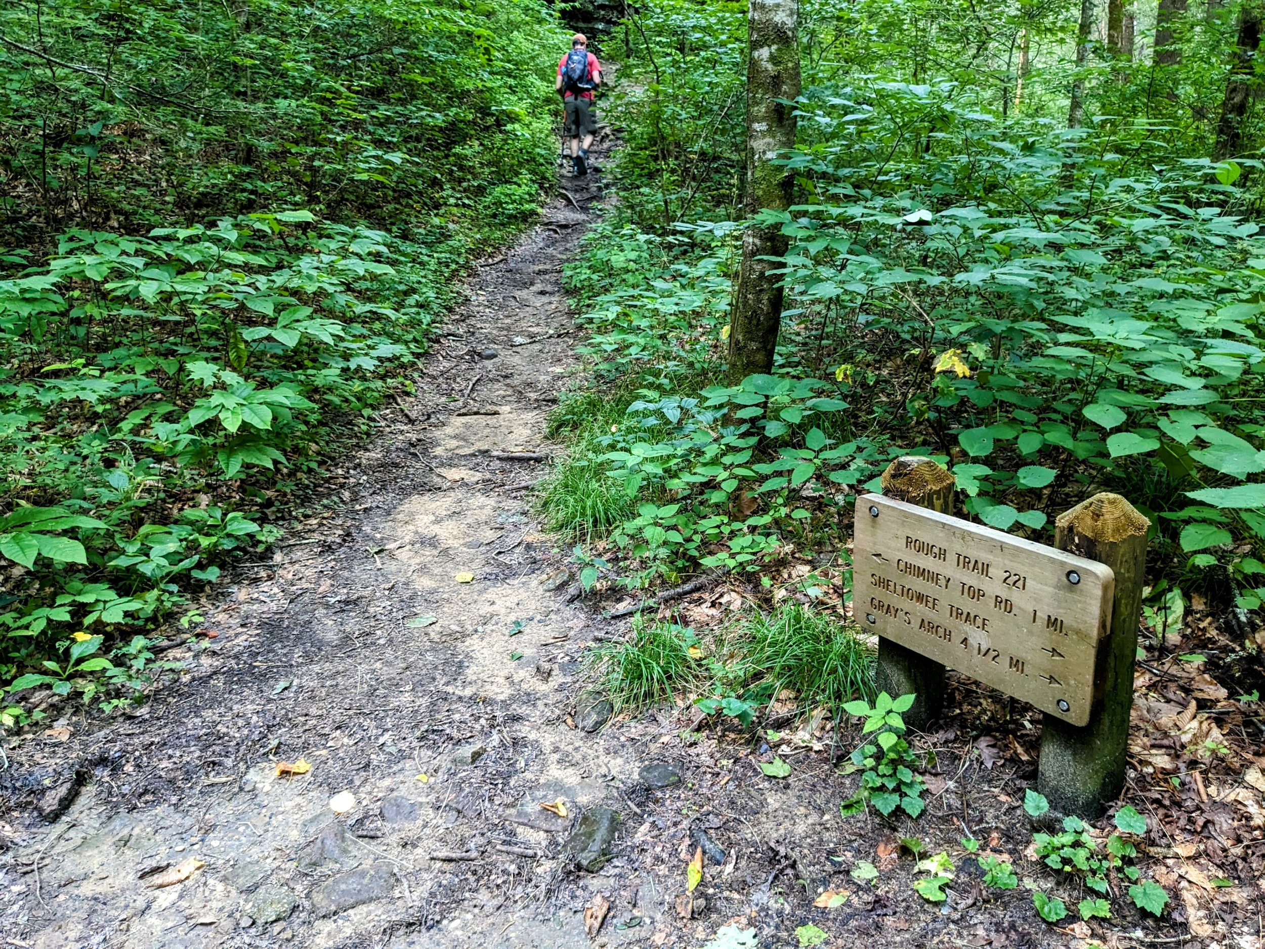
Rough Trailhead | 37.819503, -83.667339
Martin’s Fork Overlook | 37.809008, -83.661961
Gray’s Arch Trail Junction | 37.808953, -83.660511
Mid-step Arch | 37.817942, -83.657719
Turn to Gray’s Arch | 37.817703, -83.658092
Little Gray’s Arch | 37.817742, -83.658144
Gray’s Arch | 37.816986, -83.658031
Turn to The Veranda | 37.819236, -83.645575
The Veranda | 37.818119, -83.641011
Turn to Hanson’s Point | 37.811556, -83.636472
Hanson’s Point | 37.816633, -83.626572
”Lightning Rod Overlook” | 37.810500, -83.634411
Rough Trail Window | 37.803492, -83.603447
Crossover to Swift Camp Creek Trail | 37.801836, -83.590897
Turn to Angel Windows | 37.798369, -83.590656
Angel Windows Trailhead | 37.798767, -83.591197
Angel Windows | 37.799903, -83.592589
Red River Gorge Area Map
Parking. Limited parking is available at the Martin’s Fork parking lot on KY-77 (Nada Tunnel Road). This lot frequently fills up over the weekends from Spring through Fall.
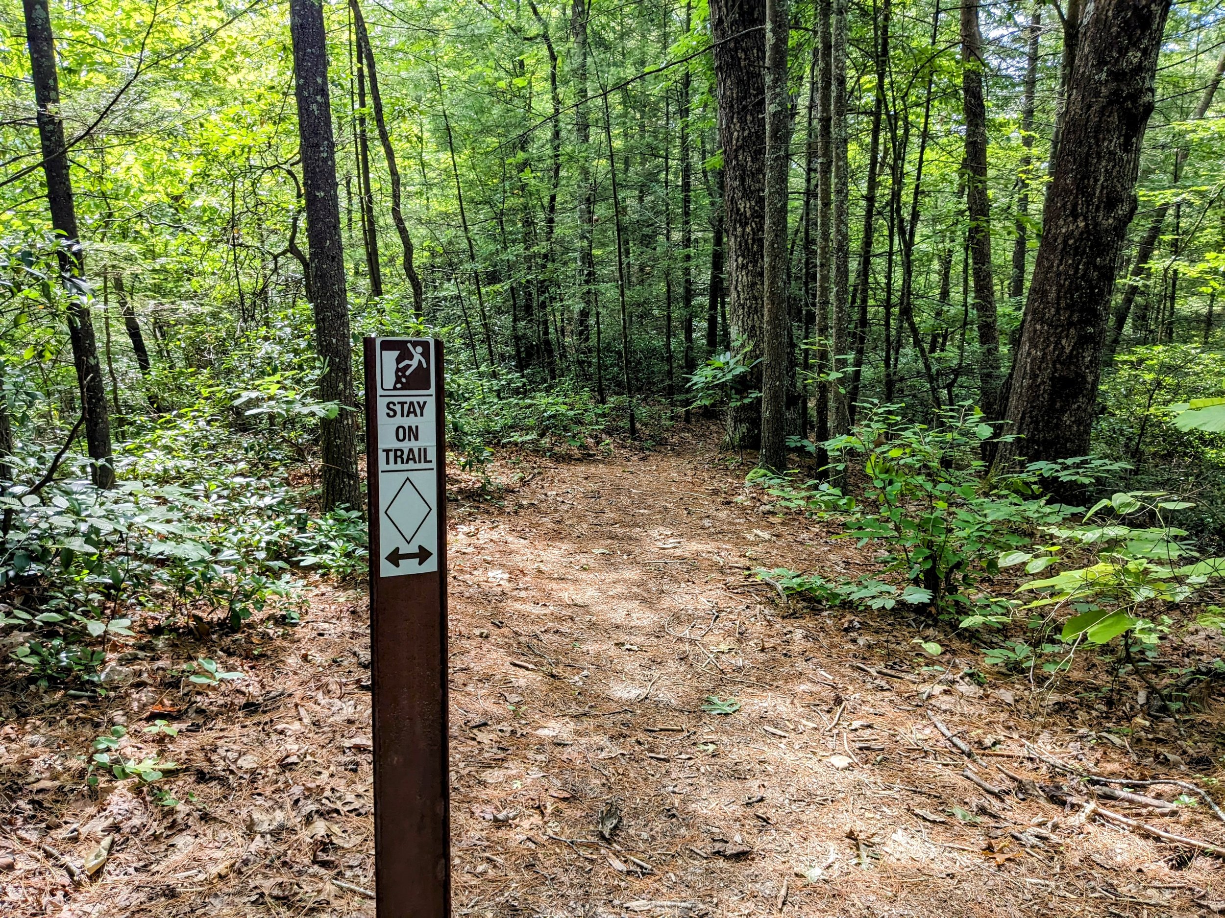
Trail Navigation. This route uses heavily trafficked trails. It is easy to get lost momentarily, but very difficult to actually get lost if you save a copy of this page as a .pdf, upload the .gpx file to a map app, save the waypoints, and properly use a map and compass. Rough, Gray’s, Swift Camp Creek, and Angel Windows Trails are marked and maintained - follow the white diamond blazes. The spurs to The Veranda and Hanson’s Point are unmarked and unmaintained, but are readily discernable by following the widest trail. Hanson’s Point will eventually be added to the official trail system, so it will be blazed as well at some point in the future.
Here is the navigation in simplest form:
Begin at Martin’s Fork Parking Lot
Turn right (southwest) and walk KY-77 to reach the trailhead
Cross the footbridge and stay straight past Military Wall and Left Flank Trail junctions
Take the left fork to stay on Rough Trail and head uphill at the junction with D. Boon Hut Trail
Enjoy the smaller views on the way to the top of the ridge
Turn left (northwest) at the large heavily impacted patch near Martin’s Fork Overlook
Return to the trail and turn left to follow Rough Trail
Turn left (north) at the Gray’s Arch Trail junction and descend
Make a sharp left at the base of the second staircase to see Mid-step Arch
Return to the trail and descend, continuing straight (southwest) to the Gray’s Arch Trail Spur
Look up and to the right to see Little Gray’s Arch
Ascend to Gray’s Arch; place your feet on the flat spots on the somewhat pointy rock and use your left hand to balance while ascending
Enjoy Gray’s Arch and retrace your steps
Go straight (east, then north) at the trail junction to continue on Rough Trail
Drop down awhile before ascending to Rush Ridge
Go straight past the trail junction and look for a junction with a sharp turn; go straight (east-southeast) for The Veranda
Follow the most well-trod path to reach The Veranda while passing a couple campsites along the way
Retrace your steps and turn left (south-southwest) to descend on Rough Trail
Drop down and climb back up
Very near the top of the ridge, turn left (north) at the wide trail - this is Hanson’s Point Trail
Continue on single track trail before reach a couple large, impacted camping areas - stay right at each and follow the widest path - one campsite can throw you off course, but retrace and continue generally east
Retrace your steps and turn left (southeast) on Rough Trail
Stay left (east) at the junction with Pinch ‘em Tight Trail
Go straight at the water crossing in a southeastern direction; Sheltowee Trace splits north here
Continue southeast (left) past the junction with Koomer Ridge Trail
Continue up to the next ridge and cross Chimney Rock Road
Descend and walk along Parched Corn Creek north before crossing east
Ascend to KY-715 and crossover on Swift Camp Creek Trail
Make a sharp right turn (west-northwest) at the unmarked, but well trod spur to Angel Windows
Walk to Angel Windows and retrace your steps to the parking lot
Done
HIKER NOTE - Allow Plenty of Time. This is one of the most physical hikes outside of the mountains in Kentucky. If you’re not used to this type of punchy terrain, be sure to allow plenty of time - this might range from 45 to 75 minutes per mile depending on the hiker.
HIKER NOTE - Uphill Skills. Take shorter strides uphill and keep an even pace. Shorter strides take elevation in smaller doses and helps to keep your heart rate down compared to taking ‘normal’ strides. Hiking poles are helpful to add your upper body to the fight against gravity. Engage ‘four-wheel drive’ with your poles and slow your pace to avoid gasping for breath. Steady, well-below-maximum effort is ideal.
HIKER NOTE - Downhill Skills. Shorter strides here are beneficial as well to reduce your risk of falling by maintaining a tighter center of gravity. Hiking poles can be lengthened on downhills and used to add balance and reduce the load on knees. If you have bad knees, using poles in this way can be helpful - you can even extend them and place palms on top to help reduce lower body loads in a braking type of stance.
HIKER NOTE - Water Carry and Filter Stops. Bring a water filter and filter water when needed at any of the bottoms that each have reliable water except in substantial drought conditions. Avoid carrying too much weight that for day hikers is typically sourced from water carry.
HIKER NOTE - Bail Outs. If the struggle is real, there are numerous bailouts on the route at Gray’s Arch Trail, Rush Ridge Trail, Pinch ‘em Tight Trail, Koomer Ridge Trail, and Chimney Rock Road. Gray’s, Rush, and Pinch ‘em all lead to Tunnel Ridge Road for pick-up. Koomer Ridge leads up to Koomer Ridge Campground.
HIKER NOTE - Don’t Be THAT Friend. This is not a good route for inexperienced hikers. If you bring a friend that hasn’t gotten into hiking and/or isn’t physically fit, they will hate this hike and have difficulty completing it. Take them on the Hanson’s to Gray’s Loop instead and add The Veranda if you like. Going out to Hanson’s first builds confidence and delivers an epic view. That loop cuts out three of the climbs and is a good opening dose of Rough Trail hiking.
CAUTION - Deadly Drops. Long falls from high places are the #1 non-health related cause of death for hikers in Kentucky. Keep your distance from the edges of cliffs to avoid a deadly fall. Young children should be kept close.
CAUTION - Poisonous Snakes. Copperheads and timber rattlesnakes can be found in the area. Should you encounter one, stop and slowly back away. Always give venomous snakes a wide berth. Know Before You Go => University of Kentucky Venomous Snake Guide
CAUTION - Black Bears. Ursus Americanus - a.k.a. the American black bear is growing in population throughout much of Kentucky. Know Before You Go => US Forest Service Black Bear Safety Tips

Martin's Fork Trailhead Sign

Rough Trailhead at Martin's Fork

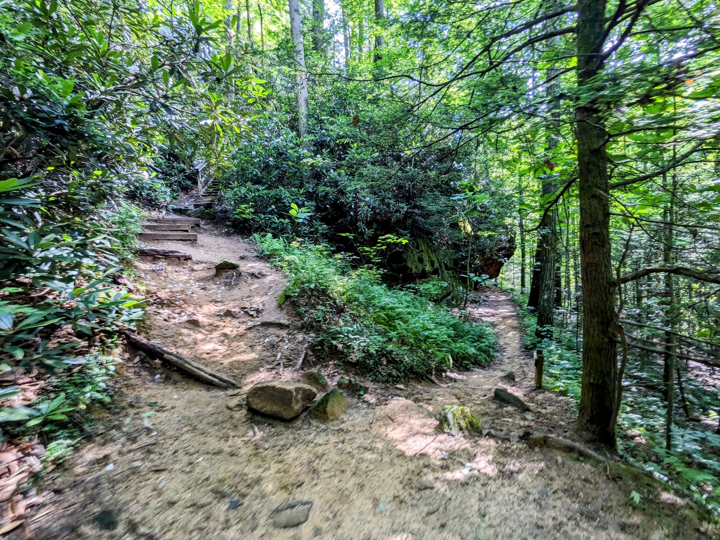
First Footbridge on Rough Trail

Left for Rough Trail, Right for D Boon Hut Trail

Top of the Ridge, Sharp Left for Martin's Fork Overlook

Martin's Fork Overlook - We walked through a large group camping at the overlook; the view is much better than shown here

Junction with Gray's Arch Trail - Go Left for Rough Trail

Down the Steps to Mid-Step Arch

Mid-Step Arch

Little Gray's Arch

Multi-Layered Rock Shelter and Hardwoods Near Gray's Arch

Gray's Arch Back View
Gray's Arch-Rough Trail Lower Junction - Hang a Right

Flora and Geology in Epic Combination

Rhododendron in Bloom

Rough-Rush Ridge Trail Junction - Stay Left
Split to The Veranda - Go Straight

Pinch 'em Tight Gap from The Veranda

Split to Hanson's Point - Go Left
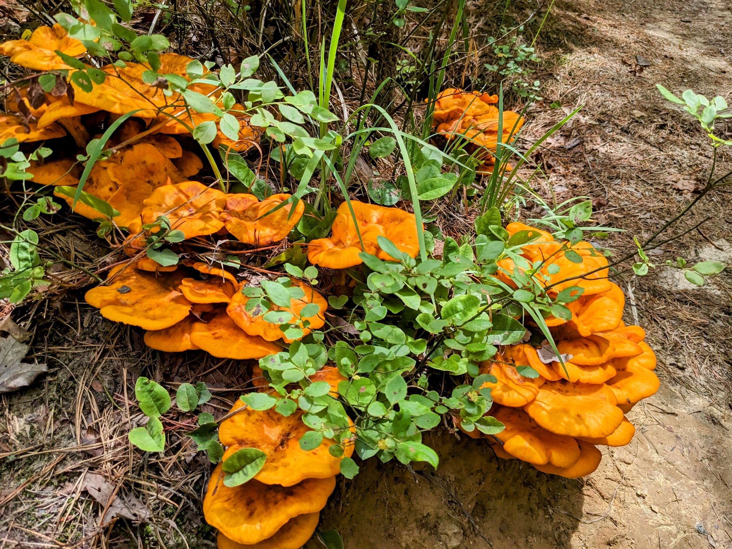
Big Patch of Chicken of the Woods

Hanson's Point

Pinch 'em Tight-Rough Trail Junction - Go Left

“Lightning Rod Overlook”
Rough Trail-Sheltowee Trace Split - Go Uphill
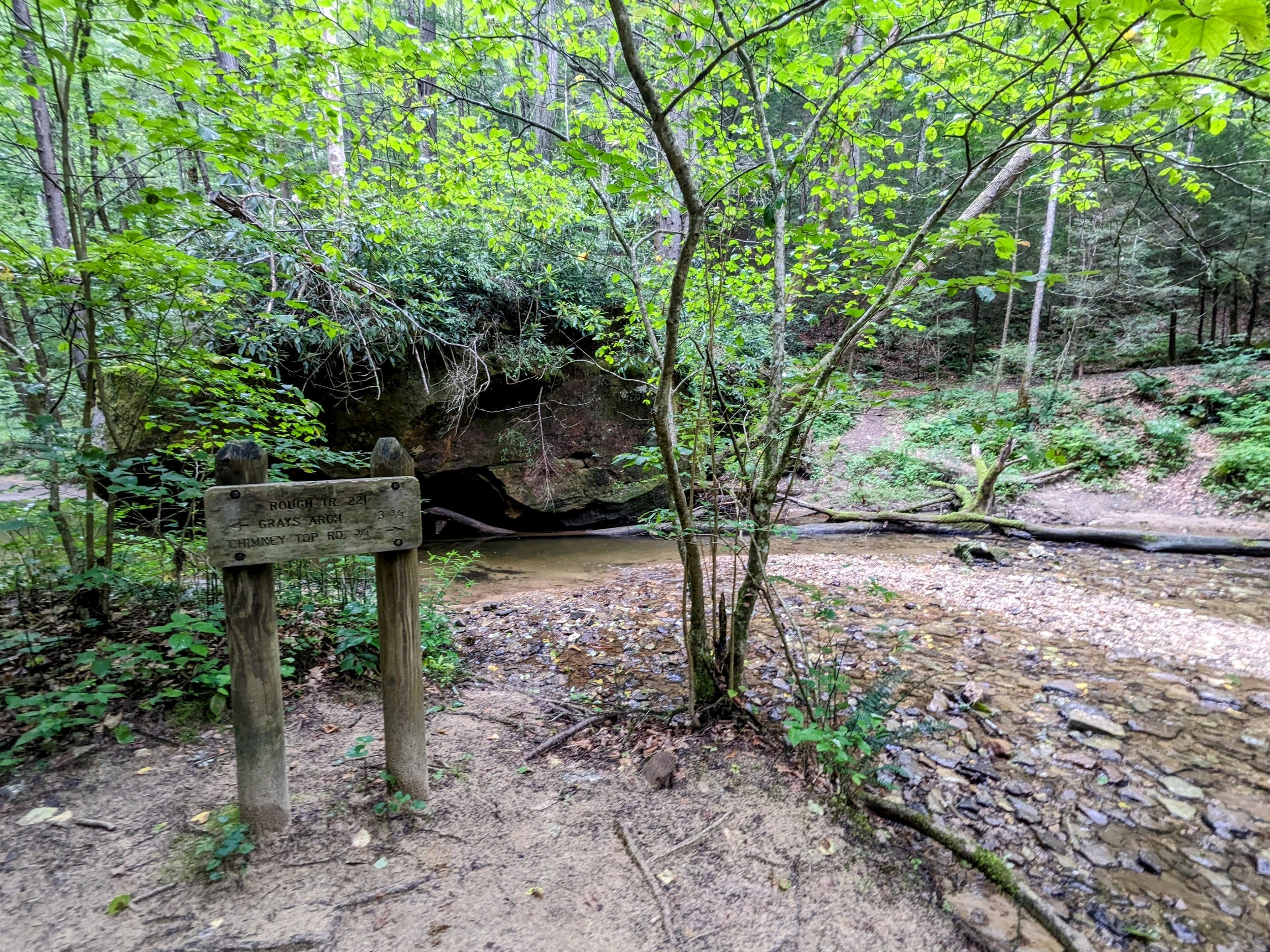
Koomer Ridge-Rough Trail Split - Cross the Stream

Rough Trailhead at Chimney Top Rock Road

Rough Trail Window

Rough-Swift Camp Creek Trail Crossover at KY-715

Angel Windows Trailhead

Angel Windows Trail Photo Booth

Angel Windows Approach View

Angel Windows Back View