Cruise Liner Rock Out and Back Highlight Reel
Map of Cruise Liner Rock Out and Back Highlight Reel, Red River Gorge
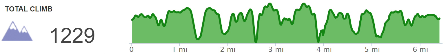
Elevation Profile of Cruise Liner Rock Out and Back Highlight Reel, Red River Gorge
Overview. There are a dozen or more overlooks off the main trail along with a number of arches. This hike is the highlight reel version - taking advantage of the more expansive overlooks and dropping down to Sky View and Star Gap Arches on the way back. It is a tremendous walk that packs a ton of sights into a half-day hike with just a bit of spice with a pair of scrambles en route to the arches.
Route Type | Out and Back
Total Distance | 6.39 miles
Elevation Gain | 1,229 feet (overstated)
Overall Difficulty | Easy with Two Class 2/3 Scrambles
*this hike is mostly on unmarked and unmaintained trails, but is relatively easy to navigate
GPS Waypoints
Double Arch Trail Gate | 37.819772, -83.682728
Turn to “Cruise Liner Rock Trail” | 37.822053, -83.690122
Turn to Overlook | 37.820211, -83.696575
Overlook | 37.816344, -83.699025
Turn to Overlook | 37.822117, -83.702522
Overlook | 37.821356, -83.702833
Get Lost Junction | 37.824344, -83.703686
Cruise Liner Rock | 37.827100, -83.708722
Turn to Sky View Arch | 37.824058, -83.705542
Sky View Arch | 37.824818, -83.705349
Turn to Star Gap Arch | 37.820533, -83.695578
Turn to Scramble | 37.821511, -83.695925
Star Gap Arch | 37.822569, -83.696085
Red River Gorge Area Map
Parking. Park at the roundabout or at Auxier Ridge Parking Lot at the end of Tunnel Ridge Road.
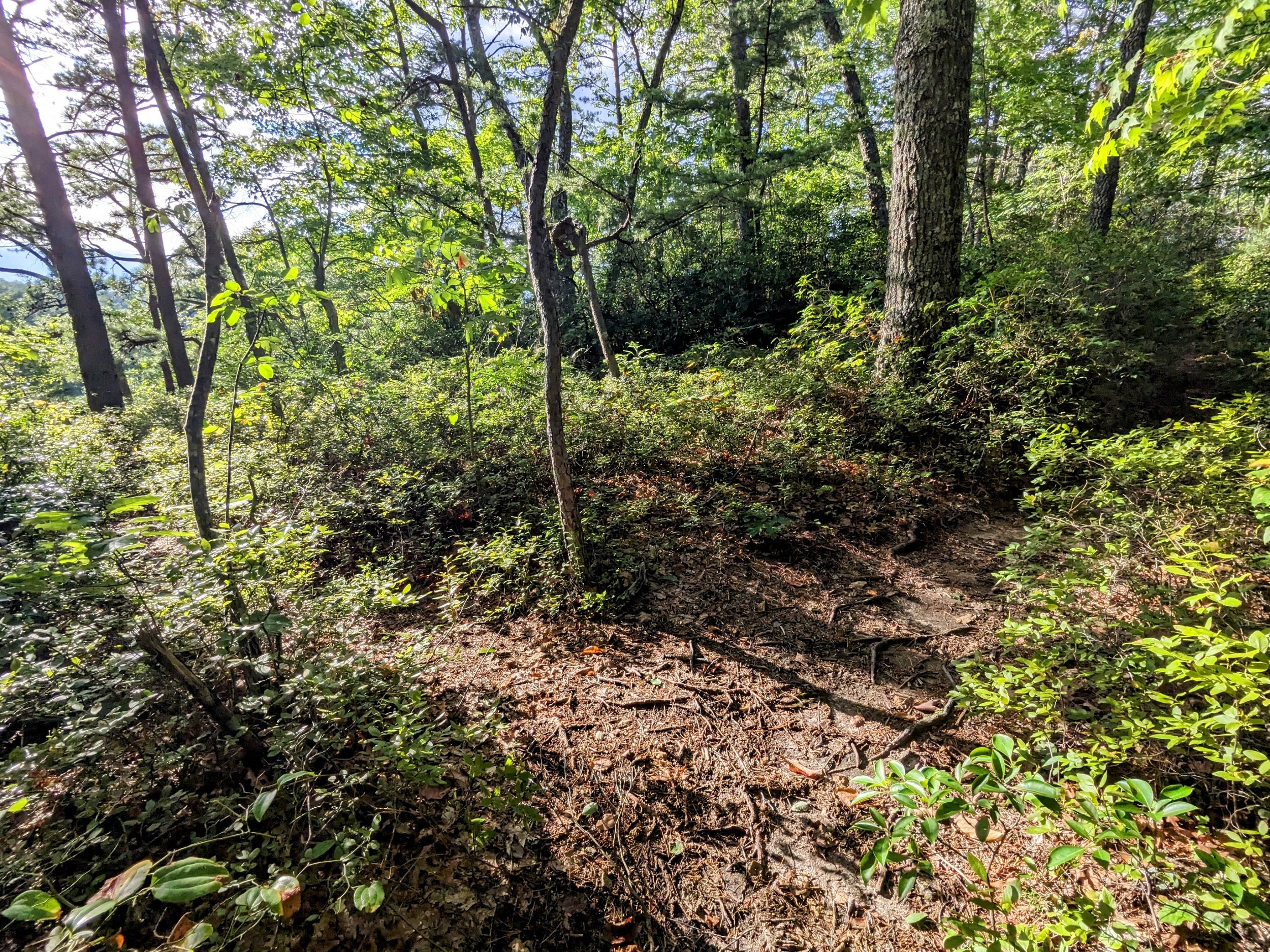
Trail Navigation. This hike is a whole bunch of left turns with a right turn when coming back onto Double Arch Trail. The entire trail after leaving Double Arch Trail is unmarked and unmaintained, but relatively easy to navigate. It becomes narrower and brushier as you move further out the ridge with plenty of side trails to help you get temporarily lost. All side trails lead to an overlook, a campsite, or both.
Start down the gravel road between the no parking signs at the roundabout and pass around the gate
Mile 0.6 | Take the left (west) fork uphill off the gravel road; this is “Cruise Liner Rock Trail” or “Star Gap Arch Trail”; my preference is the former, as this is the end destination of this trail
Mile 1.0 | Take the left (southwest) fork into scruffier terrain and reach the overlook at mile 1.4
Retrace your steps and turn left (northwest) back onto the main trail
Continue until reaching the next well defined trail intersection and turn left (south-southwest); this junction has a patch of plantlife surrounded by a rounded triangle of user trail
Retrace your steps and turn left (northwest) onto the main trail that will get brushier as you continue toward Cruise Liner Rock
You’ll top out at a junction that has two equally worn paths; go left (west) and meet a rhododendron tunnel shortly after
Continue downhill across some exposed rock; you’ll revisit this when heading back and down to Sky View Arch
Continue on the main trail and Cruise Liner Rock will come into view when looking north/northwest
Additional views are available on or just a couple steps off the trail, so take them as you please
Wrap around on the ridge to climb Cruise Liner Rock; pick a view and enjoy
Retrace your steps to the waypoint for the junction with the spur to Sky View Arch; it’s well-defined, but somewhat hidden on the north side of the ridge
Follow the trail and scramble down the steep dirt slope - go lightly on the vegetation!
Continue to the arch by walking along the cliff face until it comes into view
Take some time here and retrace your steps, turning left on the main trail
Continue walking the main trail retracing your steps until reaching the junction with the spur trail to Star Gap Arch
Turn left (north-northwest) and descend
Take the second well-defined path to reach the scramble; use your eyes to find the zig zagging path that takes advantage of flat footplants
Continue north on the very narrow trail and slice the crack in the rock before reaching Star Gap Arch shortly after
Retrace your steps and turn left onto the main trail before passing the forest service gate and turning right onto Double Arch Trail
HIKER NOTE - Dozen+ Overlooks. There are more than a dozen overlooks along “Cruise Liner Rock Trail”. If you’d like to see them all, make a left turn at all intersections and follow the trail. The bigger the overlook, the more well trod the path. You’ll clock in somewhere between 9 and 11 miles if you include the arches described here.
HIKER NOTE - Erosion at Sky View Arch. I omitted the details to this hike for a number of years, as the web footprint back then was much smaller than it is now. Since it is well documented and highly trafficked at this point, the details are provided. To assist in preserving the trail, please observe these items below:
Hike when dry or damp, not when wet and muddy. Hiking soaked trails speeds erosion and soil here is thin.
Sidestep the steep dirt scramble. There are some intuitive footplants that have developed over the years. Use them by side stepping up and down the slope. This will improve your balance, pack down the footplant spots, and help to reduce erosion.
Go easy on the vegetation. There are some rhododendron stabilizing the soil here, so use them lightly for balancing holds. Placing too much weight will kill the rhododendron, destabilize the soil, and expedite trail degradation.
CAUTION - Class 2/3 Scrambles. There is a dirt scramble to reach Sky View Arch and a rock scramble to reach Star Gap Arch. The best technique is to side step up/down the dirt scramble at Sky View Arch. To reach Star Gap Arch, take the 2nd defined path and zig zag down. There are intuitive spots with flat or flat-ish spots to walk down. While some will slide down the exposed rock at the 3rd defined path, this is a dangerous method because there is very little room at the base if you lose balance or tumble. Skip this if it’s wet/icy/snowy.
CAUTION - Deadly Drops. Long falls from high places are the #1 non-health related cause of death for hikers in Kentucky. Keep your distance from the edges of cliffs to avoid a deadly fall. Young children should be kept close.
CAUTION - Poisonous Snakes. Copperheads and timber rattlesnakes can be found in the area. Should you encounter one, stop and slowly back away. Always give venomous snakes a wide berth. Know Before You Go => University of Kentucky Venomous Snake Guide
CAUTION - Black Bears. Ursus Americanus - a.k.a. the American black bear is growing in population throughout much of Kentucky. Know Before You Go => US Forest Service Black Bear Safety Tips

Begin at the roundabout near the Auxier Ridge Parking Lot

Gate to Double Arch Trail

Turn left for “Cruise Liner Rock Trail” often referred to as “Star Gap Arch Trail”

Campsite with antique seating

Take the left fork for the first overlook on this hike

Old truck cab from a homestead added to Daniel Boone National Forest

Homestead remnants along the trail spur
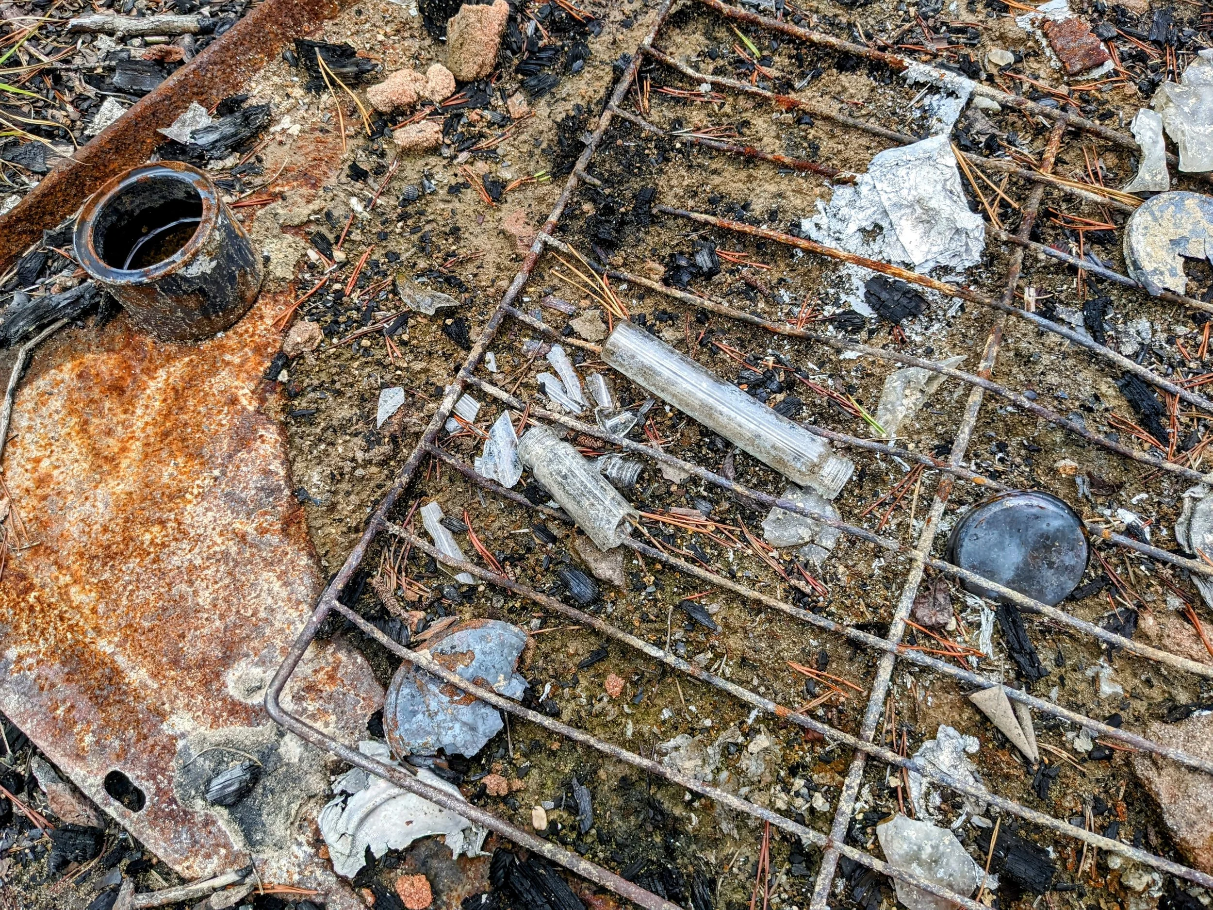
Keep the glass and home and don’t do drugs, kids

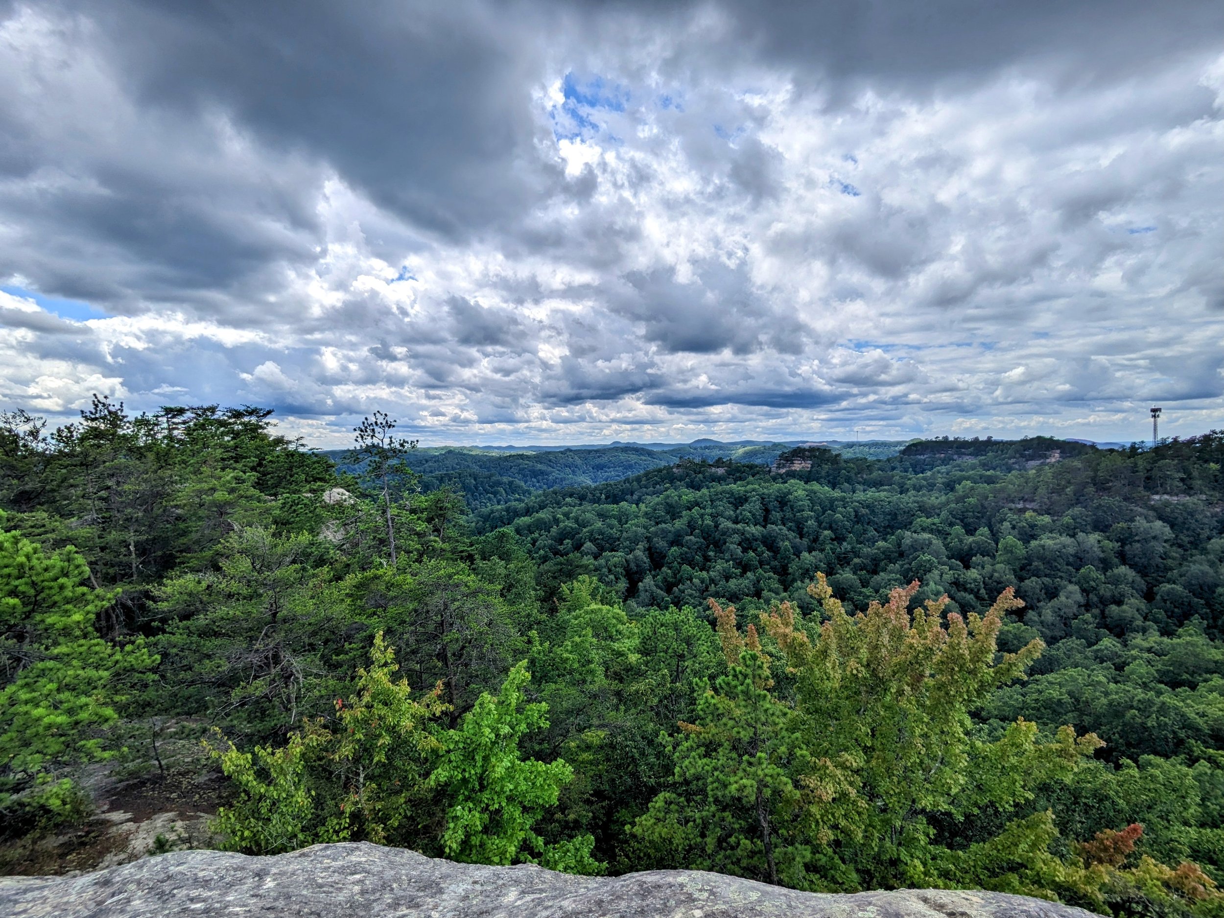
Looking out to Moreland Branch South Overlook in the shadows

View of Moreland Branch South Overlook where we spent sunset

Turn left for the next major overlook
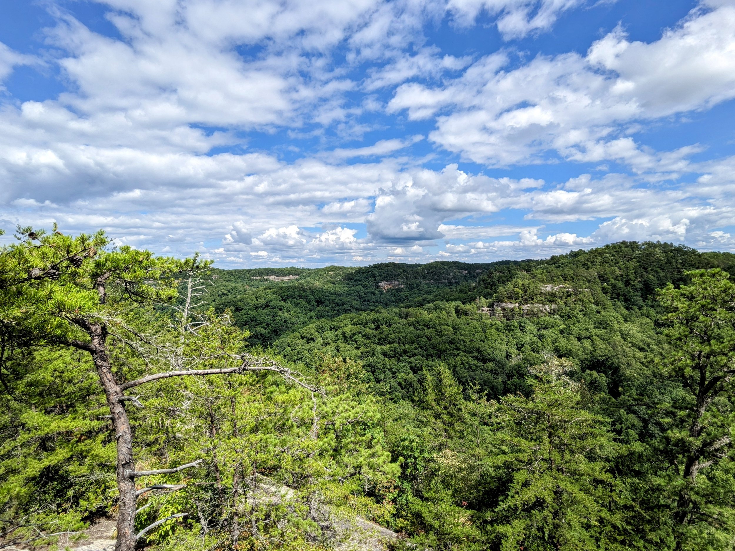
Views northwest with loads of cell towers dotting the landscape

Looking north to the next finger of the ridgeline; this is accessible with climbing equipment

Equally trod paths - go left for Cruise Liner Rock; right leads to a campsite and some additional views if memory serves correctly; it’s easy to get temporarily lost out here
Trailside view en route to Cruise Liner Rock

View from the base of Cruise Liner Rock

A few paces of the trail for a beautiful view of this knob

Narrow path left for Sky View Arch
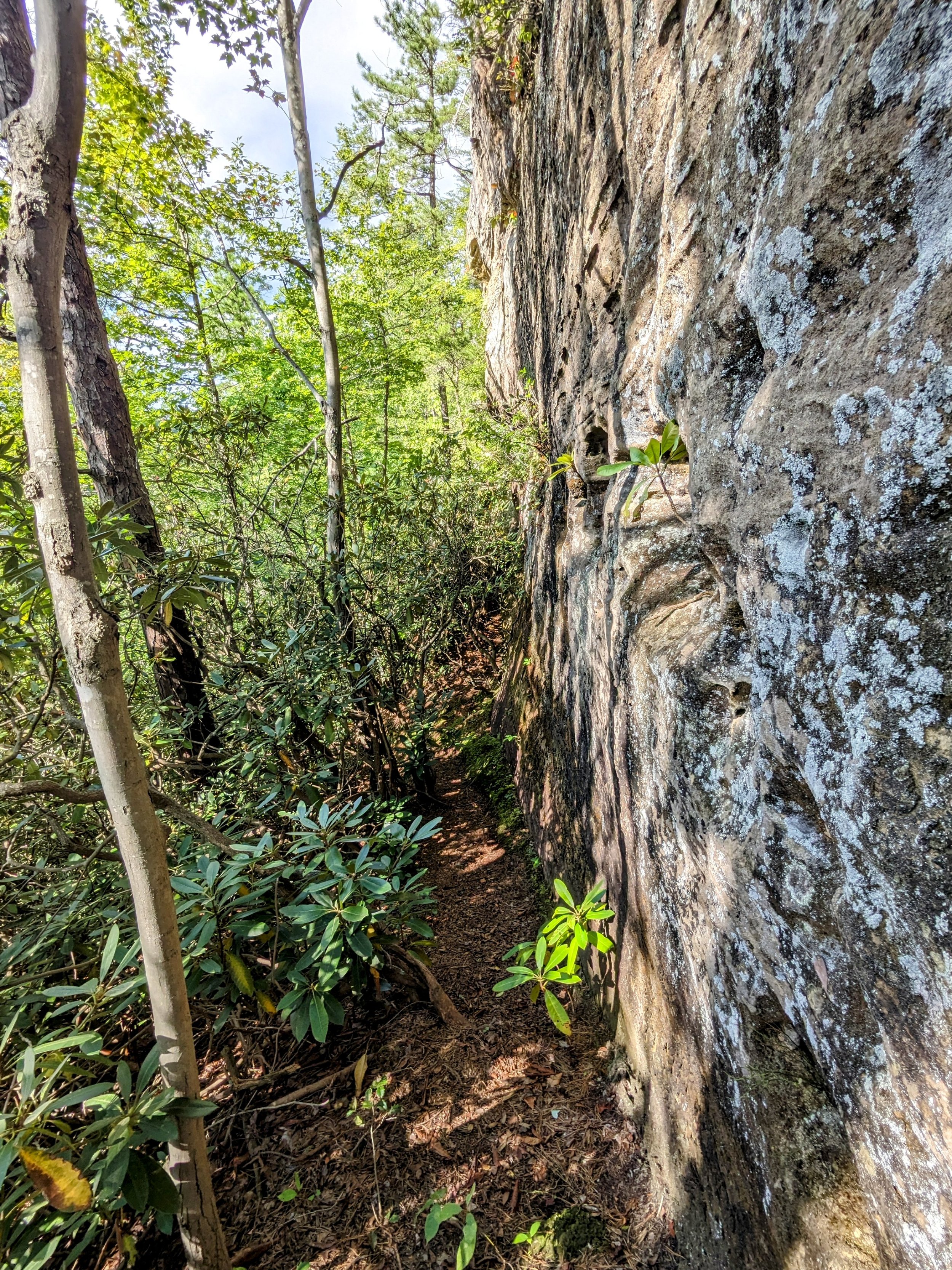
Hug the rock to reach the arch

Sky View Arch

LaFonda below the arch

A second stop at the 2nd overlook for improving skies

Relatively recent survey marker - the south side is private property and the north side is National Forest

Turn left for Star Gap Arch and go downhill
Take the second well defined side trail to reach the scramble and zig zag down using rocks and roots to reach the very narrow pathway to the arch

Drop through the crack in the rock

Star Gap Arch approach view

From the far side

Under the belly

Walking out on Double Arch Trail