Sky Bridge Recreation Area Overlooks Tour - Summer Edition

Map of Sky Bridge Recreation Area Overlooks Tour - Summer Edition
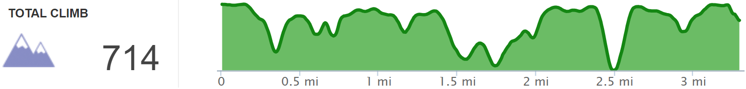
Elevation Profile of Sky Bridge Recreation Area Overlooks Tour - Summer Edition
Overview. While many will be familiar with Sky Bridge - the incredibly beautiful double arch - relatively few visiting Red River Gorge are aware of the other unmarked overlooks in the recreation area. On this walk, we took advantage of the summer sun setting to the northwest at Buzzards Roost South while visiting Sky Bridge and Keystone Arches along the way.
Route Type | Loop and Spurs
Total Distance | 3.29 miles
Elevation Gain | 714 feet
Overall Difficulty | East to Moderate with a Class 3/4 Scramble
GPS Waypoints
Devil’s Canyon Roadside Parking | 37.812231, -83.590139
Turn to Swift Camp Creek South Overlook | 37.813203, -83.586620
Swift Camp Creek South Overlook | 37.813022, -83.584911
Turn to Swift Camp Creek North Overlook | 37.814594, -83.584475
Swift Camp Creek North Overlook | 37.814236, -83.584136
Swift Camp Creek Official Overlook | 37.814664, -83.584536
Road Fork to Camera Point Overlook | 37.817299, -83.583246
Camera Point Overlook | 37.816061, -83.580192
Handicap Accessible Overlook | 37.816883, -83.580904
Turn to Sky Bridge Connector | 37.817083, -83.582033
Turn to Sky Bridge Trail | 37.817825, -83.582147
Sky Bridge | 37.818915, -83.578903
Fork to Sky Bridge Picnic Connector | 37.817897, -83.582367
Buzzards Roosts “Trailhead” | 37.816219, -83.585164
T-Intersection | 37.816675, -83.586058
Keystone Arch Scramble | 37.816972, -83.587919
Buzzards Roost South | 37.816969, -83.588511
Unnamed Roadside Overlook | 37.813414, -83.586483
Devil’s Canyon Overlook | 37.812422, -83.590381
Red River Gorge Area Map
Parking. Park across from Devil’s Canyon Overlook where up to three cars will fit. This is a drive-up overlook with people popping in and out of the car in quick succession. If this is full, park a little further up the road at designated roadside spots, at the picnic area, or at the Sky Bridge parking lot.
Trail Navigation. Some of the spurs on this route are unmarked and unmaintained user trails, but all are well traveled. Be sure to download the .gpx file and waypoints before heading out. In simplest form, here is the turn by turn:
Park at Devil’s Canyon
Walk down the road to the next overlook that is unnamed
Take the trail across from the unnamed overlook to reach Swift Camp Creek South Overlook
Retrace your steps and turn right on the road
Stop at Swift Camp Creek Roadside Overlook
Take the narrow path between the sign and the stone fence to reach Swift Camp Creek North Overlook
Retrace your steps and turn right on the road
Take the right fork where the road splits; it is marked to ‘viewpoints’
Reach Camera Point Trailhead and walk out
Retrace your steps and go right around the cul-de-sac/turnaround for the handicap accessible overlook
Take the singletrack dirt trail off the road and continue alongside the Sky Bridge Parking Lot
Descend the steps and turn right sharply to join the official Sky Bridge Trail
Descend the steps, walk to the underbelly of Sky Bridge, loop around and walk on top of the arch before exiting the trail at the road
Take the singletrack trail on the right to reach Sky Bridge Picnic Area
Walk to the end of the parking lot and take the trail between the privies and the handicapped parking spot
Stay left at the fork and turn left at the T-intersection
Descend steeply and reach a break in the rock; this is the top of Keystone Arch
Take your pack off and scramble down the south side (left side on approach) using palms on flat rock and finding footholds as you go; do NOT stand tall until you’ve reached the base because you’ll hit your head on the rock
Turn right (west) to reach Buzzards Roost South
Retrace your steps - scramble up, ascend steeply, right at the T-intersection, straight through the fork, and back to the parking lot
Turn right on the road and pass the unnamed overlook and finally Devil’s Canyon Overlook
CAUTION - Class 3/4 Scramble. You’ll need to use all four limbs to negotiate the scramble that leads to the roost, and a tumble here can result in death - thus the Class 4 part for exposure risk. It is manageable, however, without too much trouble for experienced hikers in good physical shape. Click here for a video of LaFonda on this scramble.
CAUTION - Deadly Drops. Long falls from high places are the #1 non-health related cause of death for hikers in Kentucky. Keep your distance from the edges of cliffs to avoid a deadly fall. Young children should be kept close.
HIKER NOTE - Buzzards Roosts and the Sun. We took advantage of the more northerly track of the sun at this time of year. I would favor Buzzards Roost Central nearer the equinoxes and Buzzards Roost North near winter solstice.
RULE REMINDER - Day Use ONLY. No camping is permitted here - and that’s a good thing. Rather than clogging up parking with campers and backpackers, you’ll find plenty of spots early morning and late afternoon even on busy weekends.
CAUTION - Poisonous Snakes. Copperheads and timber rattlesnakes can be found in the area. Should you encounter one, stop and slowly back away. Always give venomous snakes a wide berth. Know Before You Go => University of Kentucky Venomous Snake Guide
CAUTION - Black Bears. Ursus Americanus - a.k.a. the American black bear is growing in population throughout much of Kentucky. Know Before You Go => US Forest Service Black Bear Safety Tips

Devil's Canyon Overlook Sign - Park Here to Start Your Hike

Unnamed Overlook - Look Right and Take the Well Defined Path to Swift Camp Creek South Overlook

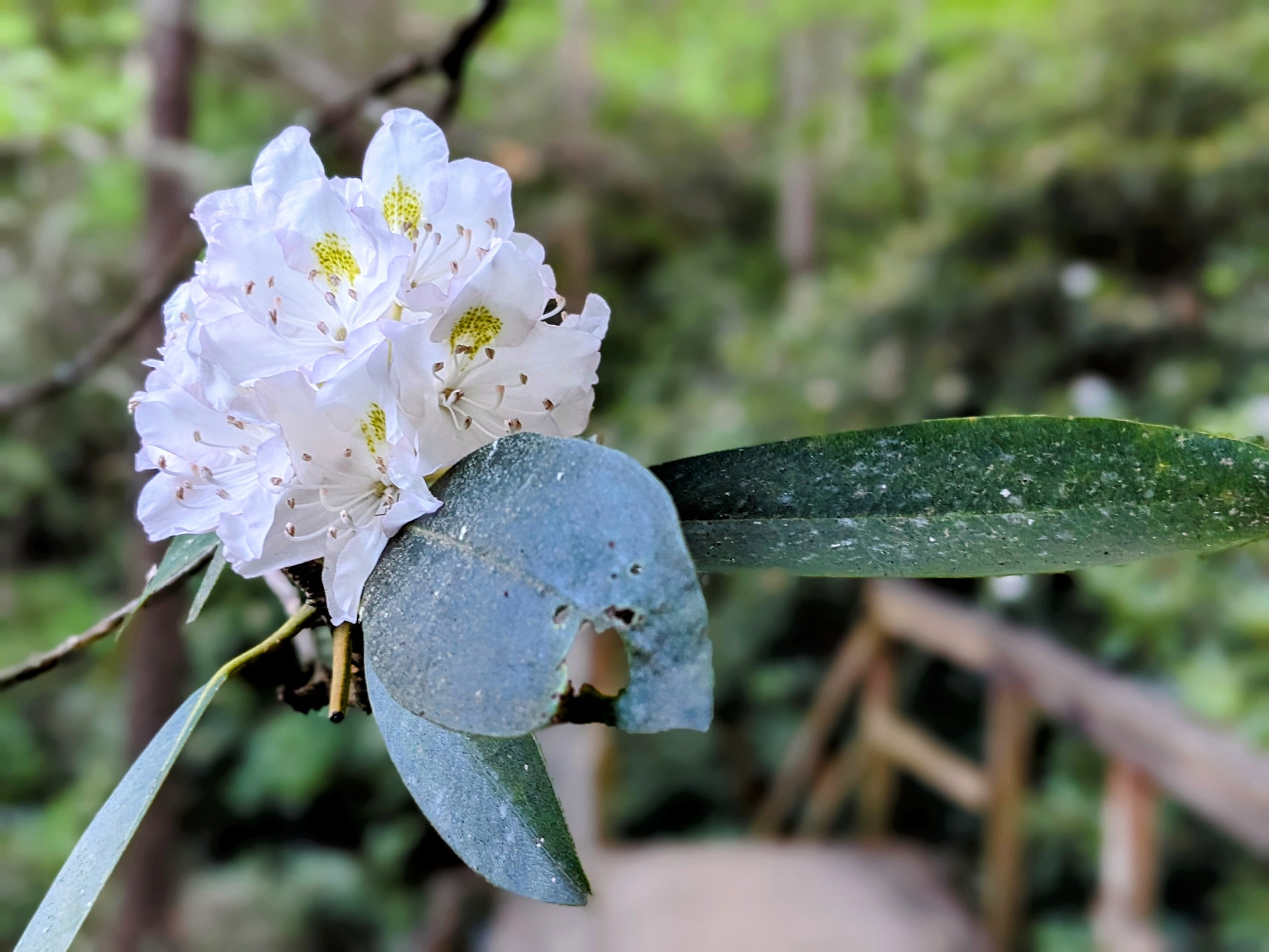
Rhododendron in Full Bloom

Illegal Campsite Near Swift Camp Creek South Overlook - Sky Bridge Recreation Area is for Day Use ONLY - Parking Tickets and Fines Can Be Issued to Those Caught Parking and Camping Here

2X Zoom of Castle Arch from Swift Camp Creek South Overlook

Looking Out to Buzzards Roost South from the Unnamed Roadside Overlook

View from Swift Camp Creek Roadside Overlook

Take the Narrow Path for Swift Camp Creek North Overlook

View from Swift Camp Creek North Overlook

Fork to Camera Point

Camera Point Trailhead

View from Camera Point

Handicap Accessible Overlook Near Camera Point - This has distant views to Sky Bridge and is best in wintertime

Connector Trail to Sky Bridge Loop - Go Right

Descend to Connect with Sky Bridge Trail
Rhododendron Line the Trail at the Staircase

Carving is Ugly - Just Like the End of Cheryl's Relationship

Walking Up to a Magical Scene at Sky Bridge
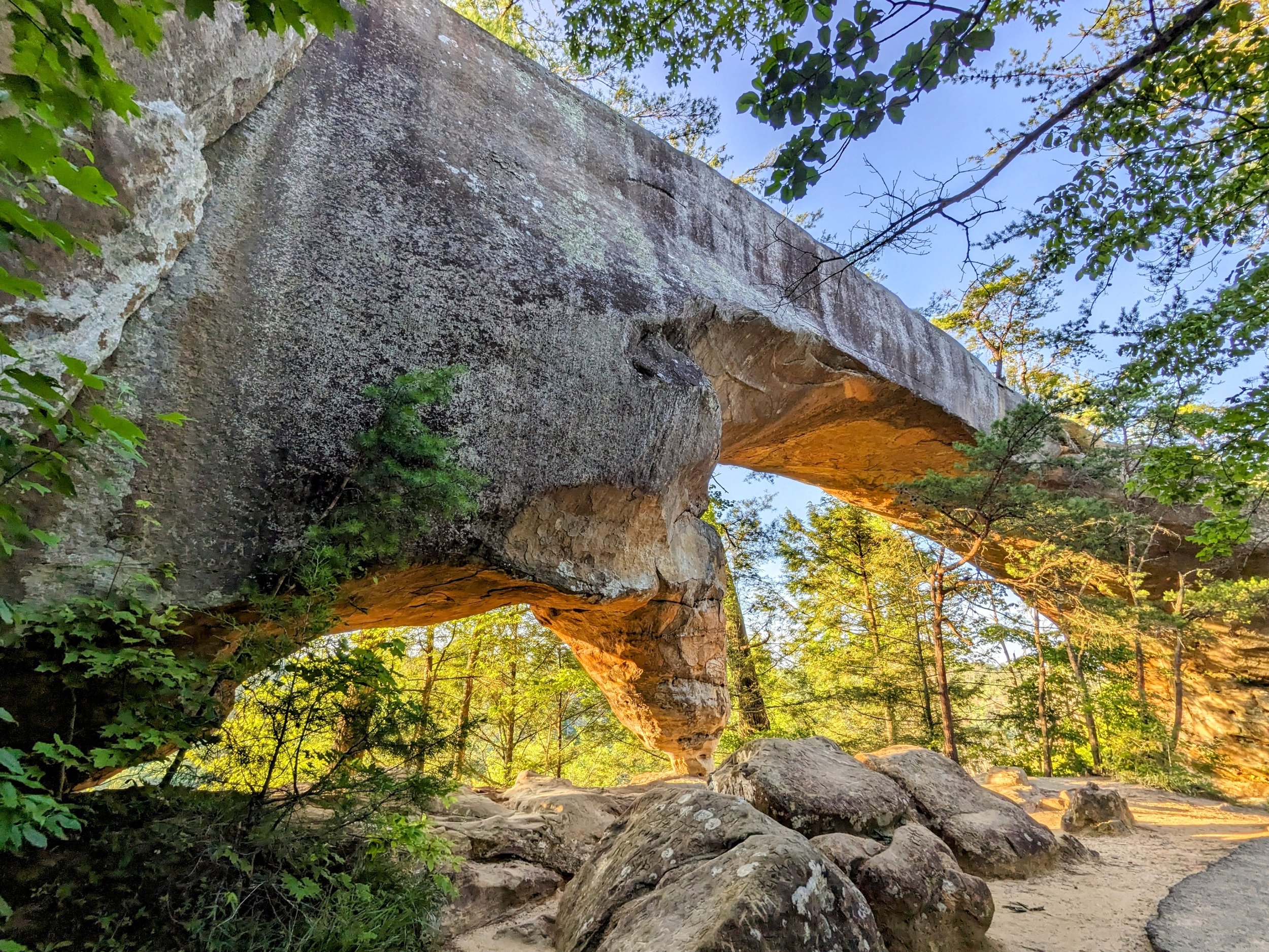
Sky Bridge in Full View Late in the Day

LaFonda Approves of This Hike

View from the Far Side of Sky Bridge

Walking on Top of Sky Bridge

One of My Favorite Trees in Red River Gorge

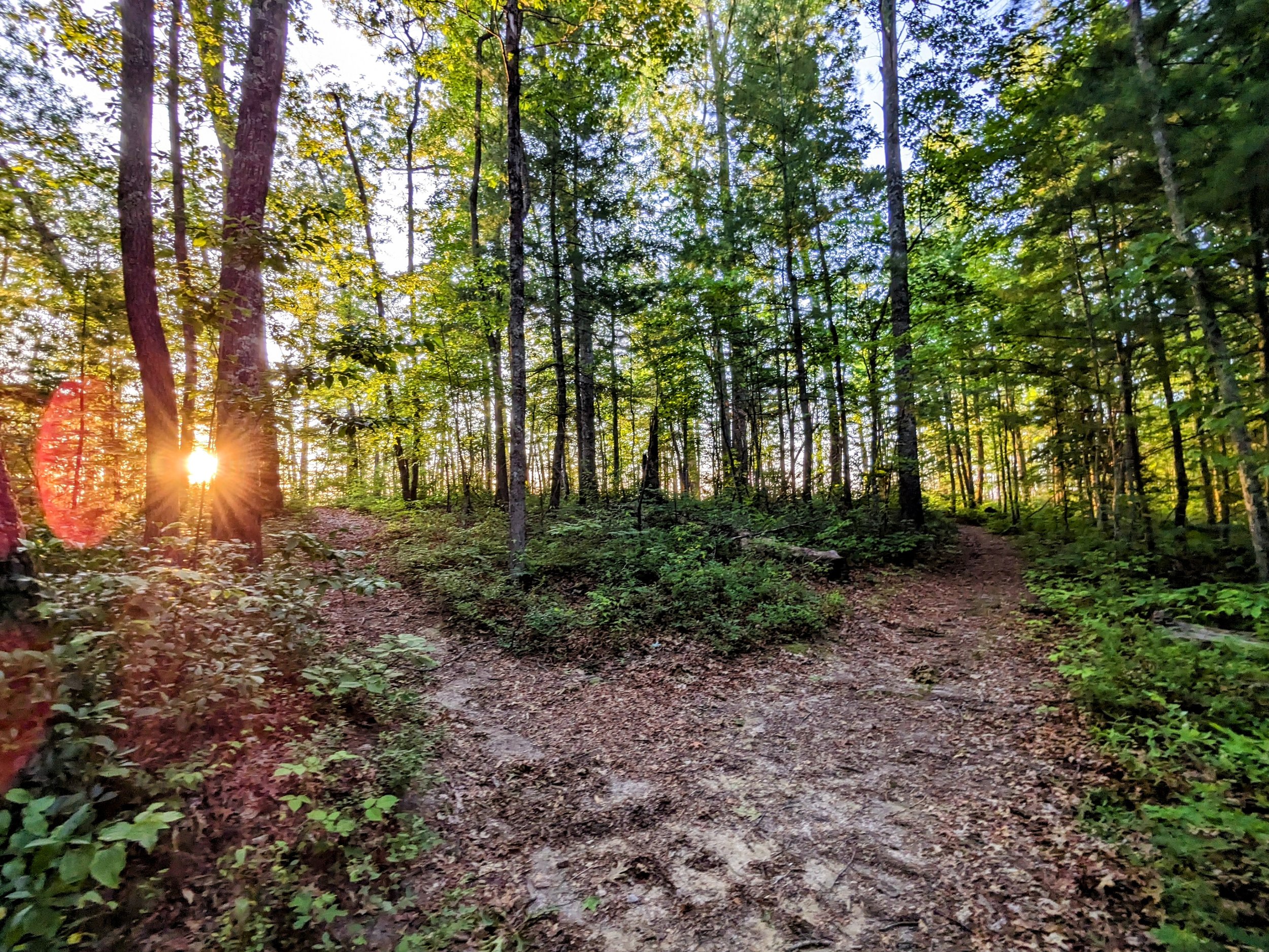
Big Sun Over the Burn Scarred Side of the Trail

Take the Dirt Path to Sky Bridge Picnic Area

Take the Path at the End of the Parking Lot
Take the Left Fork for Buzzards Roost South

Left at the T-Intersection for Buzzards Roost South

Keystone Arch - A Class 3/4 Scramble to Reach Buzzards Roost South

Just in Time for Sunset at Buzzards Roost South

After Sunset at Devil's Canyon Overlook