“Walrus Rock” at Windy Gap
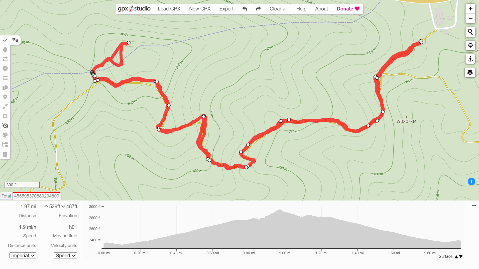
Map of Windy Gap Out and Back, Pine Mountain
Overview. This hike isn’t worth doing on its own unless you’re looking for a spot to camp and maybe a little geology after packing up - and that’s exactly what I did here. That said, read the note below for a more satisfying hike to Twin Cliffs.
Route Type | Out and Back
Total Distance | 1.97 miles
Elevation Gain | 529 feet
Overall Difficulty | Moderate
GPS Waypoints
PMSST Highland Section North Terminus | 37.1538444,-82.6317972
Windy Gap/Trail Junction | 37.1528222,-82.6413083
”Walrus Rock” | 37.153592, -82.640472
Map of Highland Section of Pine Mountain State Scenic Trail/Great Eastern Trail from Kentucky State Parks and Pine Mountain Trail Conference
Parking. Ample parking is available in the gravel lot next to the trailhead. Pull in just to the west of the paved gas station lot next door. I HIGHLY recommend grabbing everything you need at the gas station including made to order sandwiches.
Trail Navigation. This hike follows the Highland Section of Pine Mountain State Scenic Trail/Great Eastern Trail that is blazed reflective yellow. Trail junctions have directional blazes - that’s two blazes with the uppermost blaze indicating the direction of the trail.
Locate the trailhead marked with a large, beautifully carved and painted stone. Sign in next to the kiosk and begin your hike downhill for a moment, then uphill for the remainder. You’ll reach a junction with a gate indicated with the waypoint above. This is Windy Gap and the intersecting road is an access road that circles around to US-23 west of where you parked. I camped on a patch of vegetation behind the gate and walked up to “Walrus Rock” in the morning before hiking out. You’ll notice a path in the woods away from the gate - this is the unmarked path to the interesting rock feature. When the leaves are absent, decent stick views can be had here. When you’re ready, retrace your steps to the parking lot.
HIKER NOTE - Get to Twin Cliffs. This hike was all about camping for me, but a great day hike would be a total of about 5 miles out and back to Twin Cliffs. To get there, continue southbound on PMSST/GET passing Jack Sautter Campsite, the spur to the Old Meade Homeplace (water available here), Marshall Taylor Gap, and finally, Twin Cliffs. Just be sure to take in both clifftop views to get your money’s worth.
CAUTION - Poisonous Snakes. Copperheads and timber rattlesnakes can be found in the area. Should you encounter one, stop and slowly back away. Always give venomous snakes a wide berth. Know Before You Go => University of Kentucky Venomous Snake Guide
CAUTION - Black Bears. Ursus Americanus - a.k.a. the American black bear is growing in population throughout much of Kentucky. Know Before You Go => US Forest Service Black Bear Safety Tips

Pound Gap Trailhead - Pine Mountain State Scenic Trail/Great Eastern Trail

Always Sign In at the Sign In Box | More sign ins help trail managers make a stronger case for additional resources to build and/or maintain trails. Lightly or unused trails are less likely to receive maintenance and can be abandoned over time.

Red Fox Trail Junction | This trail drops down lower on the Virginia side of Pound Gap and is primarily used by horses.

Foot Traffic Only Past This Gate

Windy Gap Sign with Road Gate Behind

My Campsite | This is definitely a rule violation, but it was the only flat patch not on the trail. After seeing the area in daylight, there is a nice little campsite up the knob just past “Walrus Rock”. Jack Sautter Campsite (my intended destination) is another 0.6 miles down trail.
Unmarked, But Clear Path to Walrus Rock

Straight Uphill

“Walrus Rock” at Windy Gap