Red River Gorge Northside Traverse with Cloudsplitter, Adena Arch, and Indian Staircase

Map of Red River Gorge Northside Traverse with Cloudsplitter, Adena Arch, and Indian Staircase, Red River Gorge

Elevation Profile of Red River Gorge Northside Traverse with Cloudsplitter, Adena Arch and Indian Staircase, Red River Gorge
Overview. This is the most popular variation of this traverse with unmarked/unmaintained trail stops at Cloudsplitter, Adena Arch, Indian Staircase, Osborne Bend Arch, and Moonshiners Arch traveling mostly official trails from Sheltowee Backpackers’ Lot to Osborne Bend’s East Trailhead. Route info and navigation is for eastbound travel.
Route Type | Point to Point
Total Distance | 15.35 miles
Eastbound Elevation Gain | 2,683 feet
Westbound Elevation Gain | 2,636 feet
Overall Difficulty | Moderate to Strenuous with Class 2, 3, and 4 Scrambles
GPS Waypoints
Sheltowee Connector Trailhead | 37.823102, -83.628063
Jump Rock Access | 37.824156, -83.625775
Sheltowee Trace Suspension Bridge | 37.827925, -83.624492
Turn to Cloudsplitter | 37.837594, -83.622650
Scramble to Cloudsplitter | 37.838119, -83.621489
Cloudsplitter Overlook | 37.837478, -83.620500
Turn to Adena Arch | 37.842403, -83.615936
Adena Arch and Overlook | 37.839147, -83.612342
Indian Arch | 37.842883, -83.616144
Turn to Indian Staircase Loop Trail | 37.842706, -83.617000
Turn to Mid-Level Loop Trail | 37.844403, -83.618167
Council Chamber Rock Shelter | 37.847511, -83.619267
Frog’s Head | 37.846963, -83.616787
Shawnee Arch | 37.8467139,-83.6162306
Indian Staircase | 37.846224, -83.615890
Junction with Sheltowee Trace | 37.844347, -83.614225
Junction with Bison Way | 37.842633, -83.611303
Junction with Lost Trail | 37.856592, -83.593908
Gladie Creek Ford | 37.856492, -83.588914
Lost Trail Continues | 37.857658, -83.588767
Junction with Osborne Bend Trail | 37.849811, -83.575350
Turn to Osborne Bend Arch | 37.826639, -83.571842
Osborne Bend Arch | 37.826543, -83.571711
Unicorn Arch | 37.825229, -83.572129
Turn to Moonshiners Arch | 37.821183, -83.572894
Moonshiners Arch | 37.821177, -83.571706
Osborne Bend East Trailhead | 37.820294, -83.574561
Red River Gorge Area Map
Parking. Ample parking is available at the Sheltowee Trace Connector Trailhead with the nastiest port-o-let in Red River Gorge. Use the bathroom before you get there. The lot is frequently full on Summer weekends with swimmers and rock jumpers, so get there early.
Water Sources. There are three reliable water sources on this route. Red River is accessible from the west or east endpoints and Gladie Creek in-between.
Trail Navigation. This route uses mostly marked and maintained trails with three exceptions - (1) Cloudsplitter Spur, (2) Adena Arch Spur, and (3) Indian Staircase Loop. The unmarked and unmaintained sections are heavily traveled and easily navigated.
Many user trails exist on this route, so follow the white diamond blazes except for the three side trails described. All turns and major intersections have waypoints listed above and a .gpx file can be uploaded to your preferred hiking app.
In simplest form:
Begin at Sheltowee Connector Trailhead
Turn left (north) at the footbridge
Cross KY-715
Turn left (northeast) to Cloudsplitter
Retrace to Sheltowee and turn left (southeast)
Go straight to Adena Arch (southeast)
Retrace to Sheltowee and turn right (northwest)
Turnaround at Indian Arch
Turn right (west) to Indian Staircase Loop
Turn right (northeast) at the campsite and descend
Continue around the rim
Go past Frog’s Head and Shawnee Arch
Descend (south) Indian Staircase
Turn left (north) on Sheltowee
Continue straight (east) for Lost Branch Trail
Cross Gladie Creek (northeast)
Locate where Lost Trail continues uphill
Turn left (east) at Osborne Bend Trail
Turn left (south) at Osborne Bend Arch Spur
Retrace and turn left (west) on Osborne Bend Trail
Eyes right for Unicorn Arch (I blew by it, but it sits just above the trail in view)
Sharp left (west, almost a U-turn) to Moonshiners Arch
Drop into the arch past the campsite
Retrace to Osborne Bend Trail
Done
HIKER NOTE - Shuttle Service. Leave No Trace Adventures provides shuttle service that can be booked in advance. Park your car at the end of your route and get a shuttle to where you’ll begin. There are few things more annoying than waiting for a shuttle after you’ve hiked a big day and finished where you have zero cell service. Just waiting. And waiting. And waiting. And…ALWAYS leave a car at your destination!
CAUTION - Cloudsplitter. Never attempt to ascend/descend this when wet, icy, or snowy. This is a textbook example of what happens to popular user trails on steep slopes - trenches. The spur trail is a trench with multiple class 2 scrambles leading to the final scramble that is class 3/4 using the crack in the rock. “Ropes” of poor quality have been used over the years with the current iteration attached to vegetation that was coming up off the rock. NEVER use rope that you haven’t inspected from top to bottom. That means you should have someone in your hiking party be experienced in climbing the wide crack (approach right) carrying rope for your group of sufficient quality to support weight. Climb up one at a time. The climb is short and perfectly do-able if you’re in decent shape. While a helmet is always smart, let’s be real - hikers don’t carry helmets. If it’s too much, turnaround. There are plenty of great views along this route. Hell, there are hundreds of overlooks scattered throughout the Red.
CAUTION - Indian Staircase Mid-Level Loop. You will be inches from a long fall off the cliff at various points on this loop. If you’re afraid of heights, take the top-level loop by continuing past the campsite waypoint above because the mid-level trail is very thin in spots. You can drop down to Council Chamber from the top-level between the rock shelter and Frog’s Head.
CAUTION - Indian Staircase. Never attempt to ascend/descend this when wet, icy, or snowy. Turn the loop into an out and back instead using the south junction of the loop. When ascending, bear walk up and utilize the footholds. When descending, crab walk down scooting your butt as you go. It is exceedingly rare than anyone run into problems using these techniques - it is only dangerous if you use poor technique, hike in poor conditions, or have a mental freakout when you’re up there. First-timers should hike this with others who have been there.
CAUTION - Spaghetti Trails at Gladie Creek. A network of spaghetti trails between campsites has developed on the east side of Gladie Creek. Use the waypoints to avoid wandering as I did on this hike. It’s not a big deal to add an extra quarter or half-mile, but if you’re on a tight timeline, this could be frustrating.
HIKER NOTE - Horse Trails. Portions of Lost Branch and Osborne Bend Trails have horse traffic. Yield to horses by stepping to the downhill side and avoid making sudden movements or loud noises. Most of the muck spots have user trails around them, but plan on getting muddy if it’s been wet.
CAUTION - Deadly Drops. Long falls from high places are the #1 non-health related cause of death for hikers in Kentucky. Keep your distance from the edges of cliffs to avoid a deadly fall. Young children should be kept close.
CAUTION - Poisonous Snakes. Copperheads and timber rattlesnakes can be found in the area. Should you encounter one, stop and slowly back away. Always give venomous snakes a wide berth. Know Before You Go => University of Kentucky Venomous Snake Guide
CAUTION - Black Bears. Ursus Americanus - a.k.a. the American black bear is growing in population throughout much of Kentucky. Know Before You Go => US Forest Service Black Bear Safety Tips

Sheltowee Connector Trailhead a.k.a. Sheltowee Backpackers’ Lot
Jump Rock

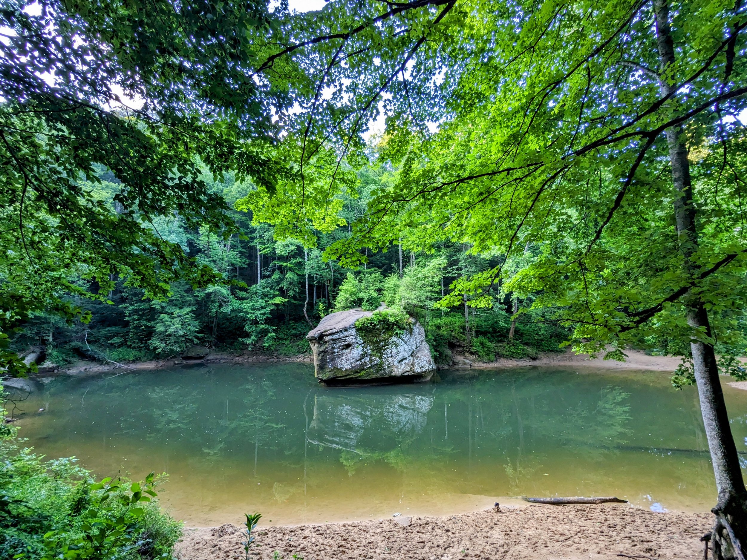
Sheltowee Trace Footbridge Across Red River

Bridge Closed, Repair Date Unknown

Sheltowee Trace Road Crossing at KY-715

Morning Forest Views on Sheltowee Trace

Rhododendron with Raindrops from Last Night

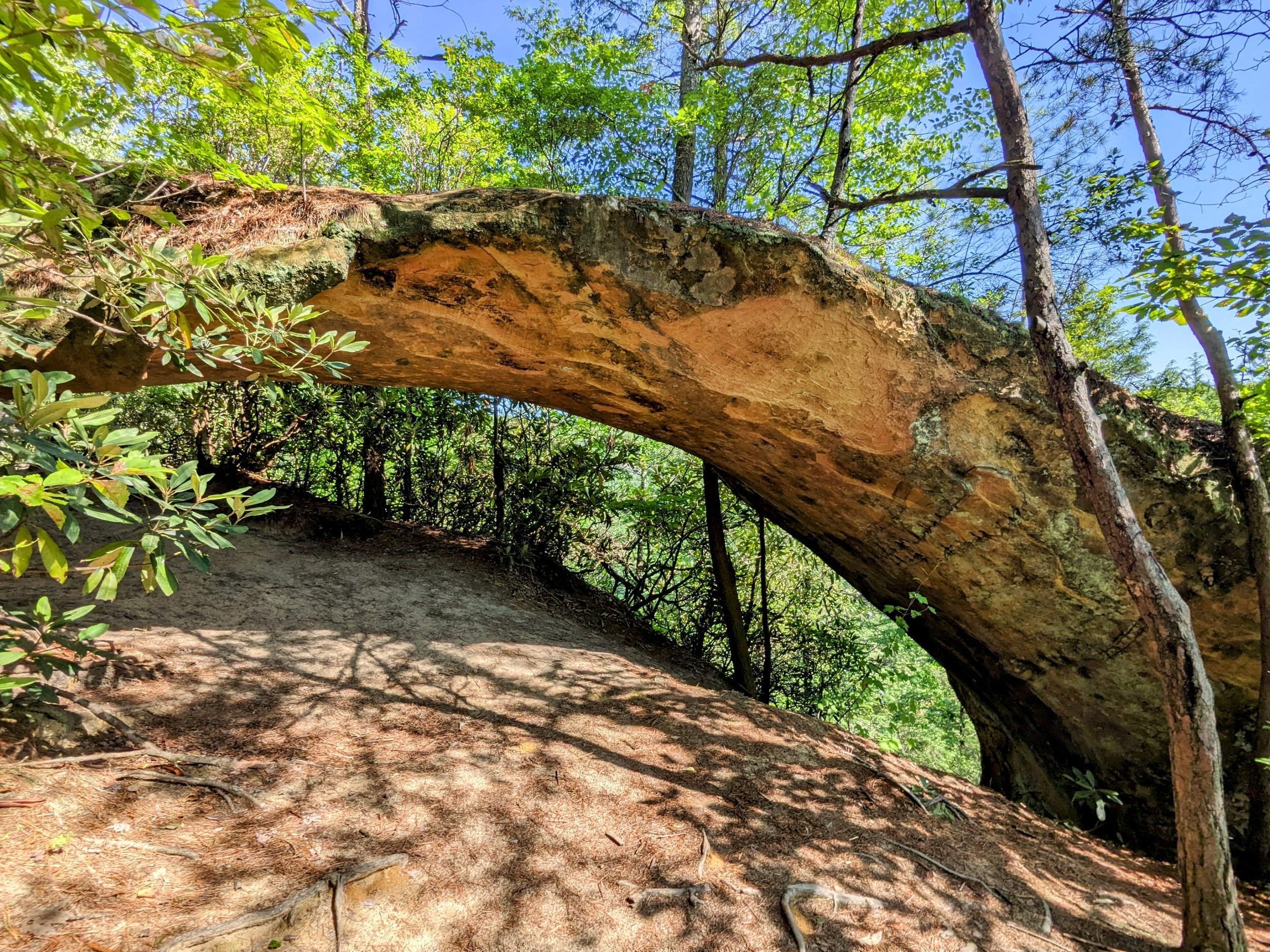
Window Complex Along Sheltowee Trace

Back View of Window Complex

Bald Ground => High Use; Carved Tree to Cloudsplitter

“CS” for Cloudsplitter Marks the Way

Trench Trail Resulting from Heavy Use without Trail Planning, Proper Construction, or Maintenance (this is the end result of any sloped user trail with enough use and water drainage)

Looking Up the Seam on Final Approach to the Top - NEVER use rope here unless you’ve inspected it from top to bottom - this rope was attached to vegetation that was lifting off of the rock and the “rope” was rated for 250 lbs. and was knotted together - real climbing rope won’t snap until 5,000 lbs.

The Crack to the Right - My Preferred Route; the rope here was closer to string and in tatters
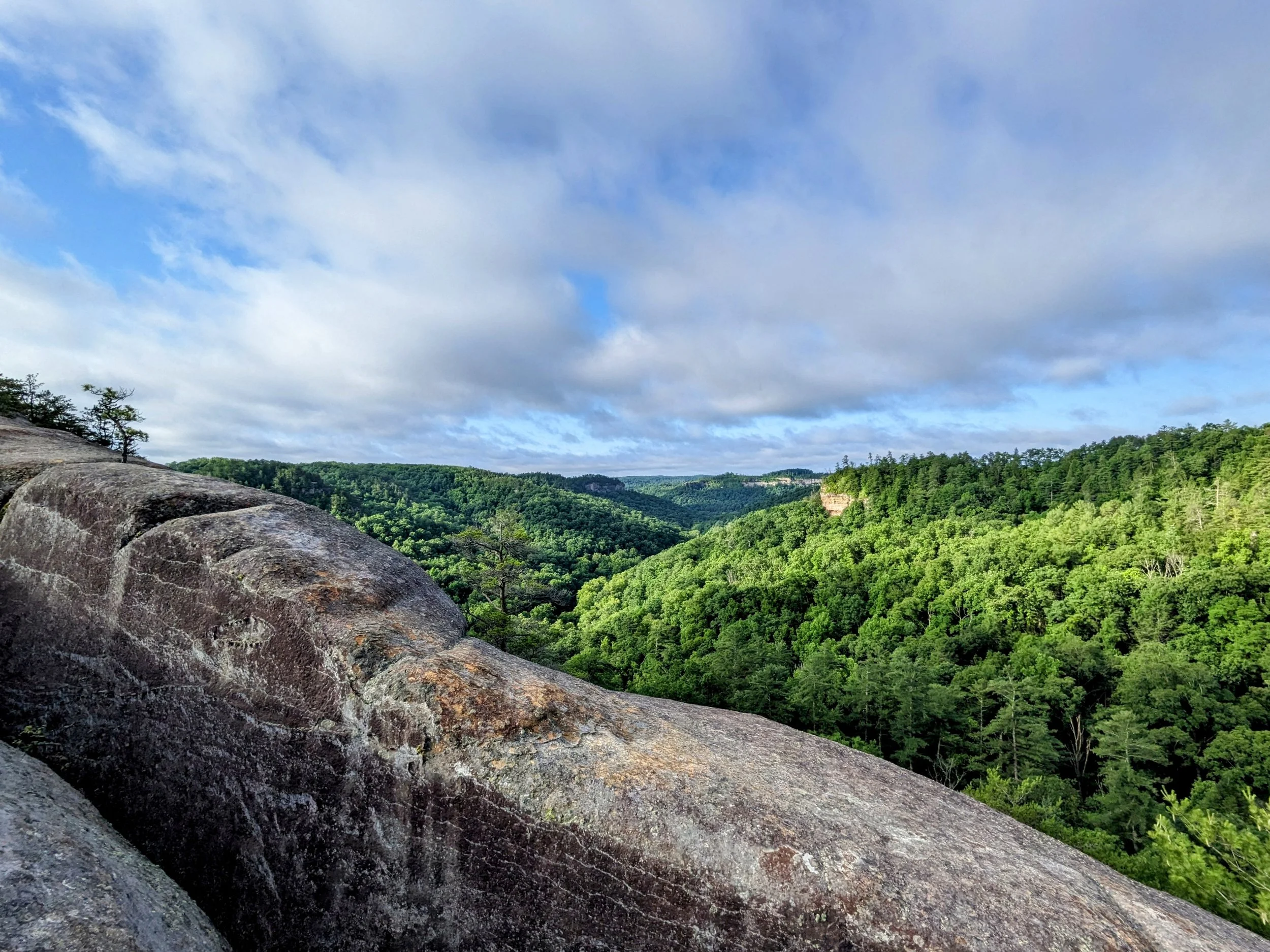
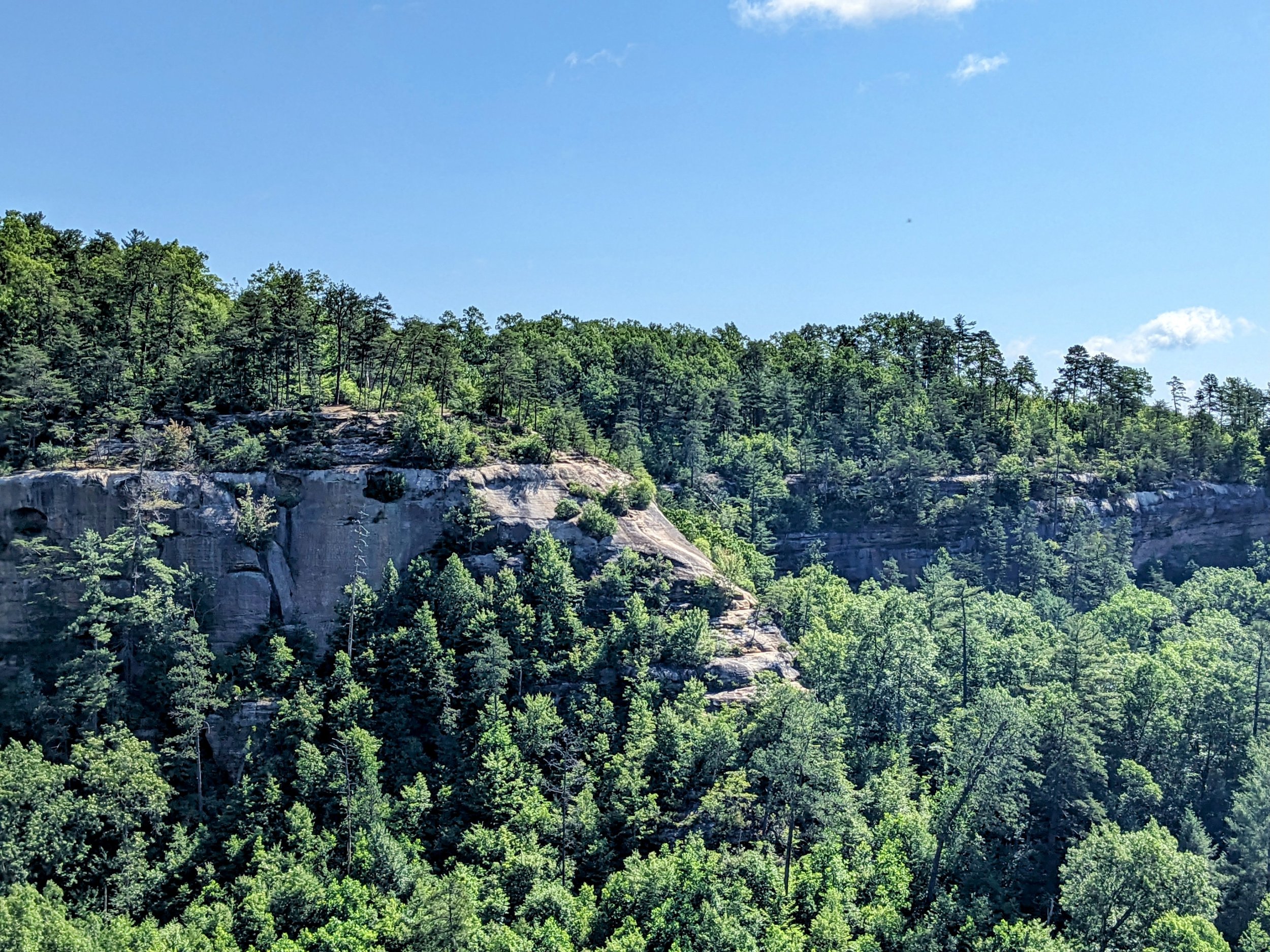
Morning Sun and Clouds Over Red River Gorge

Nice View from the Main Overlook at Cloudsplitter

Views from the Side of Cloudsplitter

Sheltowee Trace (go left) or Adena Arch (go straight)

Adena Arch Approach View
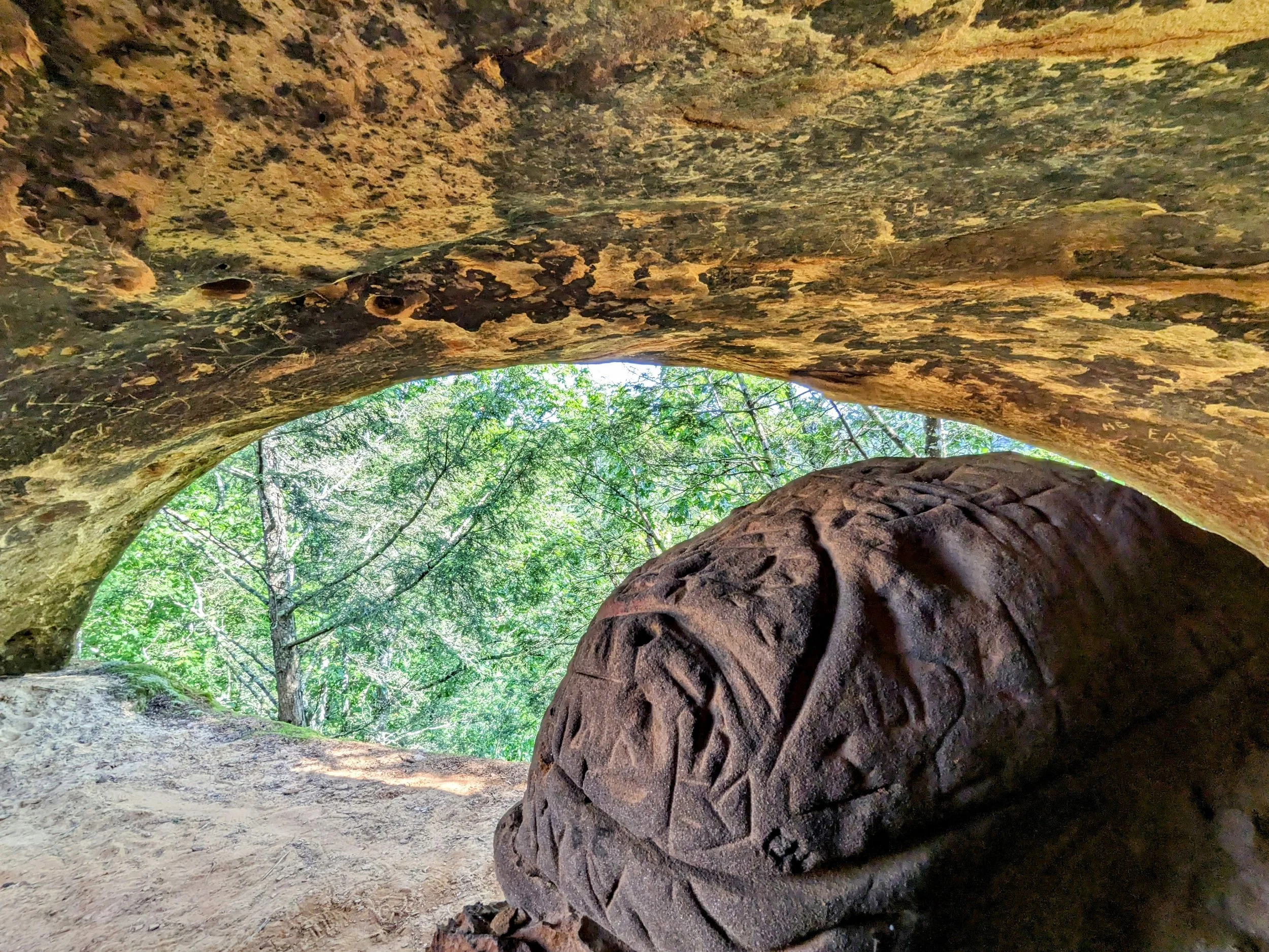
From Inside Adena Arch
Above the Arch is Adena Arch Overlook
Indian Arch with Its Beautiful Curves

Back View of Indian Arch

Trail Split - Left for Sheltowee Trace Southbound, Right for Indian Staircase

Large Campsite Marks the Turn; Peep the Stump on the Right

Follow the Path Past the Stump to Descend on the Mid-level Trail to Council Chamber

Looking Out to the Cliff Face with Frog’s Head (center) and Indian Staircase (right)
Indian Staircase is the Well Worn Streak on the Steep Slope

White Haired Goldenrod are Endemic to Red River Gorge - It Grows Nowhere Else on Earth

Approaching Council Chamber

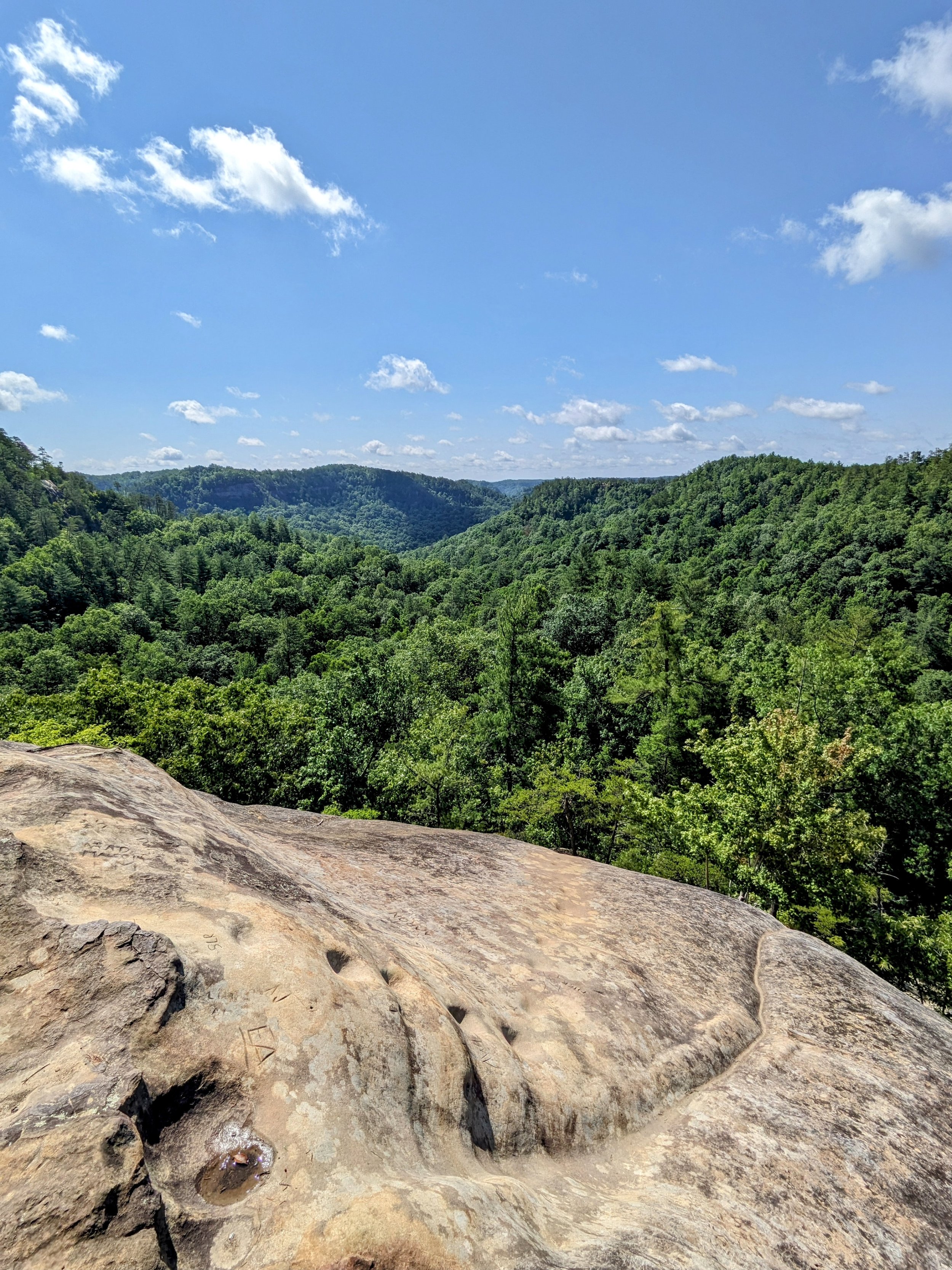
Looking Out from Council Chamber

Sacrificial Altar (fore) and Frog’s Head (back)

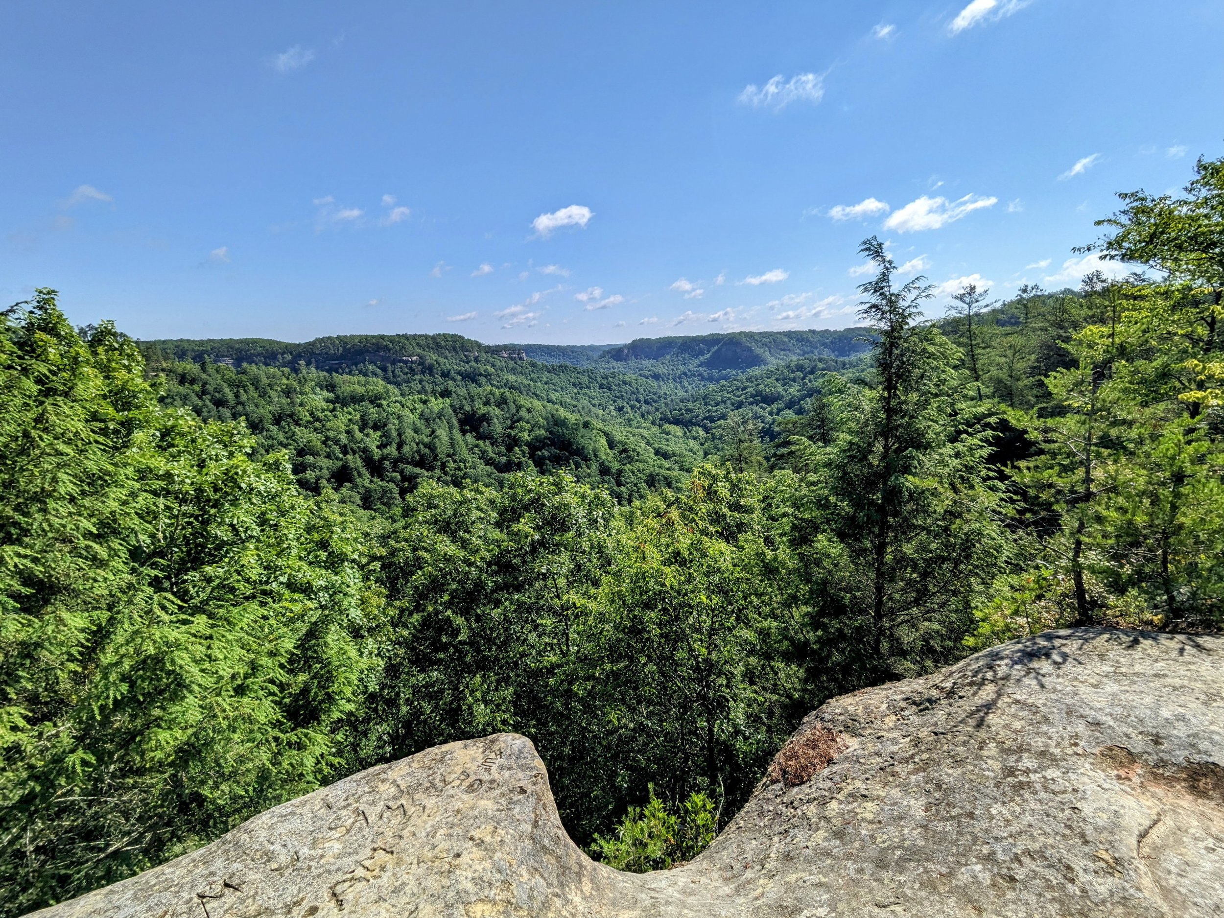
Looking Back at the Rim

Shawnee Arch Along the Unmarked, Unmaintained Indian Staircase User Trail
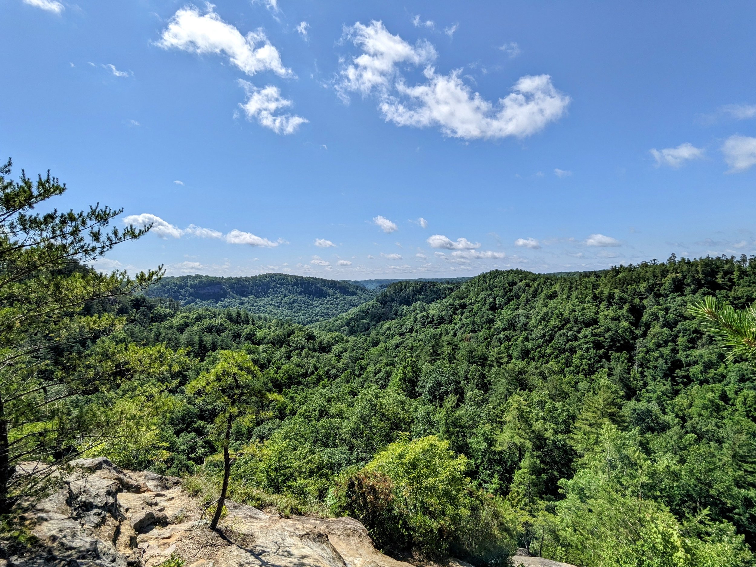
Plenty of Views on the Trail
Indian Staircase (bottom) Provides Another Great View

Crabwalking Down Indian Staircase - It’s Much Easier Ascending for Most

Scramble to Return to Official Trail

Looking Back at the Intersection of Sheltowee Trace and Indian Staircase Trail

Another Carved Tree Marks the Way

Sheltowee Trace-Bison Way Trail Junction

Departing Sheltowee Trace to Hike Eastbound on Lost Branch Trail
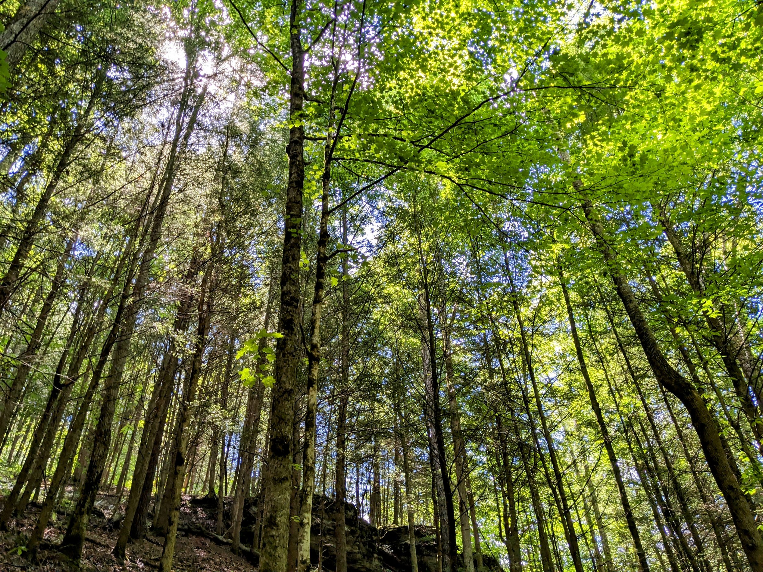
Quiet Forest Views

Long-used Campsite on Lost Branch Trail

Gladie Creek Summertime Water Level

One of MANY Campsites at the Gladie Creek Crossing - be sure to save the waypoint to avoid wandering spaghetti trails as I did

Lost Branch Trail’s Ascent to Osborne Bend Trail

T-intersection with Osborne Bend Trail - Left to Continue; Right to Bail
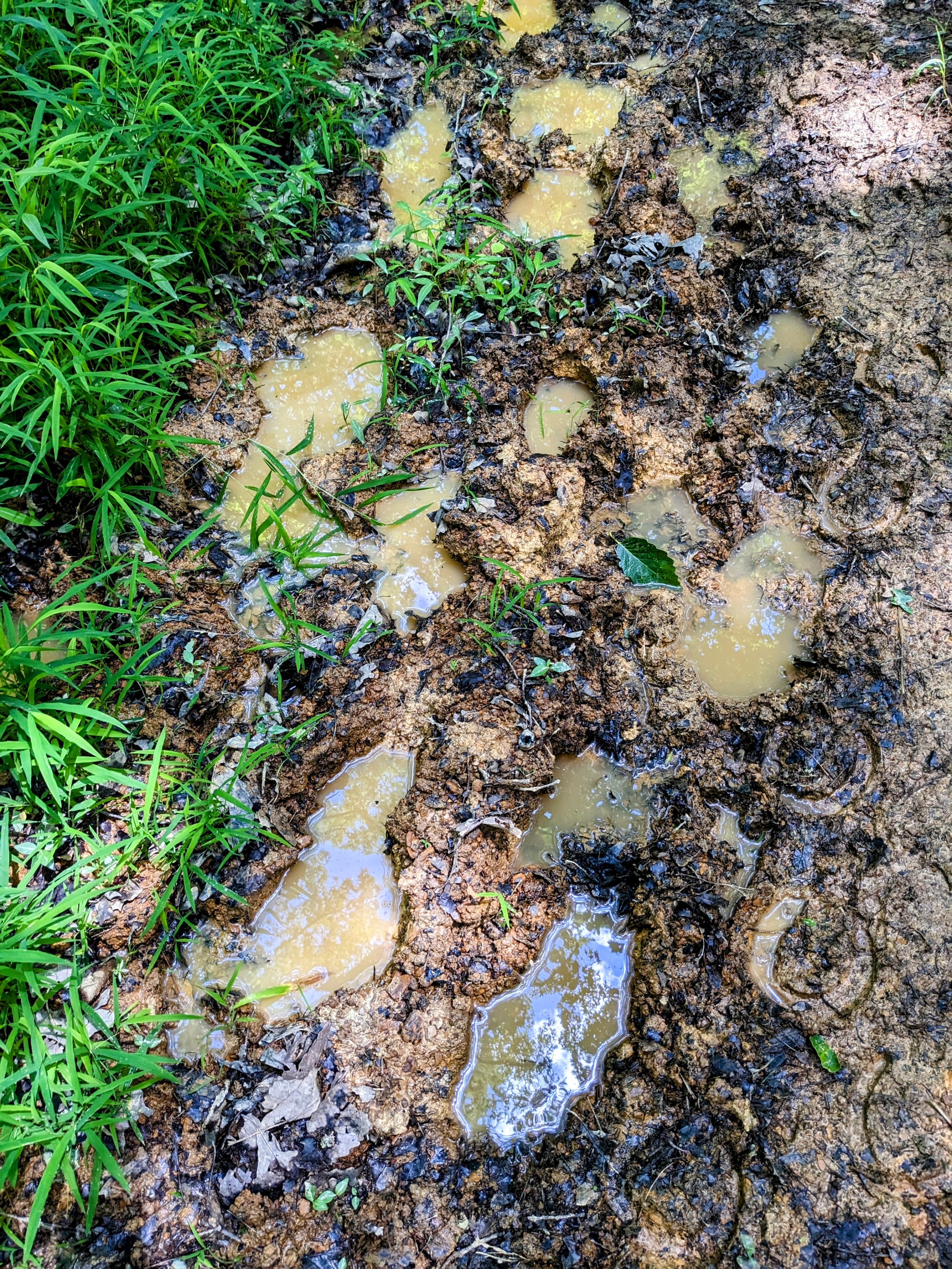
And Yes, Horses Have Been Here

Tons of Ferns Across Many Sections of This Route

Junction with Eagle Point Buttress Unmarked/Unmaintained User Trail - Left for the Buttress and Above Average Odds of Getting Lost, Right to Continue This Hike

Unassuming Junction with Path to Osborne Bend Arch
Osborne Bend Arch

Sweet Cliffline!

Looking Back at the Sharp Turn to Moonshiners Arch

Moonshiners Arch

View from Inside the Arch

Looking Up at the Chimney/Skylight and Back Entrance

Osborne Bend East Trailhead