Henson’s Arch, Whittleton Arch and Falls, Whittleton Branch Falls, Hanson’s Point, The Veranda, and Rush Ridge Overlook Lollipop

Map of Henson’s Arch, Whittleton Arch & Falls, Whittleton Branch Falls, Hanson’s Point, The Veranda, and Rush Ridge Overlook Lollipop

Elevation Profile of Henson’s Arch, Whittleton Arch & Falls, Whittleton Branch Falls, Hanson’s Point, The Veranda, and Rush Ridge Overlook Lollipop
Overview. Hike to two arches and two premium views with this lollipop route from the Whittleton Branch day use parking lot. Hike this after heavy rains and enjoy Whittleton Arch Falls and Whittleton Branch Falls too!
Route Type | Lollipop
Total Distance | 13.65 miles
Elevation Gain | 2,454 feet
Overall Difficulty | Moderate
spur trails to Hanson’s Point and The Veranda are unmarked and unmaintained; hike at your own risk
GPS Waypoints
Whittleton Branch Day Lot | 37.779994, -83.675261
Henson’s Arch Trailhead | 37.779847, -83.673431
Henson’s Arch | 37.777372, -83.674481
Whittleton Branch Trailhead | 37.782753, -83.672942
Whittleton Arch Trail Junction | 37.785931, -83.660594
Whittleton Arch/Falls | 37.782917, -83.661906
Whittleton Branch Falls | 37.788939, -83.656994
Pinch ‘em Tight Parking Lot | 37.805389, -83.655472
Pinch ‘em Tight Trail Crossing | 37.807081, -83.655953
Pinch ‘em Tight-Rough Trail Junction | 37.810767, -83.636361
Turn to Hanson’s Point “Trail” | 37.811522, -83.636700
Campsite | 37.814303, -83.637022
Campsite | 37.816589, -83.631761
Hanson’s Point | 37.816658, -83.626447
Turn to The Veranda “Trail” | 37.819139, -83.645469
The Veranda | 37.818119, -83.641011
Rush Ridge/Rough Trail Junction | 37.819028, -83.646417
Rush Ridge Overlook | 37.814500, -83.649061
Rush Ridge-Pinch ‘em Tight Trail Junction | 37.807889, -83.653319
Red River Gorge Area Map
Parking. Limited parking is available on either side between the check-in station and the campground. Do NOT park at campsites or in the cul-de-sac by Whittleton Branch Trailhead. Overflow parking is available across KY-11.
Trail Navigation. This is a longer route, so here’s the bullet point navigation:
Depart the day parking area and move northeast.
Crossover the bridge toward the bathrooms and bypass them to reach Henson’s Arch Trailhead past a few campsites tucked in the back loop.
Cross the footbridge and ascend steeply. You’ll loop around and arrive at Henson’s (Cave) Arch. Descend the steps for a closer inspection and retrace your steps back to the main road at the campground.
Make a right (north-northeast) and follow the road to its end at Whittleton Branch Trailhead. Take the trail east-northeast until reaching the junction with Whittleton Arch Trail.
Descend the spur trail and cross the streambed before ascending steeply to Whittleton Arch. Enjoy the arch and the falls if they’re flowing and retrace your steps to the main trail.
Continue on Whittleton Branch Trail and enjoy the gentle ascent, passing Whittleton Branch Falls on your left. Continue until reaching KY-15 and crossover onto Tunnel Ridge Road.
Follow the road a short while and move back to singletrack trail on your left.
Reach the Pinch ‘em Tight Parking Lot and continue across on singletrack trail.
Cross Tunnel Ridge Road and Pinch ‘em Tight Trail continues a little to your left after crossing. Enjoy this largely flat walk, passing intersections with Rush Ridge Trail on your left and Buck Trail on your right. Stay on Pinch ‘em Tight until it ends at the T-intersection with Rough Trail.
Take a left (north-northwest) and walk a few dozen paces gently downhill until reaching the unmarked intersection with Hanson’s Point “Trail”.
Go right onto the unmarked and unmaintained user trail and stay right at all the large campsites until reaching Hanson’s Point. It is normal to get momentarily lost around these campsites - just follow the .gpx route that you surely downloaded to your map app. Or, if you’re sans tech, follow a generally eastern route until reaching the point. Enjoy the phenomenal view here and retrace your steps back to the junction with Rough Trail.
Hang a right at the fork onto Rough Trail and descend steeply to Rush Branch - filter water here if you like before continuing uphill steeply.
There is a very slick section of trail between Rush Branch and Rush Ridge. This snakes around a slot-ish canyon with slick rock and mud. Take care with your steps here - search for flat spots and maintain balance.
Just before topping out, make a right onto The Veranda “Trail” that has a stake-sign to help people stay on Rough Trail. Continue on the unmarked, unmaintained user trail and move uphill through some brush passing some small campsites until reaching The Veranda at the eastern edge of the cliffline. The Veranda is so named for it’s large semi-circular shape - check it out on satellite.
Retrace your steps to Rough Trail and continue straight ahead uphill.
In a short while, reach the junction with Rush Ridge Trail and turn left to stay high on the ridgeline. Walk a little ways more and checkout the view at Rush Ridge Overlook on the right side of the trail.
Continue on the flat, sandy trail until rejoining Pinch ‘em Tight Trail and make your way west, then south across Tunnel Ridge Road, across KY-15, and descend Whittleton Branch Trail to return to the parking lot.
HIKER NOTE - Winter Parking. The campground is closed in wintertime and a rope blocks the drive to the normal parking area. Park next to the rope, but don’t block access in the event search and rescue requires access. If the lot is full, park across the street.
HIKER NOTE - Wet Weather Waterfalls. Both waterfalls on this route flow primarily after heavy rains thanks to small watersheds feeding them. That said, Whittleton Arch Falls is one of my favorites in Kentucky when conditions are right, so if you catch it on a good day, it’s pretty awesome.
HIKER NOTE - Ideal Conditions. The best time to hike this is in Spring when the wildflowers are blooming and after multi-day soaking rains. I also love this hike on snow-covered days (remember to bring microspikes!). It’s nice year-round and generally less insane in peak season than other parts of the Gorge. Hike mid-week to avoid crowds.
HIKER NOTE - One Night Beginner Backpacker Route. This is a really nice route that can be used by beginner backpackers for an overnight (camping near Hanson’s Point) without too much elevation gain. Just remember to top-off water before departing Whittleton Branch. The next opportunity is at Rush Branch between Hanson’s Point and The Veranda. Sunrise at Hanson’s Point is very nice.
CAUTION - Deadly Drops. Long falls from high places are the #1 non-health related cause of death for hikers in Kentucky. Keep your distance from the edges of cliffs to avoid a deadly fall. Young children should be kept close.
CAUTION - Poisonous Snakes. Copperheads and timber rattlesnakes can be found in the area. Should you encounter one, stop and slowly back away. Always give venomous snakes a wide berth. Know Before You Go => University of Kentucky Venomous Snake Guide
CAUTION - Black Bears. Ursus Americanus - a.k.a. the American black bear is growing in population throughout much of Kentucky. Know Before You Go => US Forest Service Black Bear Safety Tips

Whittleton Branch Day Use Parking is on the Right Side by the Woodshed

Instructions are Nice

Take a Right Toward Henson's Arch Trailhead

Almost There

Henson's Arch Trailhead

Looking Up from Henson's Cave Arch

Whittleton Branch Trailhead

A Nice New Bridge and a Big Old Boulder

Take the Left Fork Uphill to Stay On Trail

Take the Right Fork to Whittleton Arch

Cross the Footbridge to Whittleton Arch

View from Under Whittleton Arch with the Falls Dripping

Turn Right to Continue Toward KY-15

Whittleton Branch Falls After a Short Dry Spell

KY-15 Crossing to Tunnel Ridge Road

Passing Over Mountain Parkway
Transition Back to Singletrack on the Left

Pinch 'em Tight Parking Lot

Pinch 'em Tight Trailhead

Crossover Tunnel Ridge Road

Pinch 'em Tight Trail Continues

Turn Left at Rough Trail Junction

Turn Right to Hanson's Point

Stay Right at the Campsites

Follow the Most Well Trod Path
Last Campsite Before the Descent to Hanson's Point

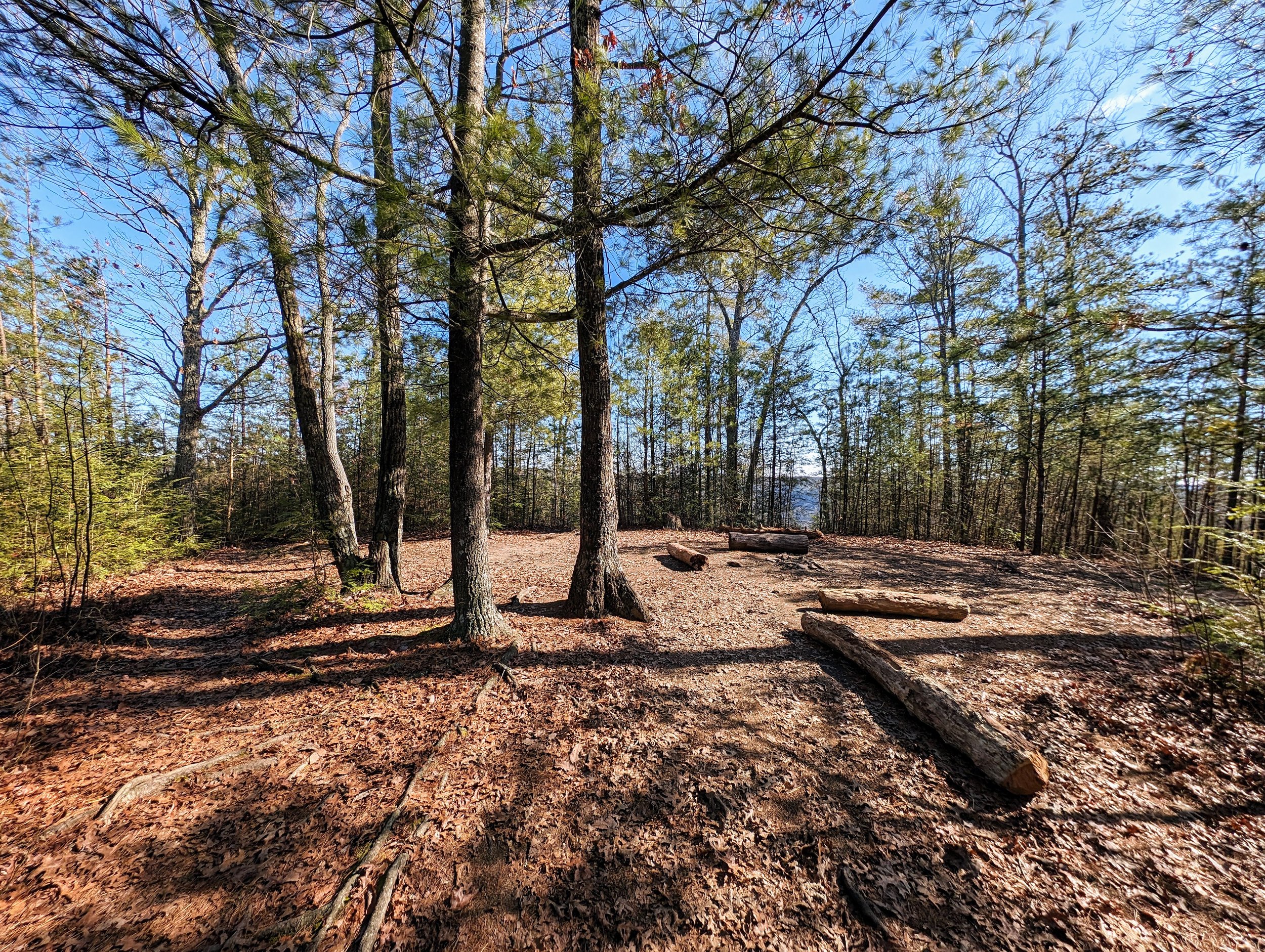
Final Approach to Hanson's Point

Pinch ‘em Tight Gap from Hanson’s Point

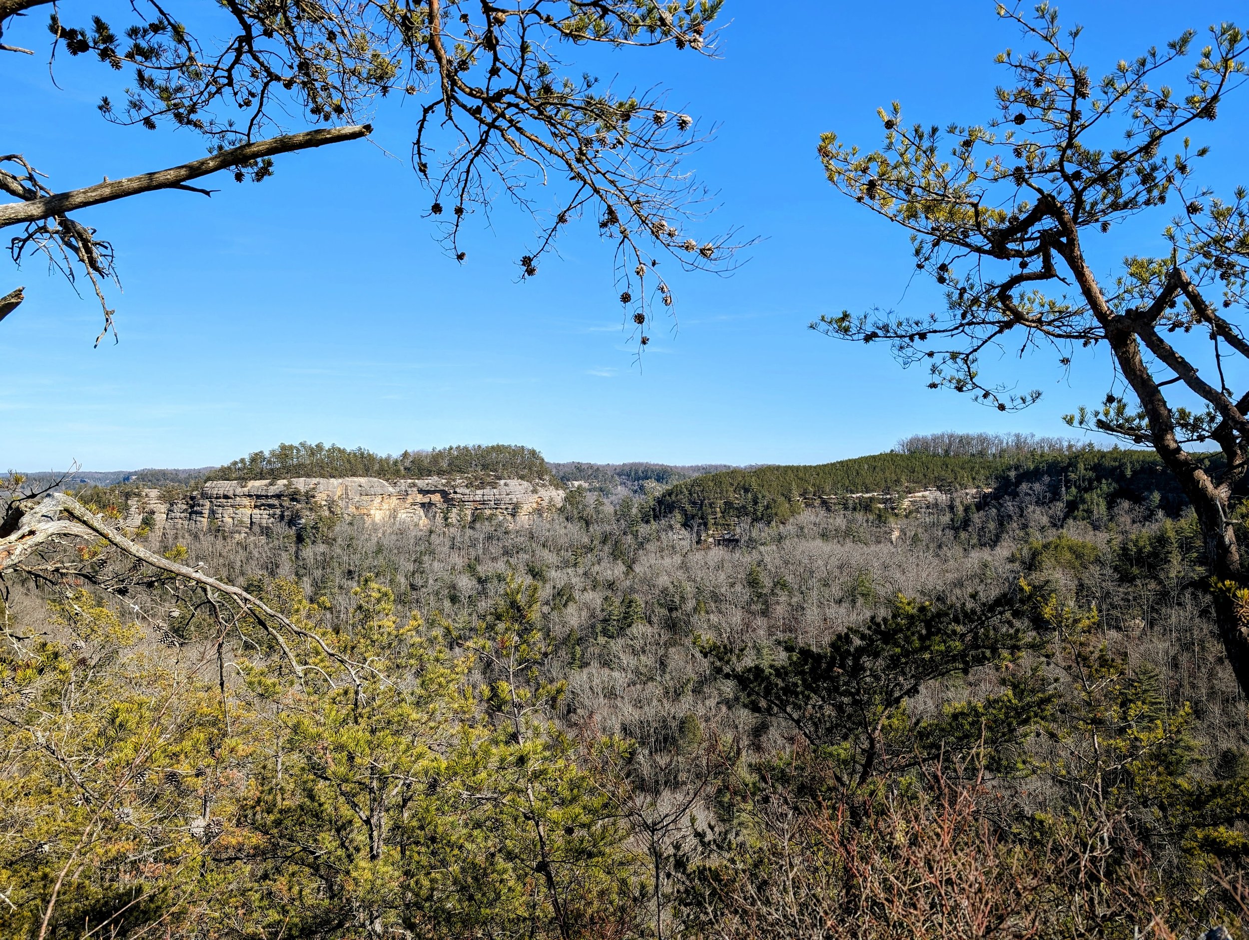
A Commanding View from Hanson's Point - Chimney Top Rock (center) and Half Moon (center-right) with Cloudsplitter waaay off in the distance (left-center)

Heading Back Off the Point

Go Straight to Continue Downhill on Rough Trail

I Spy a Bonus Arch High Above the Trail

Slick Section on the Way to Rush Ridge

Classic Multi-layered Sandston Rock Shelter

Stake Sign Marks the Start to The Veranda

Campsite Near The Veranda

Views Southeast from The Veranda
Pinch 'em Tight Gap from The Veranda

Walking Back from The Veranda

Double Diamonds Lead the Way to Rush Ridge Trail

Turn Left Onto Rush Ridge Trail

Late Afternoon Sun from Rush Ridge Overlook

Rush Ridge-Pinch 'em Tight Trail Junction

Finishing a Day Well Spent