Eagle Point Buttress Scenic Loop with Unicorn, Osborne Bend, and Moonshiners Arches


Overview. This is a classic loop in Red River Gorge that visits three arches and the best south facing overlook in the region. Situated above a bend in Red River, Eagle Point Buttress provides a stunning view if you can manage a very steep section of unmarked and unmaintained trail. Be sure to read the cautions and notes below before heading out.
Route Type | Loop and Spurs
Total Distance | 4.39 miles
Elevation Gain | 542 feet
Overall Difficulty | Moderate with Class 2 Scrambles
this loop uses unmarked and unmaintained user trails; hikers frequently get lost attempting this hike
GPS Waypoints
Osborne Bend East Trailhead | 37.820294, -83.574561
Unicorn Arch | 37.825496, -83.572170
Turn to Osborne Bend Arch | 37.826639, -83.571842
Osborne Bend Arch | 37.826543, -83.571711
Osborne Bend/Eagle Point “Trail” Junction | 37.838258, -83.565617
Turn to Eagle Point Buttress | 37.826861, -83.559447
Top of the Falls | 37.826764, -83.561625
Eagle Point Buttress | 37.826306, -83.562233
Moonshiners Arch | 37.821206, -83.571672
Red River Gorge Area Map
Parking. Limited parking is available at the Osborne Bend Trailhead and roadside near Copperas Creek. Do NOT block the spots reserved for emergency vehicles.
Trail Navigation. This hike produces an outsized number of 911 calls from lost hikers and is the site of a number of serious injuries and deaths from people falling from Eagle Point Buttress. While the user trails aren’t marked or maintained, they are heavily traveled and experienced backcountry hikers should have no problem navigating this hike. If you do not possess appropriate navigation skills, do NOT attempt this hike - ideally, go with someone who’s been here before. All that said, here is the turn by turn navigation clockwise from Osborne Bend East Trailhead:
Walk past the info kiosk and move uphill on Osborne Bend Trail
Continue uphill on the doubletrack trail and near mile 0.4, look up and left to find Unicorn Arch. To reach the arch, move uphill past it and scramble up the exposed rock. Watch your head when you get level with the arch.
Drop down from the arch and continue uphill on Osborne Bend Trail passing a winding section of trail before reaching the next section of wider trail.
Look right to find a narrower user trail going downhill. Follow it past a campsite and continue to find the small, but beautiful Osborne Bend Arch. Approach on the left side to drop down to the arch.
Retrace your steps and continue uphill on doubletrack before reaching a sharp turn on less clear, less traveled doubletrack trail - this is the path to Eagle Point Buttress.
Follow this long out of use forest road around numerous downed trees - there are plenty of footpaths, just be sure to stay near the old forest road.
Continue until nearing the top of the cliff shown on your topo map.
Take a right to move generally west along the clifftop - crossing the top of a wet weather waterfall - until popping out at Eagle Point that is a huge patch of exposed rock with a commanding view above a bend in Red River.
Retrace your steps and keep your eyes to the right for a very clearly defined, but steep path leading downhill. Downclimb from here and don’t be afraid to crabwalk on all fours if needed. There are numerous trails here with one going to the base of the wet weather waterfall and the others eventually bottoming out at the river.
Move west/downstream along the river and about 2/10th of a mile from the trailhead, turn right on the well trod trails (three opportunities) to reach Moonshiners Arch.
From the arch, move back down to the river and turn right to hike the final tenth or two to the trailhead. There is one scramble to get over some massive deadfall here, so manage it with care.
RULE REMINDER - All Caves are CLOSED. Caves are off limits throughout Daniel Boone National Forest. This is to reduce the spread of a fungus that causes the deadly white nose syndrome in bats. Some bat populations have declined by more than 90% in our region just in the last few decades.
HIKER NOTE - Bad Knees, Counterclockwise. If you have bad knees, hike this counterclockwise. In terms of knee stress, it is far easier to ascend the steep section below Eagle Point than to descend it. And, don’t be afraid to get on all fours when needed.
HIKER NOTE - Easier Navigation, Clockwise. If you don’t have bad knees or other physical ailments, it’s much easier to navigate this hike clockwise. When descending, there is a network of spaghetti trails, so you can pick the easiest path and simply get to the river.
HIKER NOTE - Sunrise/Sunset at Eagle Point. This is a nice spot for sunrises and sunsets, BUT it has southerly views - meaning the sun will rise and set behind you nearer the Summer solstice. Ideal time of year is on the Winter side of the equinoxes - likely late January to early February or late October into November.
CAUTION - Spaghetti Trails. There are many trails that intersect this route. These can be misleading and move you well off course - possibly resulting in a search and rescue op. Be sure to download the .gpx file to your map app and follow it closely on your hike. ALWAYS record your hike using a GPS tracking app so you can backtrack when needed.
CAUTION - Extra Time, Headlamp. Many who call 911 get caught out after dark because they don’t allow enough time for the hike. This hike takes longer than most in Red River Gorge because it requires more wayfinding, circumnavigating downed trees, and dealing with a very steep slope. Allow 1.5 to 2x your normal hiking time for this distance. If heading out within four or five hours of sunset, bring a headlamp. With batteries. That are fully charged.
CAUTION - Avoid When Wet. The section below the point is very steep dirt that turns to slick mud when wet. Avoid this hike when wet or make it a long out and back using Osborne Bend Trail.
CAUTION - Deadly Drops. Long falls from high places are the #1 non-health related cause of death for hikers in Kentucky. Keep your distance from the edges of cliffs to avoid a deadly fall. Young children should be kept close.
CAUTION - Poisonous Snakes. Copperheads and timber rattlesnakes can be found in the area. Should you encounter one, stop and slowly back away. Always give venomous snakes a wide berth. Know Before You Go => University of Kentucky Venomous Snake Guide
CAUTION - Black Bears. Ursus Americanus - a.k.a. the American black bear is growing in population throughout much of Kentucky. Know Before You Go => US Forest Service Black Bear Safety Tips

Osborne Bend East Trailhead

Begin by taking the trail uphill

Wide doubletrack trail comprises most of this route - the official, marked, and maintained section is clear and easy to travel; the unofficial, unmarked, and unmaintained section is much slower so be sure to allow sufficient time

Plenty of spring wildflowers line this route

Unicorn Arch sits just above the trail on the west side

Unicorn Arch

Trail split to Osborne Bend Arch - downhill to reach the arch

From the near side of Osborne Bend Arch
From the far side of Osborne Bend Arch

Watch for widowmakers overhead - especially when hiking in windy, icy, or snowy conditions
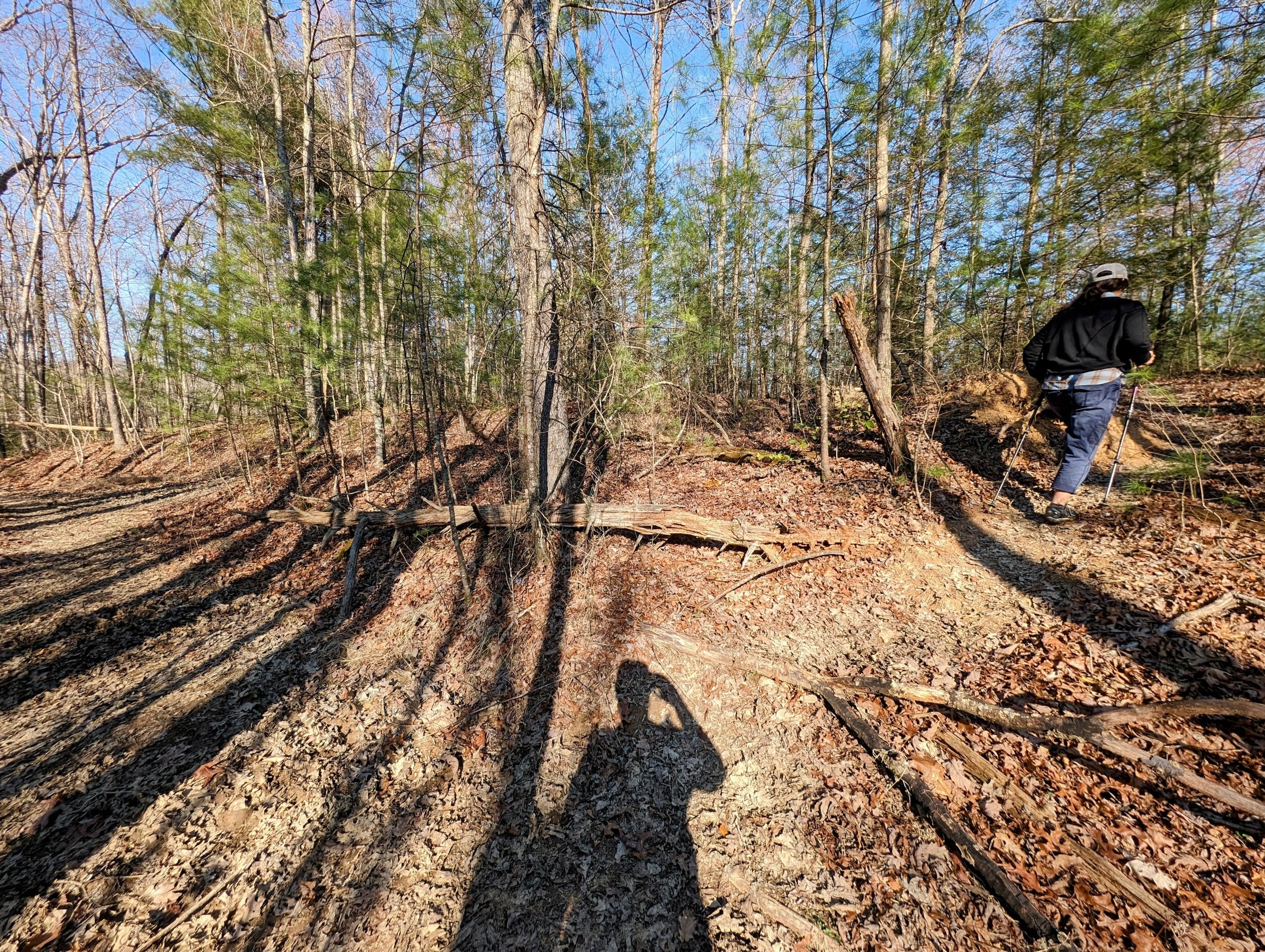
Turn sharply to the unmarked and unmaintained user trail moving toward Eagle Point - it’s mostly decommissioned doubletrack with plenty of downed trees

Continue high on the ridgeline to reach Eagle Point Buttress; going downhill leads to the river

First clifftop view - Eagle Point Buttress center-right at the ‘nose’ of the visible cliffline

Top of Eagle Point Buttress Falls - this flows only with very wet weather
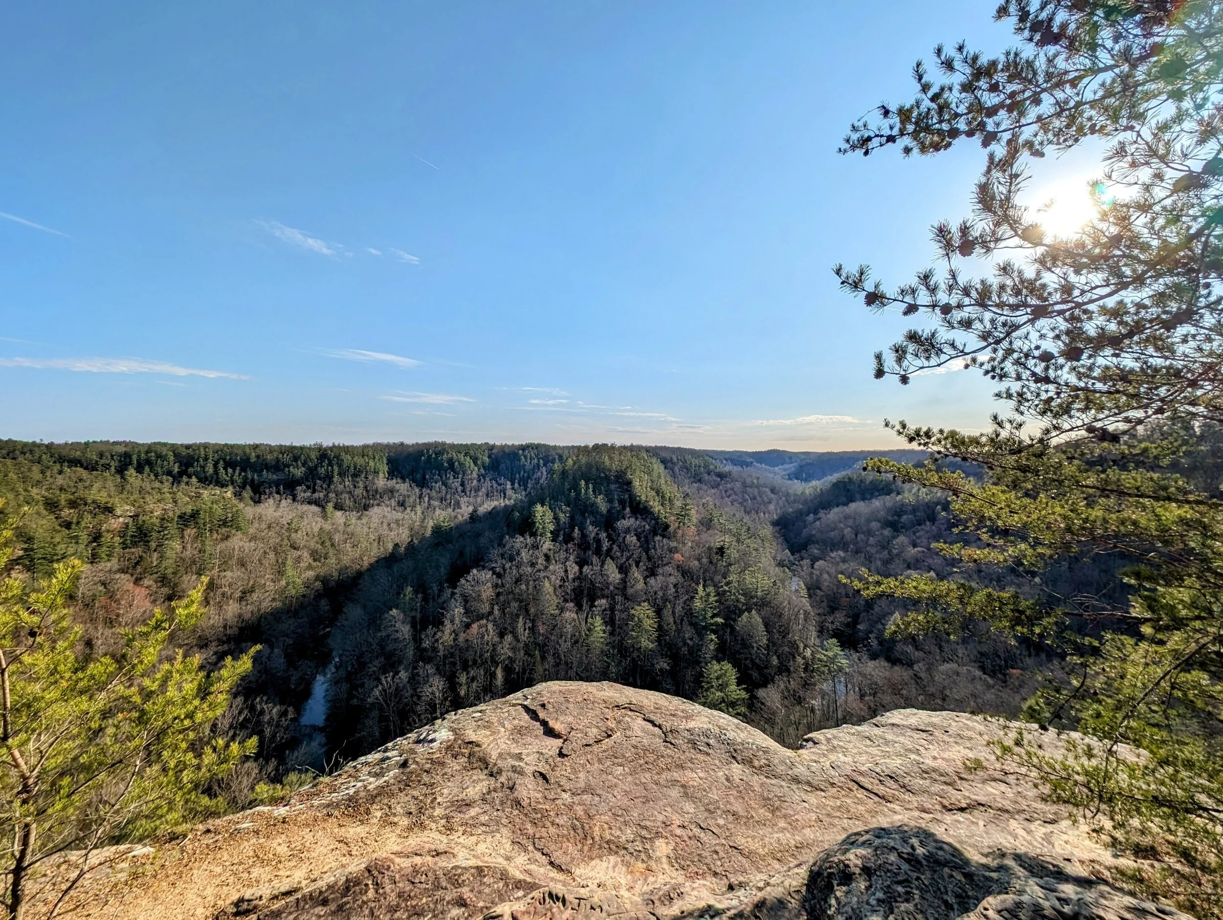
Approach view at Eagle Point Buttress
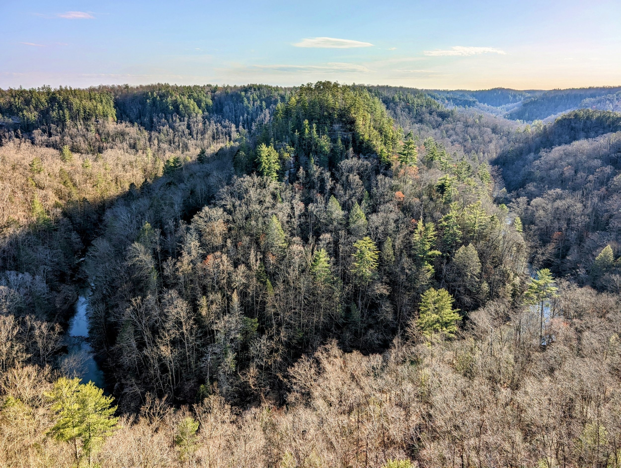
The point is above a bend in Red River and the view is similar to that found at Mill Rock Point at Breaks Interstate Park - the gorge here is about 350 feet while Breaks is almost three time greater

Sunset is down the river cut in November and January

Turn here to drop down very steeply to the river

Late day sun through the leafless forest
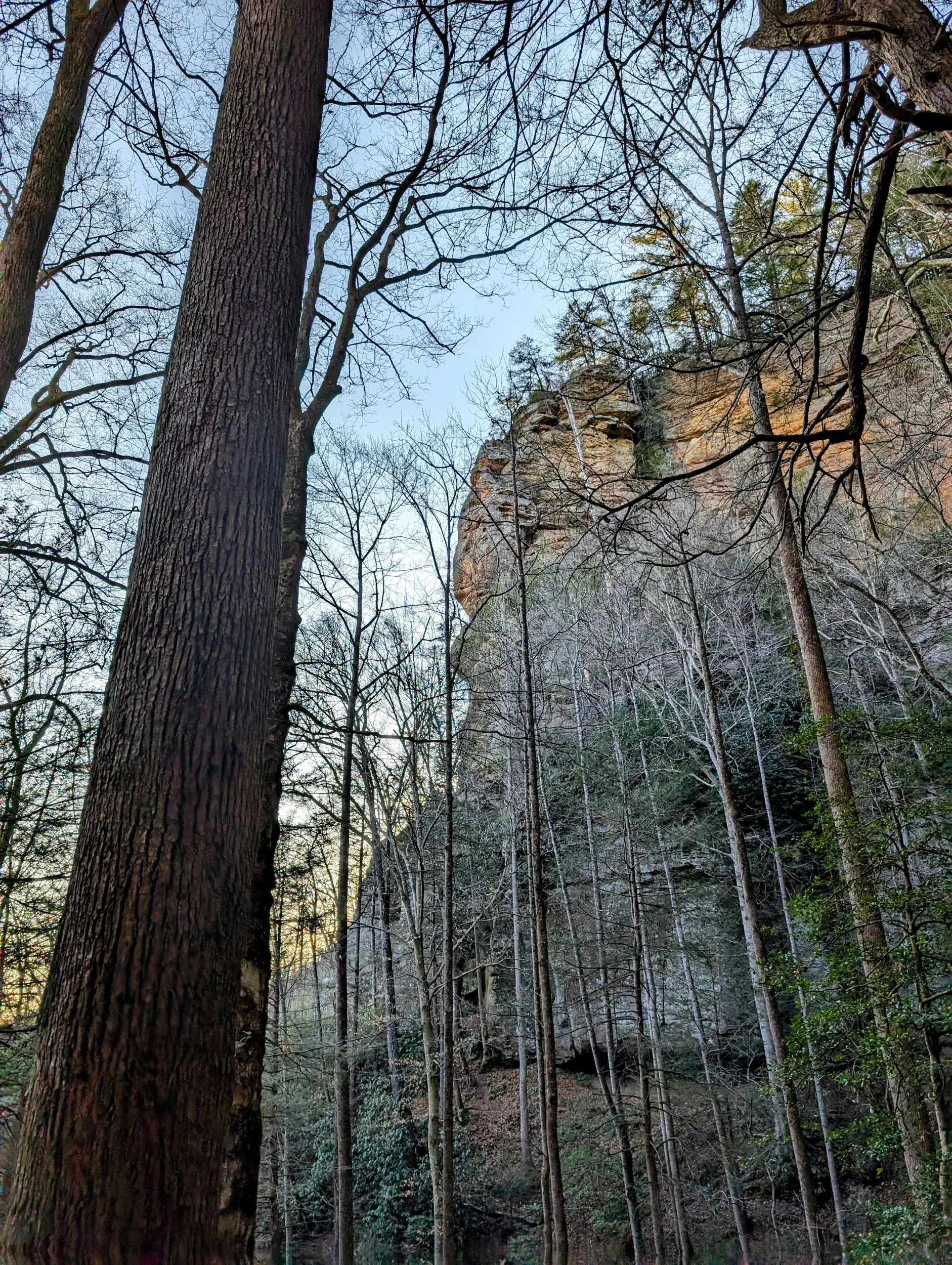
Looking up at Eagle Point Buttress

Red River

Caves are CLOSED to all visitors throughout Daniel Boone National Forest

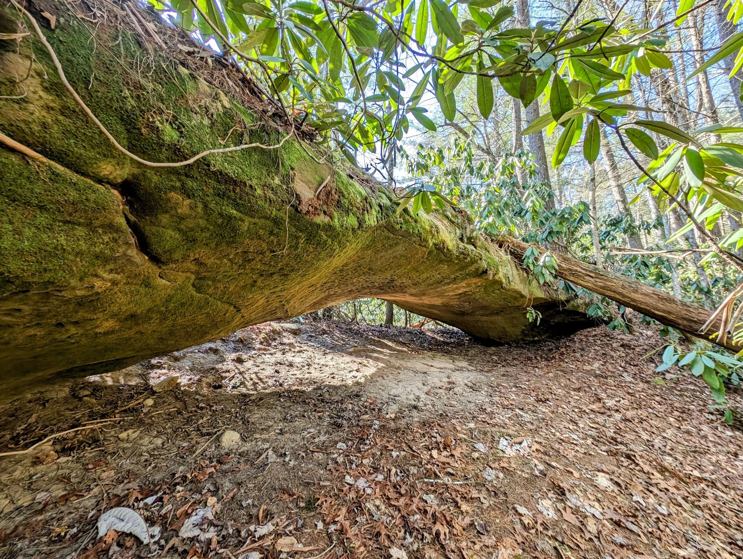
Moonshiners Arch approach view from the river

Moonshiners Arch has a nice skylight/chimney - make sure you don’t fall through if you check it out from above

Looking out toward the river from underneath the arch

Last obstacle before finishing the loop and heading to Sky Bridge Station for dinner and drinks