Cannon Mountain and the Cannonballs

Map of Cannon Mountain and Cannon Balls Loop, Franconia Notch State Park and White Mountain National Forest

Elevation Profile of Cannon Mountain and Cannon Balls Loop, Franconia Notch State Park and White Mountain National Forest
Overview. This is a hiker's hike. It's physically challenging with long stretches of steep climbs and descents, but it is gorgeous! With 360 degree views from the tower and direct views out to Franconia Ridge, this hike had plenty of views. Oh, and Lonesome Lake was a nice bonus;-)
I was supposed to hike the Kinsmans as well on this day, but due to a late start and lack of White-Mountain-fitness, I descended early and parted ways with my son. He managed the other two summits and arrived at the trailhead shortly after me.
Route Type | Loop
Total Distance | 8.72 miles
Elevation Gain | 3,592 feet
Overall Difficulty | Strenuous with Class 2 Scrambles
GPS Waypoints
Trailhead | 44.141928, -71.684206
Lonesome Lake-Hi Cannon Split | 44.140686, -71.689528
Hi Cannon-Dodge Cutoff Split | 44.143522, -71.696056
Hi Cannon-Kinsman Ridge Split | 44.152447, -71.700658
Observation Tower | 44.156625, -71.698700
Aerial Tram Station | 44.158267, -71.698294
Kinsman Ridge-Lonesome Lake Split | 44.150786, -71.706125
Kinsman Ridge-Fishin’ Jimmy Split | 44.138044, -71.733042
Lonesome Lake AMC Hut | 44.138339, -71.703061
Fishin’ Jimmy-Cascade Brook Split | 44.138175, -71.702036
Cascade Brook-Lonesome Lake Split | 44.140397, -71.699122
Franconia Notch State Park Map
Parking. Limited parking is available at the trailhead by Lafayette Campground, but this can be completely full during peak season. We had LaFonda give us taxi service for this one.
Trail Navigation. This hike is on well marked and well defined trail that are easily navigated, but with several trail intersections. Hiking the loop counterclockwise:
Begin on Lonesome Lake Trail from Lafayette Campground
Turn Right (west-northwest) onto Hi-Cannon Trail
Continue Past Dodge Cutoff
Turn Right (north-northeast) onto Kinsman Ridge Trail
Continue to Observation Tower and Tram Station
Retrace Steps and Continue Past Hi-Cannon Trail
Continue Past Lonesome Lake Trail
Turn Left (east) onto Fishin’ Jimmy Trail
Continue Past Lonesome Lake AMC Hut
Turn Right (southeast) to Circle the Lake
Continue on Cascade Brook Trail
Turn Right (east) onto Lonesome Lake Trail
Continue Past Hi-Cannon Trail
Descend to Lafayette Campground Trailhead
HIKER NOTE - Tram to the Top. You can skip the hike and take the tram when it’s running up to the top. There is a restaurant and plenty of beer too!
HIKER NOTE - Add the Kinsmans. North and South Kinsman add three miles, but are certainly worth the extra effort. I regret not reaching these summits, but I’ll get up there on a future trip…and eventually finish all the 4,000-footers.
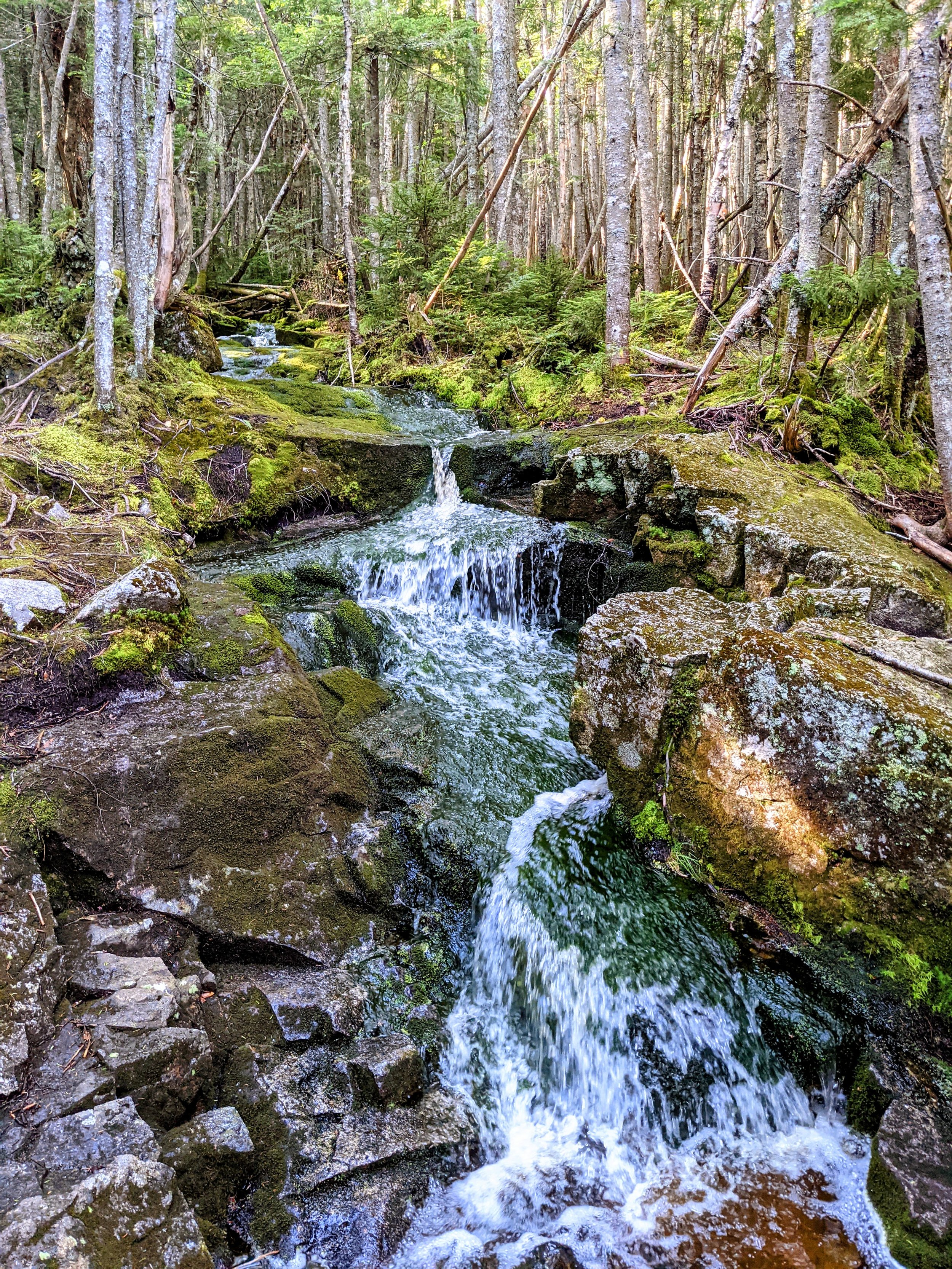
HIKER NOTE - Trail Building. This hike features perhaps the widest range of trail construction techniques I’ve ever encountered on a single day hike. It is marvelously built while remaining physically challenging and minimally invasive.
CAUTION - Be Bear Aware. Black bear are plentiful in the region. Know Before You Go => US Forest Service Black Bear Safety Tips
CAUTION - Moose. Be aware and never approach moose. Leave a wide berth and turn back if needed.

Lonesome Lake Trailhead, Franconia Notch State Park

Chase and Mason Looking Up Hi-Cannon Trail, Franconia Notch State Park
First View of Franconia Ridge, Franconia Notch State Park

A Well Worn Ladder on Hi Cannon Trail, Franconia Notch State Park

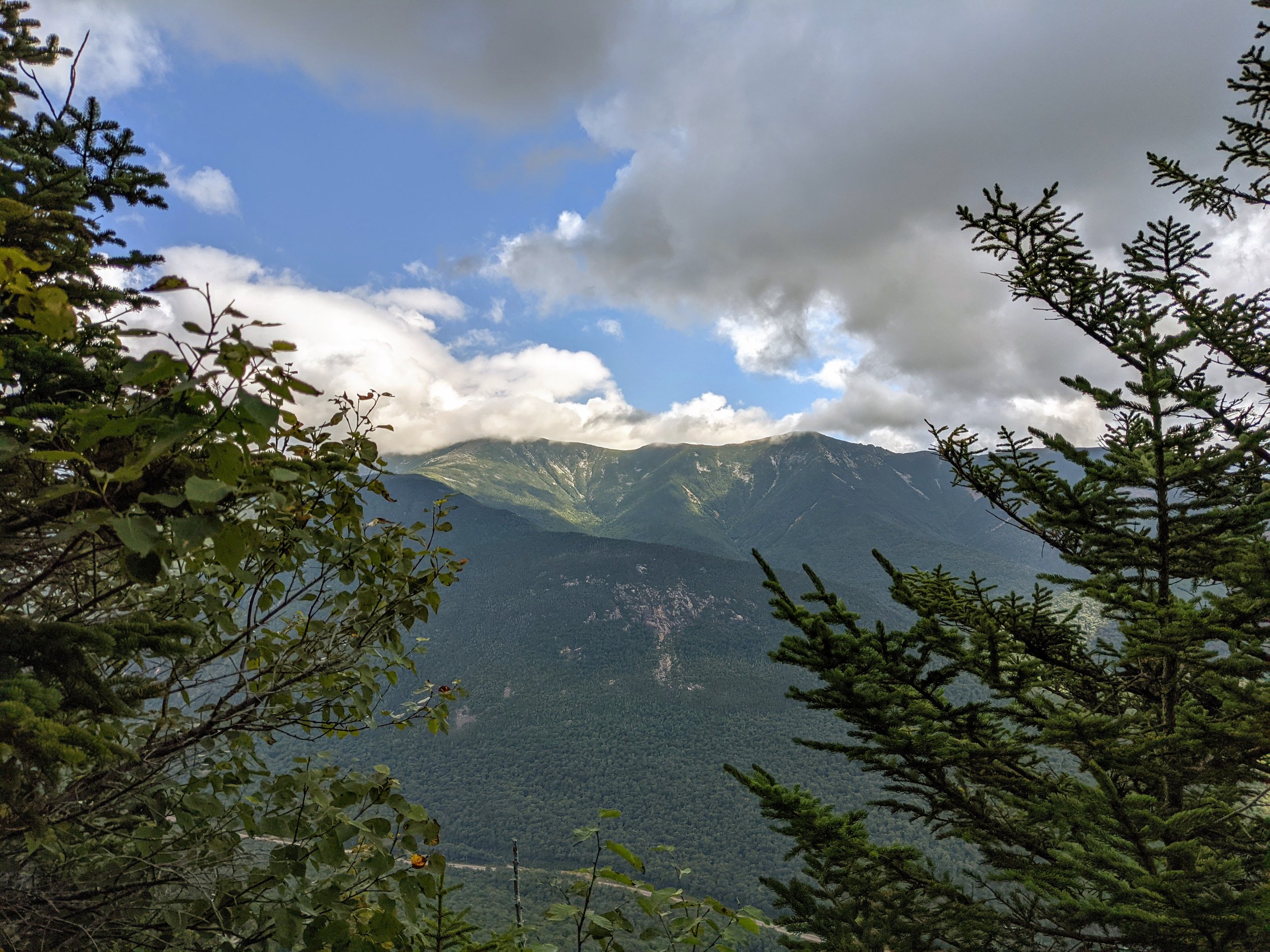
Granite Cliffs and Franconia Ridge, Franconia Notch State Park
Franconia Notch and Lonesome Lake, Franconia Notch State Park

Big View and Lively Clouds, Franconia Notch State Park

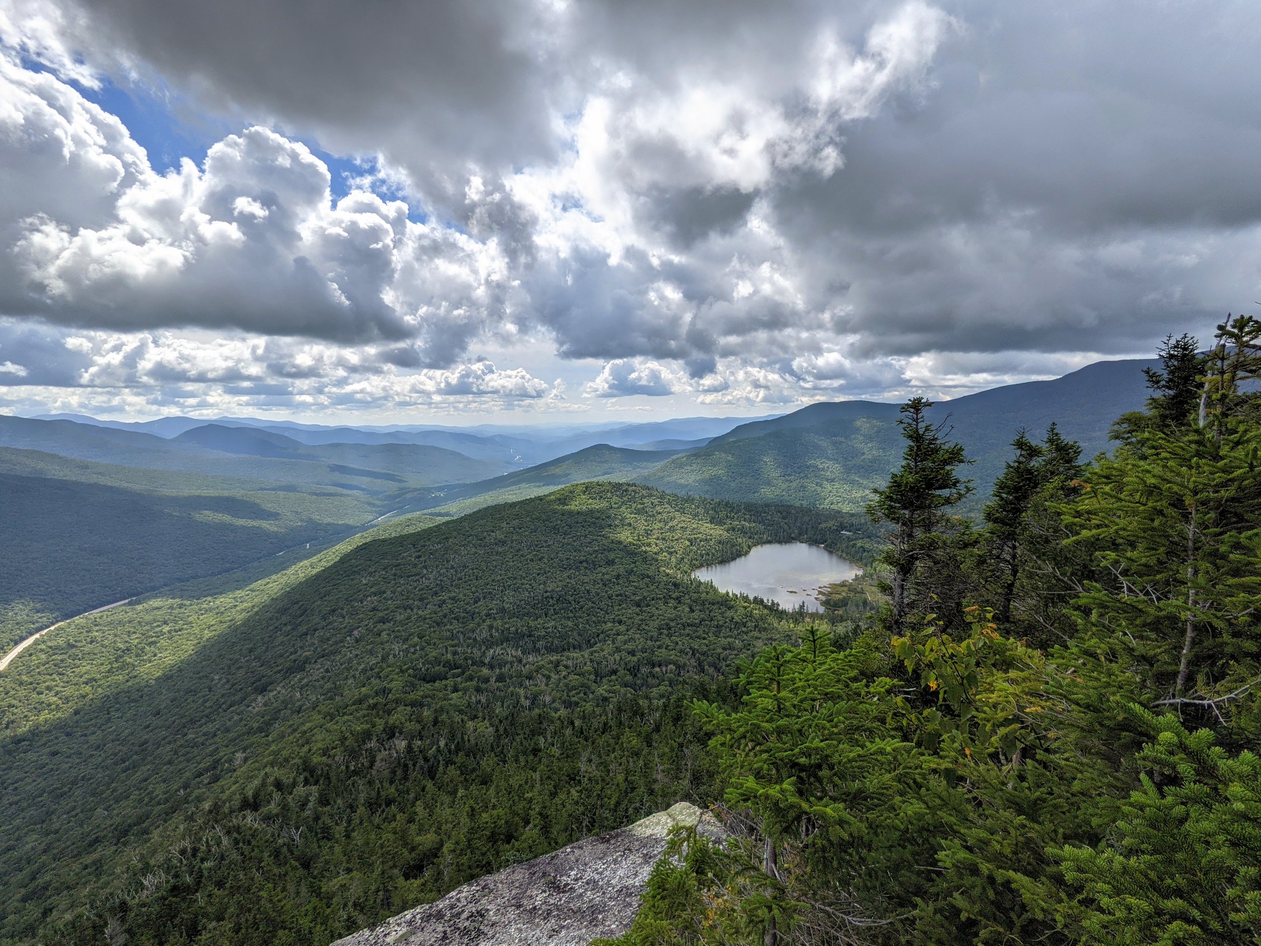
The Cannon Balls and Kinsmans, White Mountain National Forest

Franconia Notch from Cannon Mountain Observation Tower, White Mountain National Forest

Chase Looking Out to Mt. Lafayette, White Mountain National Forest

Cannon Mountain Tram Station, White Mountain National Forest

4,080’ AND Cold Beer, White Mountain National Forest

Cannon Mountain Tram, White Mountain National Forest

Sweeping Views on a Side Trail Atop Cannon Mountain, White Mountain National Forest

Sign in White Mountain National Forest Save Lives, Heed These Warnings

Looking Back from the First Cannon Ball to the Observation Tower

A different, but effective trail construction technique
A nice spot to have a sit

Lonesome Lake AMC Hut, White Mountain National Forest

Coffee Cake Delight from AMC Hut (bring cash), White Mountain National Forest

Lonesome Lake (fore), Cannon Mountain (left), Franconia Ridge (right)

The Kinsman Ridge Above Lonesome Lake