Bridalveil Falls Out and Back

Map of Bridalveil Falls Out and Back, White Mountain National Forest

Elevation Profile of Bridalveil Falls Out and Back, White Mountain National Forest
Overview. This triple breaking waterfall is a nice, steady hike on double track trail. With the relatively longer length, it’s also less likely to be filled with throngs of other hikers that opt for much shorter waterfall hikes in the region.
Route Type | Out and Back
Total Distance | 4.84 miles
Elevation Gain | 1,082 feet
Overall Difficulty | Moderate
GPS Waypoints
Parking Area | 44.181011, -71.755628
Trail Split (go left) | 44.179353, -71.750142
Coppermine Shelter | 44.161142, -71.725603
Bridalveil Falls | 44.160589, -71.724222
Parking. Limited parking is available just off NH-116. Do NOT park on private property to avoid towing. There are no services at the trailhead, so be sure to use the bathroom and pack out everything you pack in - including TP, wipes, and feces.
Trail Navigation. From the parking area, continue up the private road until reaching a 90-degree bend. Continue straight past the sign labeled “Foot Travel Only”. Stay on doubletrack and reach a fork with doubletrack on either side. Take a left toward the hiker sign and continue uphill. After a short while, you’ll come alongside Coppermine Brook and follow it up to the shelter and very shortly after, Bridalveil Falls. Retrace your steps to return to the parking lot.
CAUTION - Slick Rock. It is possible to scramble up to get a better view of the falls from the midpoint. We took the route on approach left that had some handholds. Later, we watched another hiker take the direct route up the slick rock only to fall down.
CAUTION - Be Bear Aware. Black bear are plentiful in the region. Know Before You Go => US Forest Service Black Bear Safety Tips
CAUTION - Moose. Be aware and never approach moose. Leave a wide berth and turn back if needed.

Coppermine Trail Parking Lot, White Mountain National Forest

Coppermine Trail Sign, White Mountain National Forest

Continue Straight, White Mountain National Forest
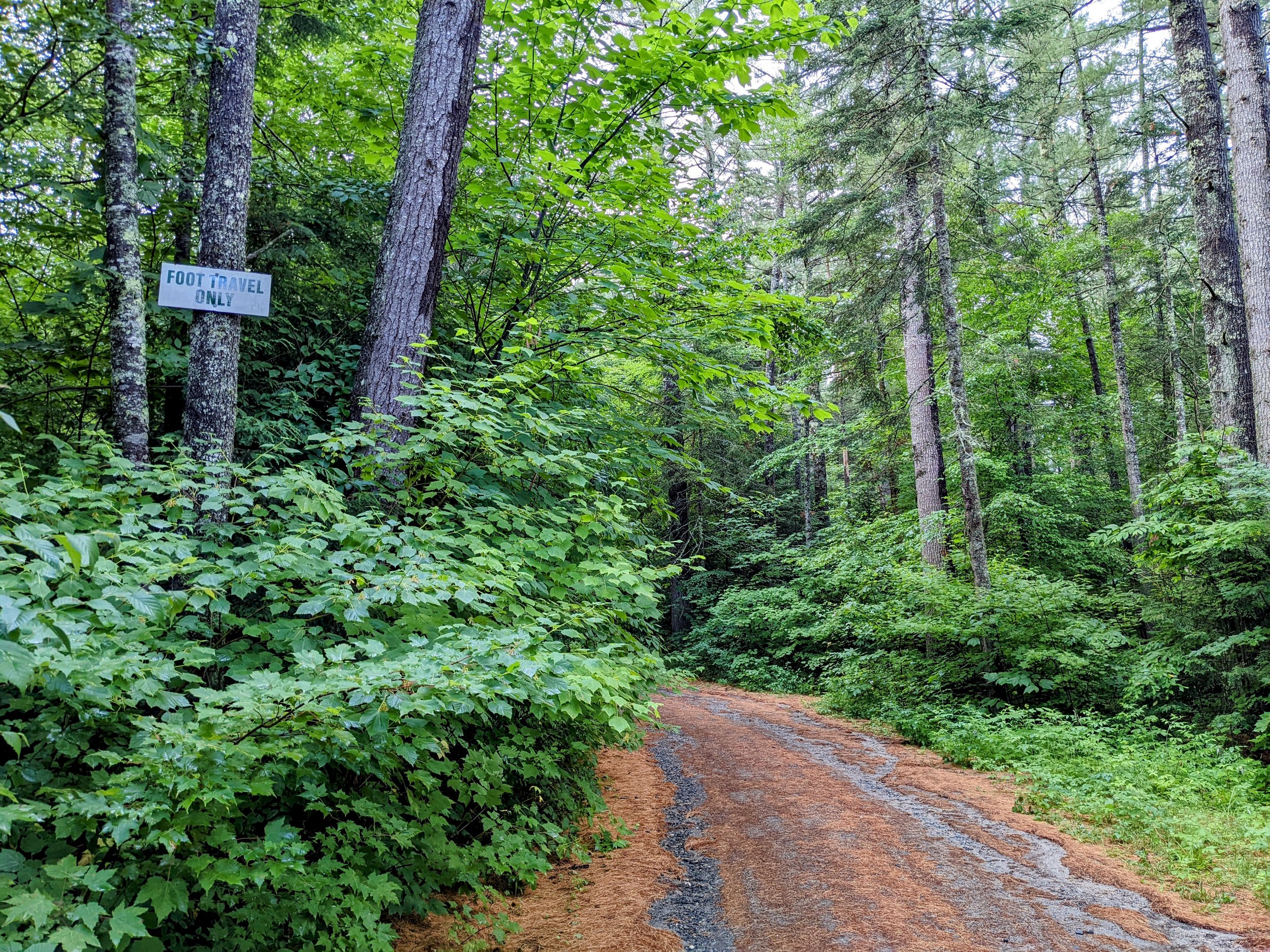
Foot Travel Only, White Mountain National Forest

Trail Split, Go Left, White Mountain National Forest

Official Trail Sign for Coppermine Trail, White Mountain National Forest

Continue Straight Alongside Coppermine Brook, White Mountain National Forest

One of Many Cascades and Pools, White Mountain National Forest

Coppermine Shelter, White Mountain National Forest

Pool at Coppermine Shelter, White Mountain National Forest

Approach View of Bridalveil Falls, White Mountain National Forest
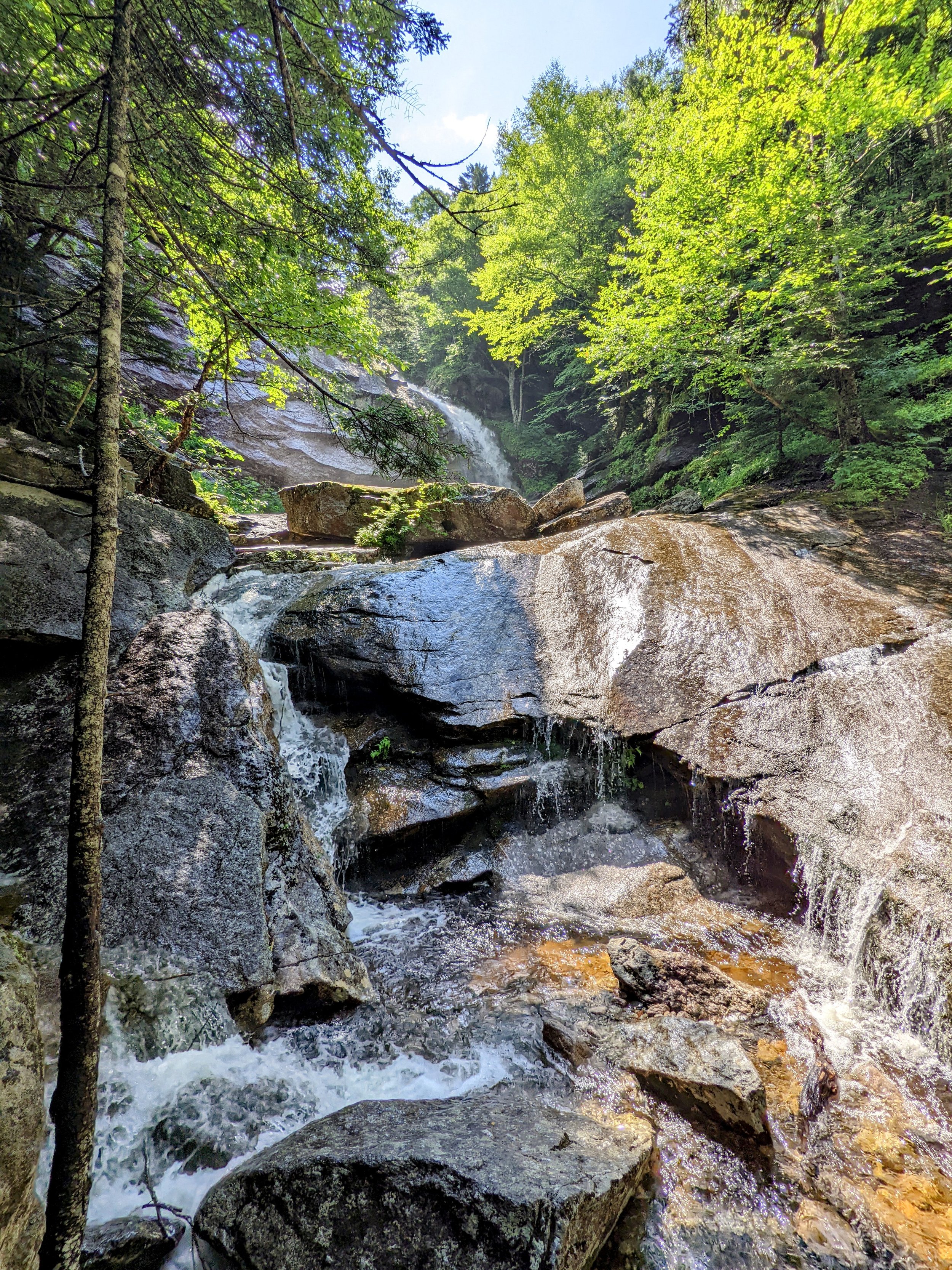
Bridalveil Falls from the Midway Up, White Mountain National Forest

Bridalveil Falls and Pool, White Mountain National Forest