Summer Paddle to Grotto Falls

Map of Grotto Falls Paddle on Grayson Lake
Overview. This was so much better than expected - and I expected it to be pretty awesome! The paddle to Grotto Falls was gorgeous with plenty of cliffs and boulders dotting the lake. And squeezing through the narrow channel before floating around the corner to have Grotto Falls revealed is the kind of thing that words can’t fully describe.
Route Type | Out and Back
Total Distance | 5 miles
Elevation Gain | 0 feet
Overall Difficulty | Easy
GPS Waypoints
Clifty Creek Boat Launch | 38.230352, -83.013781
Grotto Falls | 38.228592, -83.042442
Map of Clifty Creek Finger of Grayson Lake
Parking. Ample parking is available at the Clifty Creek Boat Launch in two lots - upper and lower. Weekends are busy here, so arrive early.
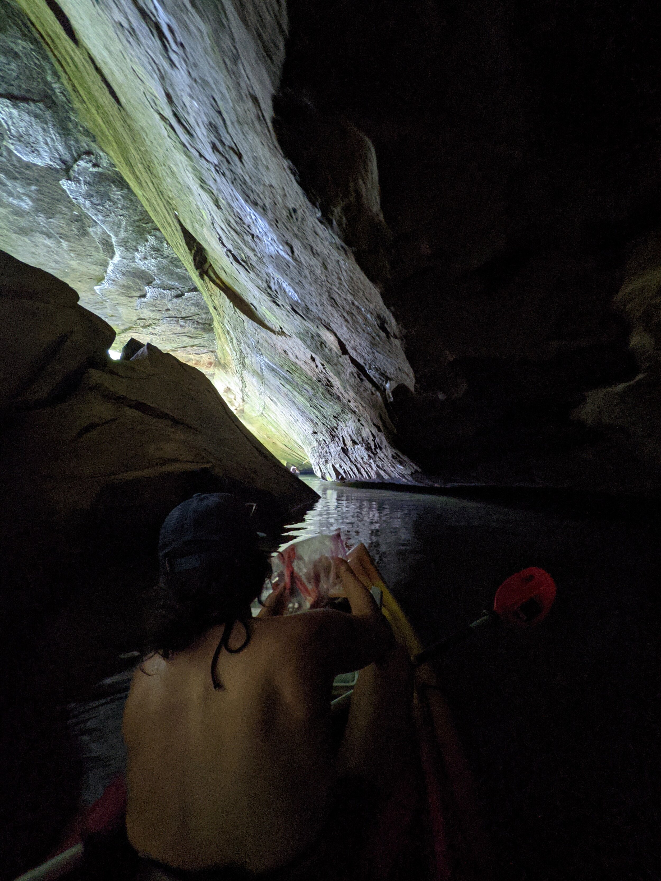
Trail Navigation. From the launch, paddle west, snaking around a few bends and taking in the views before hugging the south side of the lake. About 2 miles in, you’ll reach the narrow channel leading to Grotto Falls. Move to approach left nearest the cliff face to the southeast. Paddle under the cliff between it and the boulders to the right. Float through before having the falls reveal themselves. You can get out before the channel and walk over the boulders - just be sure to take care with your steps, as these boulders are extra slick! From here, paddle east to return to the boat launch (4 miles total) or paddle west to enjoy a little extra.
HIKER NOTE - BYO-Kayak/Canoe/SUP. There is no equipment rental at the launch, so bring your own. Rentals are available at the marina to the north, but it’s a much longer paddle from there.
HIKER NOTE - Crowds at the Falls. Weekends are crowded here and the area nearest the falls is small with a one-lane channel to navigate. Take turns, be patient, and don’t linger so others can enjoy the scene there.
HIKER NOTE - Wet Weather Waterfalls. There are a number of these along the paddle route and are best seen after multi-day, soaking rains more common in Winter and Spring.
HIKER NOTE - Sunrise/Sunset Spots. This finger has a general west-northwest orientation from the launch - making it a great area to catch sunrise or sunset.
HIKER NOTE - Option for Full Day. There are additional waterfalls around Grayson State Park with a few miles of hiking trails as well. These could be added as a long paddle/short hike day or as a pair of short paddles and short hike putting in at the state park and Clifty Creek separately.
CAUTION - Slick Rock. The rocks and boulders near Grotto Falls are super slippery, so take care with your steps and wear shoes that do well on wet rock.

Looking Up at a Wet Weather Waterfall, Grayson Lake

Lake Views, Grayson Lake

One of Many Ever Present Cliff Faces, Grayson Lake

A Split Rock Peninsula, Grayson Lake

Beautifully Eroded Sandstone Boulder, Grayson Lake

Grotto Falls, Grayson Lake

Grotto Falls 'Parking Lot', Grayson Lake
Exiting Grotto Falls Channel, Grayson Lake

Grotto Falls from the Boulders, Grayson Lake