Lick Falls Loop

Map of Lick Falls Loop, Grayson Lake State Park

Elevation Profile of Lick Falls Loop, Grayson Lake State Park
Overview. This short hike is a nice walk through three distinct forest sections that passes the top of Lick Falls. Though the falls were barely flowing, it was a nice hike through the woods to round out our trip to Grayson Lake. And, it will lead to a revisit after heavy rains when this hike is at its best.
Route Type | Lollipop
Total Distance | 3.39 miles
Elevation Gain | 493 feet
Overall Difficulty | Easy to Moderate
GPS Waypoints
Parking Lot | 38.202528, -83.028211
Turn onto Gravel Road | 38.201328, -83.028586
Trailhead | 38.201375, -83.029136
Loop Start at 4-way Intersection | 38.201639, -83.030719
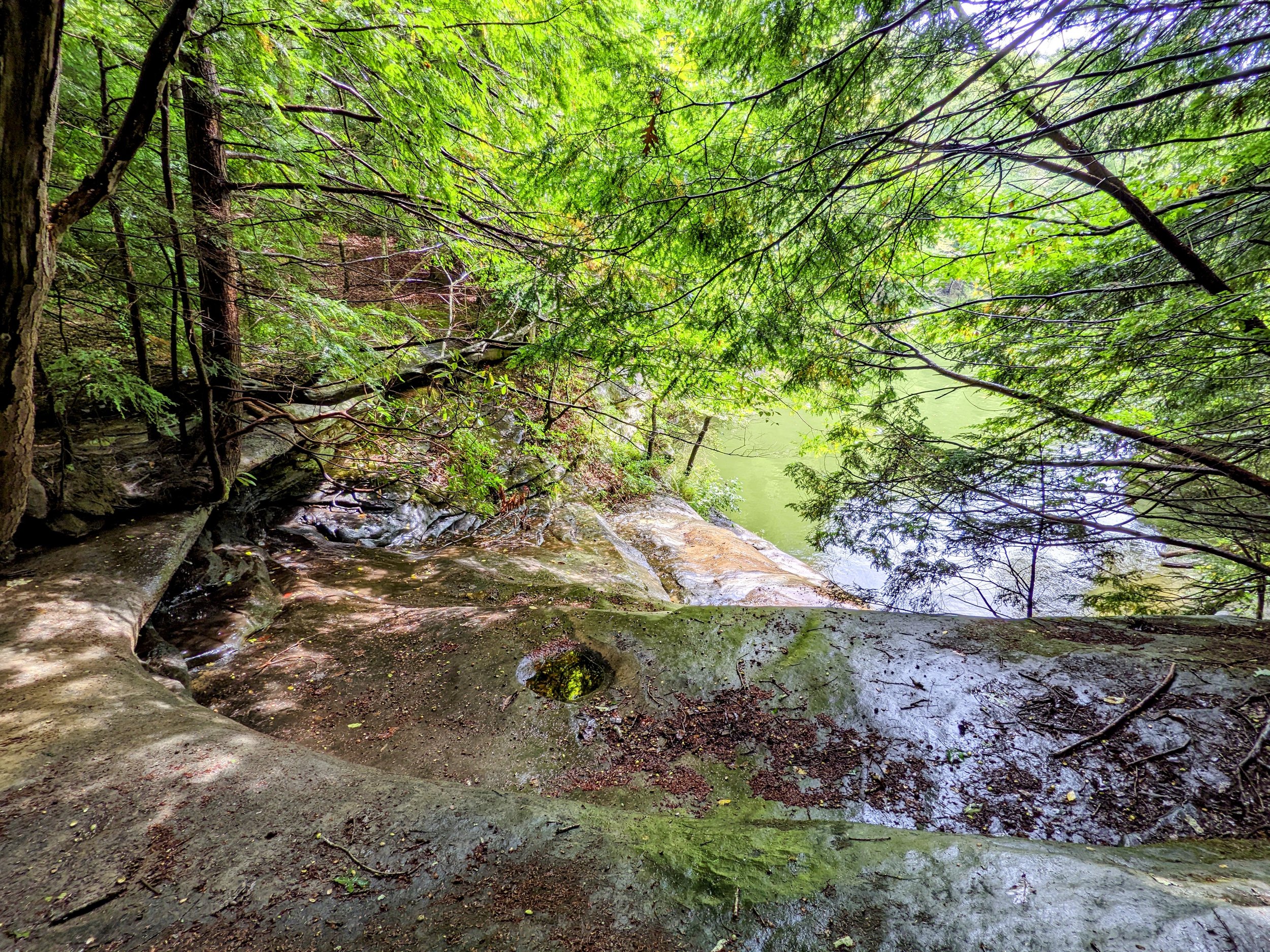
Lick Falls | 38.197808, -83.046147
Beech Hemlock T-Intersection | 38.200367, -83.030447
Grayson Lake State Park Map
Parking. Plenty of parking is available at the shelter parking lot just short of the gatehouse. Bathrooms can be found nearby at the campground.
Trail Navigation. Begin by walking the road until passing the gatehouse. Make a sharp right onto gravel road where the sign says “Trails”. Continue northwest and locate the trailhead at the forest’s edge. Take this trail straight out past the 4-way intersection and follow the orange/yellow blazes to hike the loop counterclockwise. The trail is mostly doubletrack and passes the golf course cart path a few times. Continue to follow the blazes and signs to stay on trail. As you approach Lick Falls, there is a road that crosses the creek - stay left here to stay on trail. You’ll reach the top of the falls with a handful of side trails past the falls - none of which provide a better view until after the leaves have fallen. Notice that you are at the top of a cliff here and keep children close. Continue around the loop crossing two more creeks that may have waterfalls after substantial steady rains. Eventually, you’ll come to a T intersection. Turn left (north) to reach the first trail intersection you went straight through early in the hike. Retrace your steps from here to return to the parking lot.
HIKER NOTE - Add Beech Hemlock Trail. If you’re staying at the campground, you can add 1.3-ish miles out and back to this loop. The campground trailhead is located near the far loop around sites 25-26-ish.
HIKER NOTE - Paddling for Better Views. Unlike most waterfall hikes, the base of these falls are largely out of view because they flow into Grayson Lake. For the best views after sufficient rain, grab a kayak, canoe, or SUP to see the falls from below.
HIKER NOTE - Wet Weather Waterfalls. While Lick Falls was barely flowing on our visit, a return trip in the right conditions would yield a very different result. There are one or two more wet weather waterfalls along this trail that would be far more interesting after an extended rain event.
CAUTION - Deadly Drops. Long falls from high places are the #1 non-health related cause of death for hikers in Kentucky. Keep your distance from the edges of cliffs to avoid a deadly fall. Young children should be kept close.
CAUTION - Poisonous Snakes. Copperheads and timber rattlesnakes can be found in the area. Should you encounter one, stop and slowly back away. Always give venomous snakes a wide berth. Know Before You Go => University of Kentucky Venomous Snake Guide
CAUTION - Black Bears. Ursus Americanus - a.k.a. the American black bear is growing in population throughout much of Kentucky. Know Before You Go => US Forest Service Black Bear Safety Tips

Shelter/Day Use Parking Lot, Grayson Lake State Park

Sharp Turn to the Trailhead, Grayson Lake State Park

Trailhead, Grayson Lake State Park
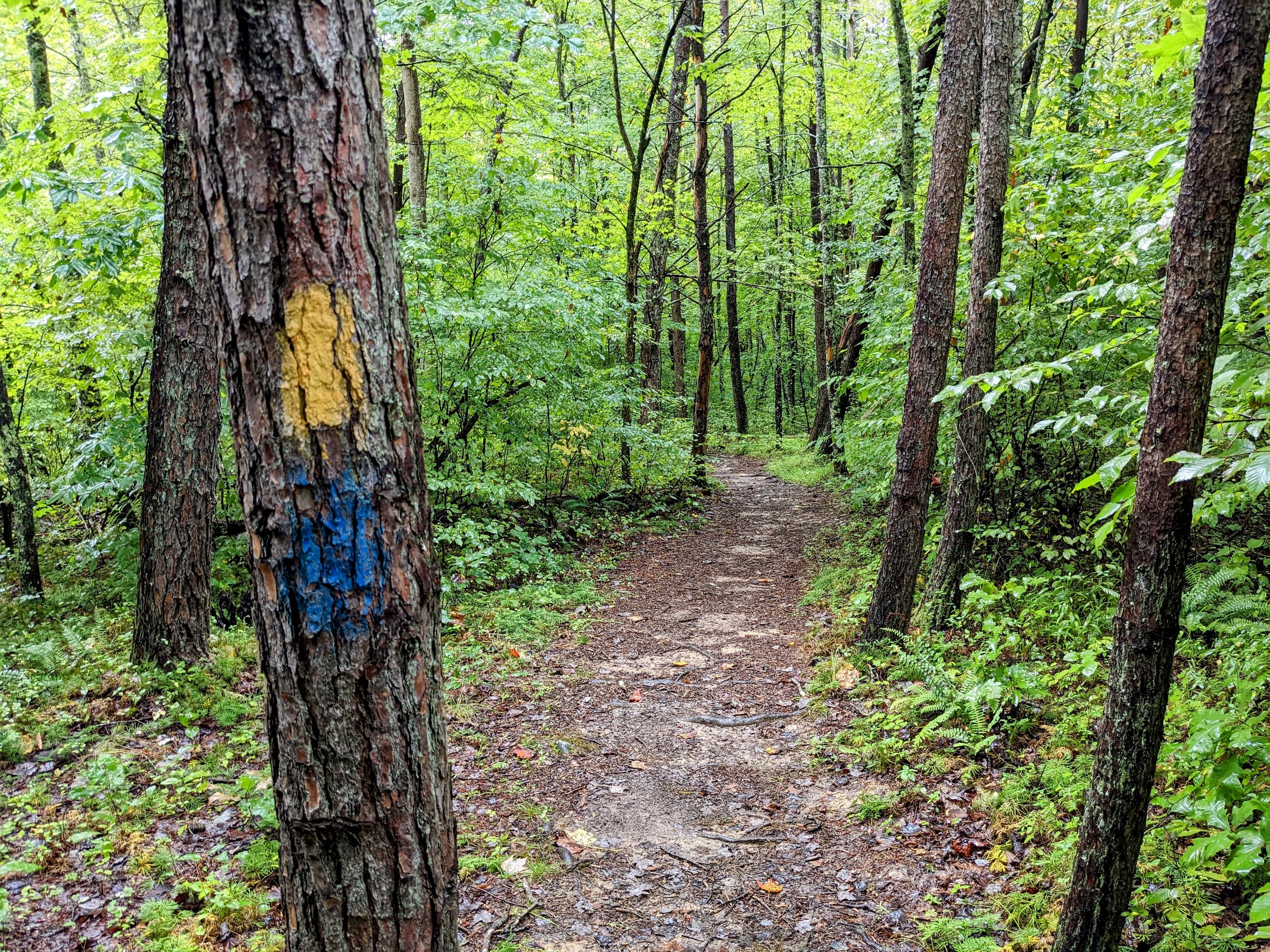
Follow the Yellow/Orange Blazes, Grayson Lake State Park

Sign at the 4-way Intersection, Grayson Lake State Park

Field Thistle, Grayson Lake State Park

Upper Lick Falls, Grayson Lake State Park

Middle Lick Falls, Grayson Lake State Park - Lower Falls Visible via Paddle

Little Sandy River Gorge/Grayson Lake, Grayson Lake State Park
Bowling Branch Wet Weather Falls, Grayson Lake State Park

Turn Left at the T and Follow the Yellow/Orange Blazes, Grayson Lake State Park