Copperas Creek Nine Arch Tour

Map of Copperas Creek Nine Arch Tour, Red River Gorge

Elevation Profile of Copperas Creek Nine Arch Tour, Red River Gorge
WARNING
This trail is on unmarked, unmaintained trails; portions of this hike are on poorly defined user trails with unstable soil/rock and a risky crawl; getting lost is possible even for experienced hikers; no cell service is available in this canyon and GPS is far from accurate; inexperienced off trail hikers should NOT attempt this hike
Overview. For arch hunters, this is a gem of a hike. For most other hikers, it’s miserable with difficult terrain, scrambling, and challenging route finding. The Copperas Creek area is home to nine arches including Hopewell, Copperas #1-4, Snow, Double Deer, and Sandy #1 and #2. And, it also has a number of waterfalls including Copperas and Big Trickle Falls on this route with others nearby.
For me, this was a phenomenal hike filled with plenty of challenge in the form of steep hiking on minimally developed user trails along with all the route finding issues commonly encountered when seeking arches in rhododendron country. Of the four spurs, three are pretty do-able for experienced hikers with the fourth being a pain in the ass for anyone of any experience level.
Route Type | Out and Back
Total Distance | 5.53 miles
Elevation Gain | 866 feet
Overall Difficulty | Strenuous with Scrambles and Difficult Route Finding
GPS Waypoints
Trailhead | 37.820917, -83.575719
Turn #1 to Hopewell Arch | 37.826928, -83.576031
Turn #2 to Hopewell Arch | 37.826561, -83.576850
Hopewell Arch | 37.827139, -83.577722
Turn to Copperas Arches | 37.830792, -83.576089
Copperas Arches 1-4 | 37.831550, -83.573841
Turn #1 to Snow and Double Deer Arches | 37.830775, -83.576314
Ascent to Snow and Double Deer Arches | 37.831597, -83.578261
Snow Arch | 37.832108, -83.579722
Double Deer Arch | 37.832003, -83.580100
Turn to Sandy Arches, Big Trickle Falls | 37.840147, -83.572836
Sandy Arches, Big Trickle Falls | 37.839819, -83.572361
Copperas Falls | 37.841056, -83.571528
Parking. Limited roadside parking is available at the trailhead and at the Osborne Bend Trailhead a short walk away. This area routinely fills up on weekends, so be sure to arrive early in the day to grab a spot.
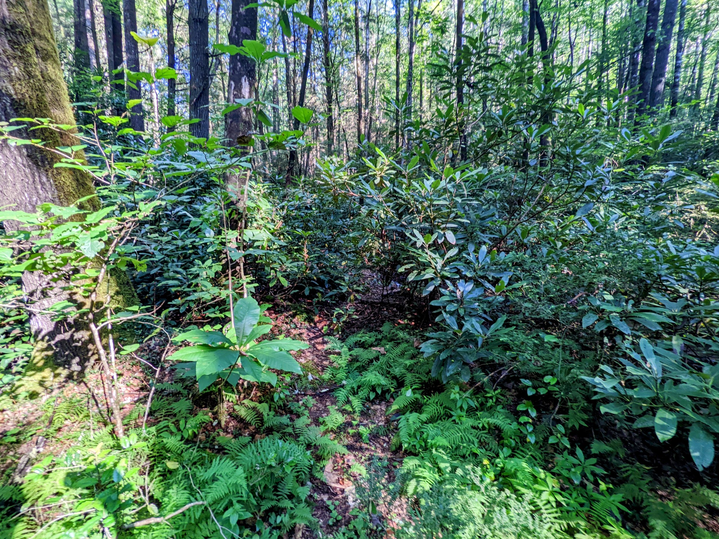
Trail Navigation. The gist of navigating this hike is a main out and back along the creek with four spurs to the various arches. HOWEVER, not all of these arch spurs are equally navigable with the route to Snow and Double Deer Arches being the least traveled and most poorly defined. ONLY long experienced off trail hikers should attempt this hike. Again, ONLY long experienced off trail hikers should attempt this hike. One more time, ONLY long experienced off trail hikers should attempt this hike. That said, Copperas Creek will be incorporated into the official trail system at Red River Gorge and presently is a spaghetti trail - meaning that many trails meander back and forth, crossing over one another, but generally leading to the same destination. As such, inexperienced hikers often report getting ‘lost’ because of so many trails. It’s hard to actually get lost on a creek hike like this - just pick a path and stay close to the creek until reaching the falls. HOWEVER, the spurs are a different story. I did each spur as they appeared off the main route - Hopewell, Copperas, Snow/Double Deer, and finally, Sandy. The path to Hopewell continues to grow in definition with a single route up to the arch. The path to Copperas Arches has two entry points that merge as the hike-able area thins on the ascent. The path to Snow and Double Deer Arches is essentially the drainage across from the campsite at the foot of Copperas Arches. This spur is particularly challenging, so be careful with your footing and route finding. Walk the drainage until reaching the waypoint and make your ascent from there. Take the trail on approach right of the big boulder and continue walking the most well trod trail as it presents itself. There is no rock scrambling until the final approach to Double Deer that requires a crawl with clifftop inches away. The spur to Sandy is hard to find thanks to rhododendron cover, but once found, the path is quite clear. Take all the spurs or none of them - this is a beautiful area either way. If you do not have map, compass, GPS, and experience using them off the beaten path, you will get lost or worse. Just remember that it is a creek, so following drainages downhill will get you back to the main trail. The bigger concern is injury on these spurs. You can’t call for help on your phone and your voice won’t carry far enough for anyone to hear you. Hike with an equally experienced partner and take particular care with your footing to avoid a fall or slide that is only one misplaced step away.
HIKER NOTE - Dry is Best. It rained enough to create horrible humidity and fill up the falls prior to my visit, but not enough to make footing extra treacherous. I suggest hiking this after a dry spell to make footing a little easier. Please avoid hiking this when the side trails are saturated, as this causes a higher degree of erosion. AND, looking at some of the vegetation, please go a little easier on the plant life. Use trekking poles and trail shoes/boots with grip to provide traction instead of putting full weight on rhododendron and small trees. Without these plants and trees to stabilize the soil, the trails will erode quickly until reaching bedrock that may or may not be hike-able.
HIKER NOTE - Easiest to Hardest Spurs. You need not visit all or any of these spurs to these arches, as Copperas Falls is a great destination all by itself. If you choose to visit these arches, here is the order from easiest to hardest:
Sandy Arch (easiest)
Copperas Arches
Hopewell Arch
Snow and Double Deer (hardest)
HIKER NOTE - Hopewell Arch Spur. This requires scrambling up large rocks and a dicey transition immediately below the arch. Those in good physical shape should be able to navigate this with relative ease. Also, advantage for height here - the taller you are, the easier the scrambling.
HIKER NOTE - Snow and Double Deer Arches Spur. This is by far the most difficult due to steepness of terrain, loose soil and rock, challenging route finding, and a false high route. Do NOT take the high route that leads to downed trees and washed out user trail. Stay in the drainage or immediately adjacent until reaching the waypoint that begins the ascent. The crawl gives advantage to short folks; I suggest removing your pack to avoid hitting the rock above and knocking yourself off balance.
CAUTION - Deadly Drops. Long falls from high places are the #1 non-health related cause of death for hikers in Kentucky. Keep your distance from the edges of cliffs to avoid a deadly fall. Young children should be kept close.
CAUTION - Poisonous Snakes. Copperheads and timber rattlesnakes can be found in the area. Should you encounter one, stop and slowly back away. Always give venomous snakes a wide berth. Know Before You Go => University of Kentucky Venomous Snake Guide
CAUTION - Black Bears. Ursus Americanus - a.k.a. the American black bear is growing in population throughout much of Kentucky. Know Before You Go => US Forest Service Black Bear Safety Tips

Copperas Creek Trailhead

Turn #1 to Hopewell Arch
Turn #2 to Hopewell Arch - Turn sharply and move uphill here

Scramble to Hopewell Arch

Hopewell Arch Approach View

Hopewell Arch from South Side

Hopewell Arch from North Side

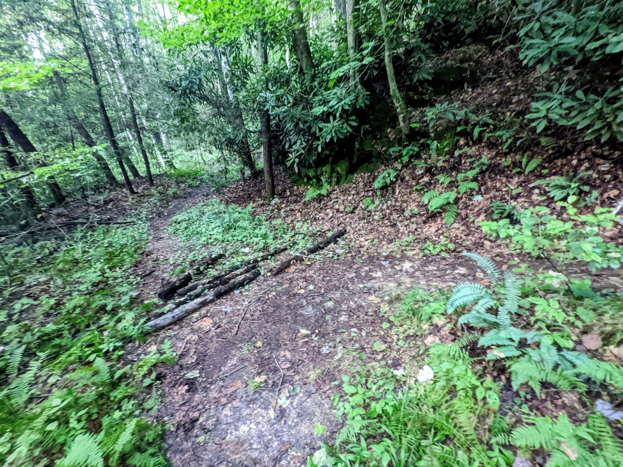
Campsite at Junction with Copperas Side Trail - Find the path past this campsite and move uphill
Copperas Arch #2
From Inside Copperas Arch #2

Copperas Arch #3
Back Side of Copperas Arch #3

Copperas Arch #1

Copperas Arch #4

Big Trickle Falls
Turn to Snow and Double Deer Arches - This path is between two drainage intersections, follow the creek to the next drainage intersection - do NOT take the high route

Drainage Intersection - this begins the arduous ascent to the arches just past this cascade

Go right of this boulder to stay on route

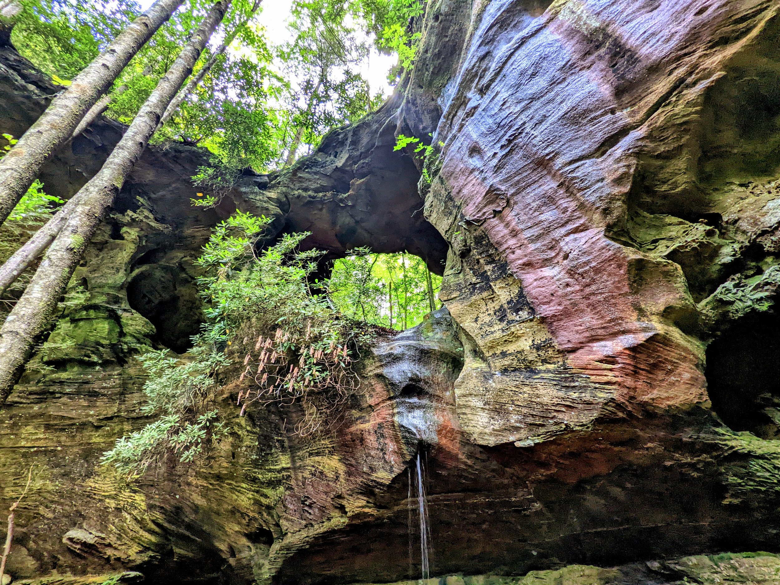
Snow Arch

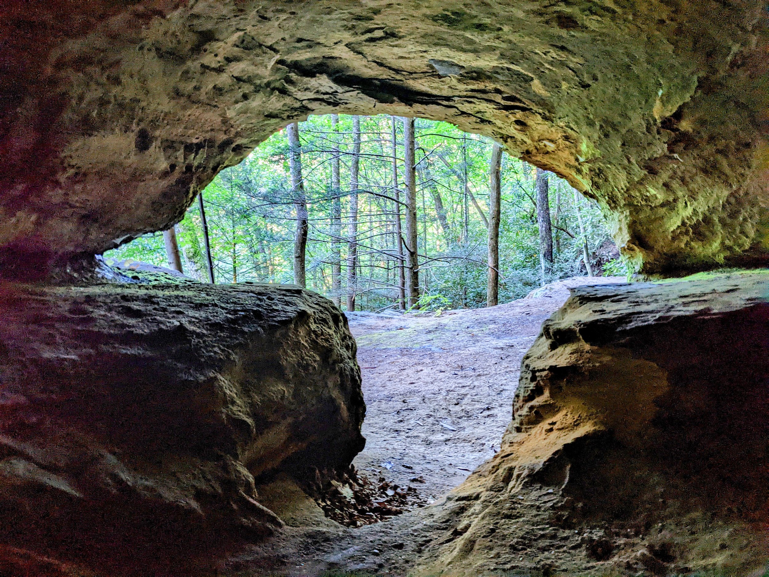
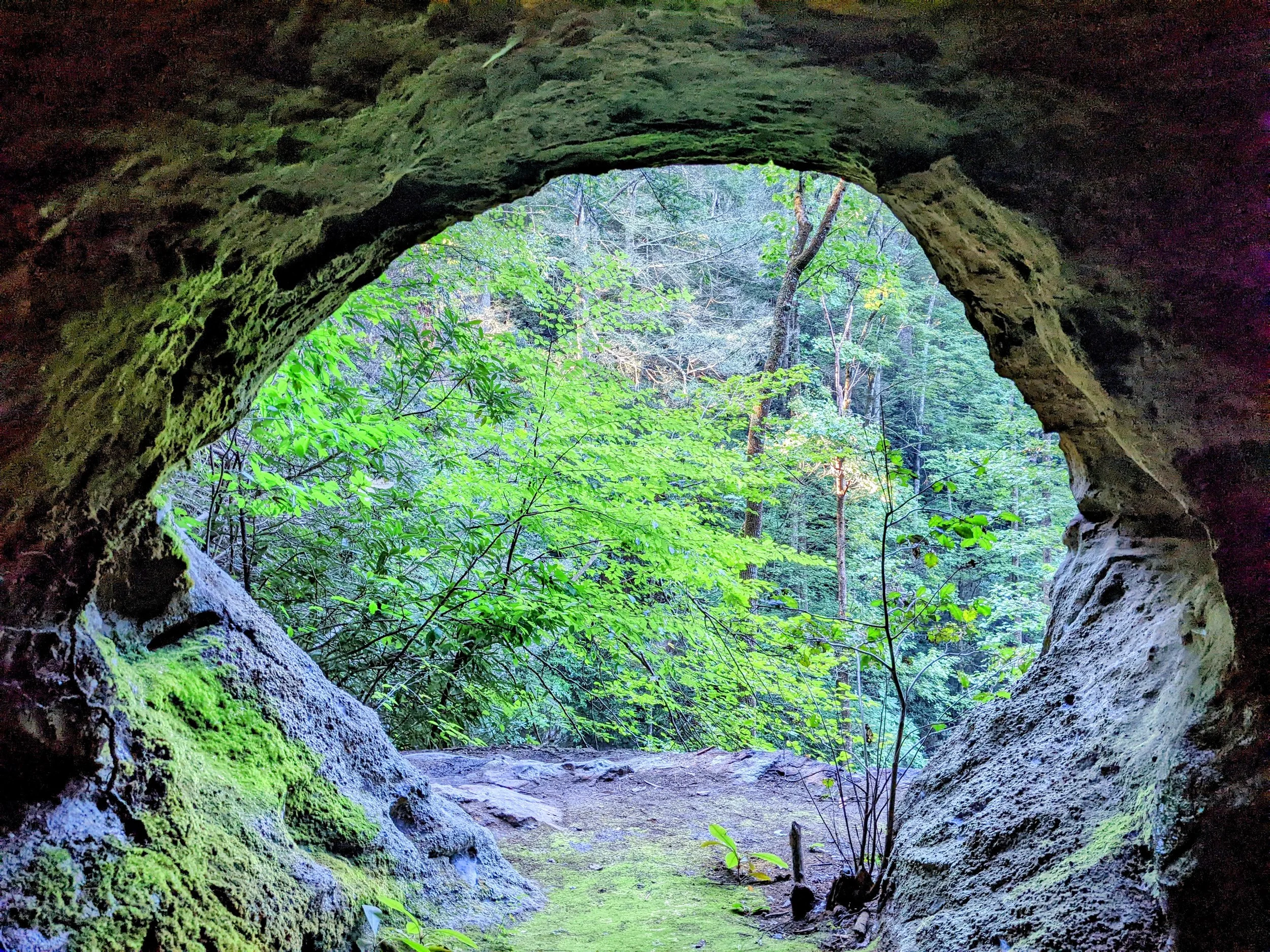
Snow Arch Window

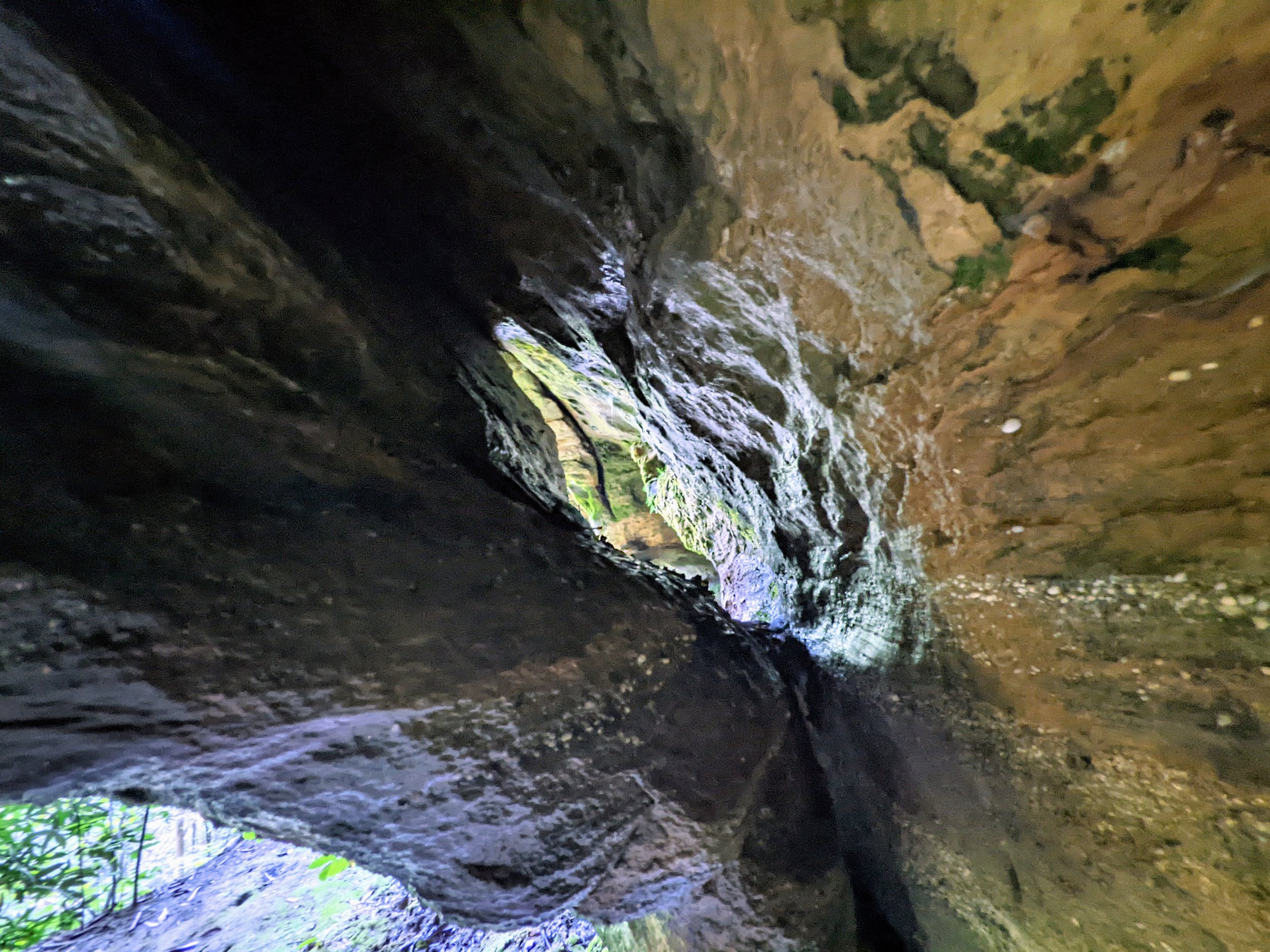
Looking Up at Snow Arch on Approach to Double Deer

Crawling Required, Major Injury or Death Over the Cliff

Double Deer Arch, Beautiful Geometry

Teeny Tiny Copperas Creek Falls

Turn to Sandy Arch

Sandy Arch Window (not a window, full grown arch despite the name)
Sandy Arch

Copperas Falls

Plunge Pool at Copperas Falls