Buzzards Roost South and Keystone Arch
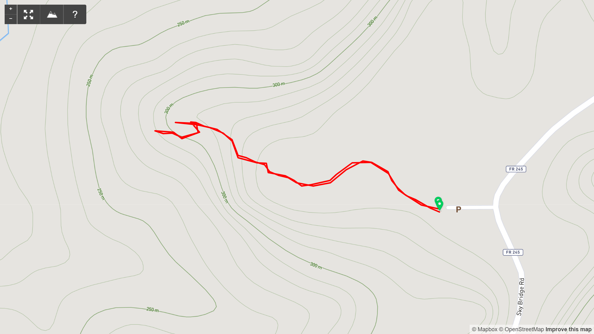
Map of Buzzards Roost South, Red River Gorge

Elevation Profile of Buzzards Roost South, Red River Gorge
Overview. This short, but spicy hike delivers a great view perched above the river and some fun scrambling at Keystone Arch. I rated this as moderate because it’s a good bit of elevation gain at >300 ft/mile, and the scramble does require a modicum of fitness.
Route Type | Out and Back
Total Distance | 0.47 miles
Elevation Gain | 170 feet
Overall Difficulty | Moderate with Class 3/4 Scramble
this hike is unmarked, but easy to navigate
GPS Waypoints
Unmarked Trailhead | 37.816219, -83.585164
T-Intersection | 37.816675, -83.586058
Keystone Arch Scramble | 37.816972, -83.587919
Buzzards Roost South | 37.816969, -83.588511
Red River Gorge Area Map
Parking. Ample parking is available at the Sky Bridge Picnic Area that is rarely full.
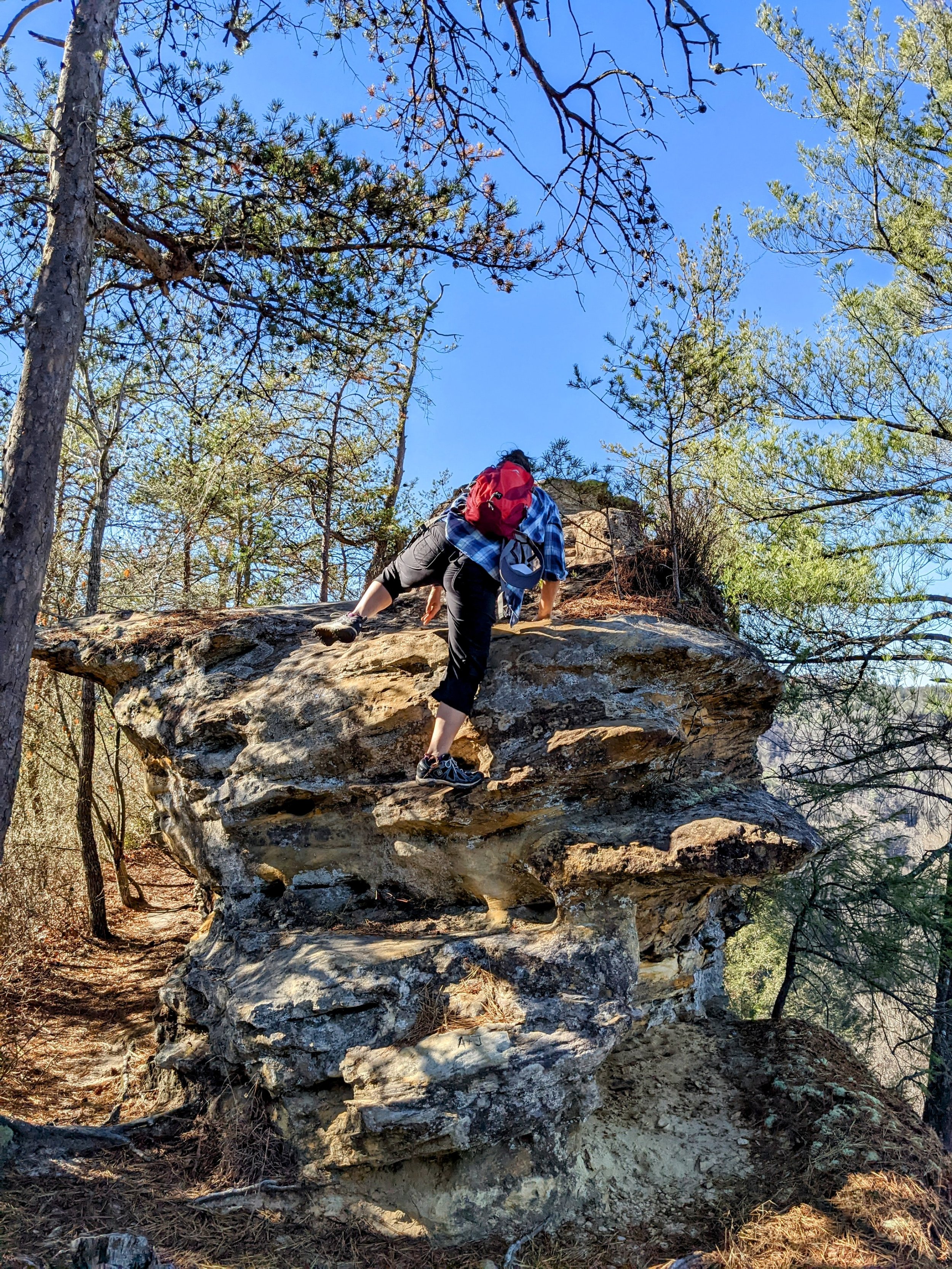
Trail Navigation. Though unmarked, this is relatively easy to navigate. Locate the unmarked trailhead at the far end of the parking lot and head generally west toward the overlook. Come to a T intersection and go left to begin descending. Reach the exposed rock section and notice a nice view southwest before crossing atop the scramble. Walk out to the end of this for another nice view. Return to the scramble section, make your way down and turn right to reach Buzzards Roost South. The final bit to the roost can be a bit scary if you’re not completely comfortable being atop a vertical wall with serious consequences for missteps. Retrace your steps to return to the parking lot.
CAUTION - Class 3/4 Scramble. You’ll need to use all four limbs to negotiate the scramble that leads to the roost, and a tumble here can result in death - thus the Class 4 part for exposure risk. It is manageable, however, without too much trouble for experienced hikers.
CAUTION - Deadly Drops. Long falls from high places are the #1 non-health related cause of death for hikers in Kentucky. Keep your distance from the edges of cliffs to avoid a deadly fall. Young children should be kept close.
RULE REMINDER - Day Use ONLY. No camping is permitted here - and that’s a good thing. Rather than clogging up parking with campers and backpackers, you’ll find plenty of spots early morning and late afternoon even on busy weekends.
CAUTION - Poisonous Snakes. Copperheads and timber rattlesnakes can be found in the area. Should you encounter one, stop and slowly back away. Always give venomous snakes a wide berth. Know Before You Go => University of Kentucky Venomous Snake Guide
CAUTION - Black Bears. Ursus Americanus - a.k.a. the American black bear is growing in population throughout much of Kentucky. Know Before You Go => US Forest Service Black Bear Safety Tips

Unmarked Trailhead at Far End of Picnic Area Parking Lot

Left at the Fork

Left at the T-Intersection
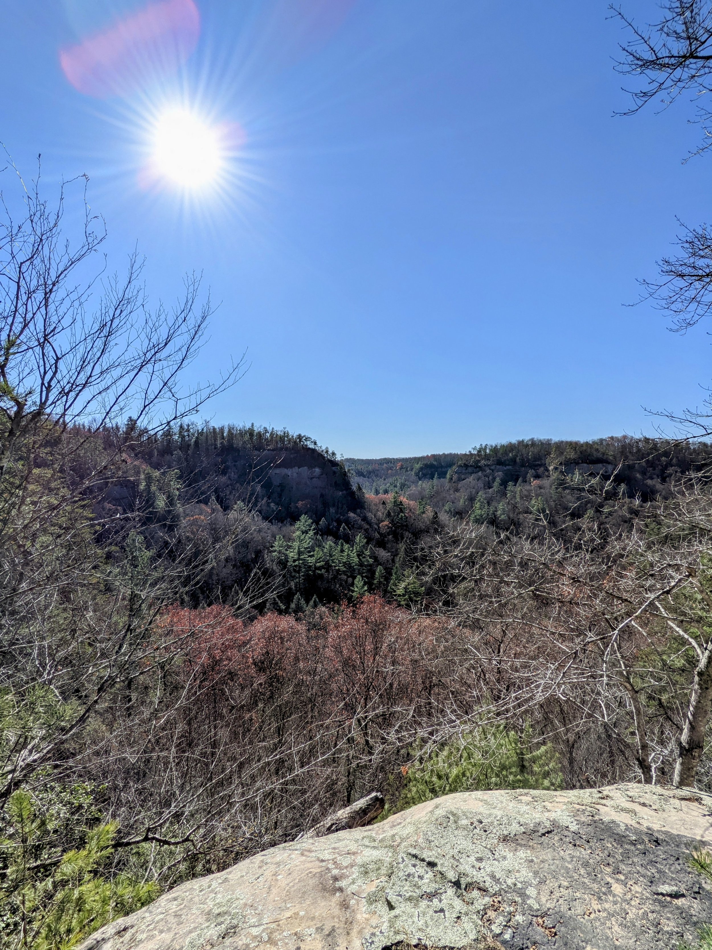
First View on the Way to the Roost

Walking to the Upper View
Optional Scramble

View North from Short of the Roost

Keystone Arch - Scramble Down Here to Reach the Roost

Buzzards Roost South