Mt. Jackson and Mt. Pierce Loop and Spurs

Map of Mt. Jackson-Mt. Pierce Loop, White Mountain National Forest

Elevation Profile of Mt. Jackson-Mt. Pierce Loop, White Mountain National Forest
Overview. This hike has all the beauty of the Whites - clifftop overlooks, mountaintop vistas, and a relaxing waterfall. While this is a strenuous hike, it rates on the easier side of things when compared to other high peaks in the region. The views from Mt. Pierce are particularly impressive with Mt. Eisenhower in the foreground and Crawford Path weaving its way up to Mt. Washington.
Route Type | Loop and Spurs
Total Distance | 8.53 miles
Elevation Gain | 2,973 feet
Overall Difficulty | Strenuous with Class 2 Scrambles
GPS Waypoints
Webster-Jackson Trailhead | 44.215147, -71.407889
Turn to Elephant Head | 44.215981, -71.406761
Elephant Head | 44.213592, -71.406289
Turn to Bugle Cliff | 44.212422, -71.401653
Bugle Cliff | 44.212186, -71.401931
Webster-Jackson Split | 44.205614, -71.392933
Mt. Jackson Summit | 44.203169, -71.375489
Mizpah Cutoff Split (high) | 44.219426, -71.370104
Mizpah Spring AMC Hut | 44.219419, -71.369633
Mt. Pierce Summit | 44.226819, -71.365756
Crawford Path Split | 44.227414, -71.364992
Mizpah Cutoff Split (low) | 44.225917, -71.371739
Turn to Gibbs Falls | 44.221167, -71.403606
Gibbs Falls | 44.221372, -71.403558
Crawford Connector Split | 44.220844, -71.406486
Crawford Path Trailhead | 44.219861, -71.409969
Parking. Expansive parking is available at the AMC Highland Center or along US-302. We opted to park at the rail platform across the street.
Trail Navigation. This hike is on extremely well marked and well signed trails. In a nutshell:
Webster-Jackson Trailhead on US-302
Elephant Head Spur Out and Back
Bugle Cliff Spur Out and Back
Left at Webster-Jackson Trail Split (left for Jackson, right for Webster)
Summit Mt. Jackson
Left at Webster Cliff Trail
Mizpah Hut Spur Down
Depart Mizpah Hut and Ascend Steeply
Summit Mt. Pierce
Left to Descend Crawford Path
Gibbs Falls Spur Out and Back
Crawford Path Trailhead on US-302
HIKER NOTE - Counterclockwise. This hike is much easier counterclockwise thanks to the amount of Class 2 scrambling on the upper portion of Webster-Jackson Trail. This trail tip was given to us by Steve Smith at Mountain Wanderer Book and Maps in Lincoln, NH. Steve is one of the editors of the AMC White Mountain Guide that every hiker visiting this area should own. And, you should visit this store to pick-up guidebooks, maps, and route beta from Steve.
CAUTION - Be Bear Aware. Black bear are plentiful in the region. Know Before You Go => US Forest Service Black Bear Safety Tips
CAUTION - Moose. Be aware and never approach moose. Leave a wide berth and turn back if needed.

Roadside Parking at the Train Station on US-302, White Mountain National Forest

Path to Webster-Jackson Trailhead, White Mountain National Forest

Webster-Jackson Trailhead, White Mountain National Forest

Split to Elephant Head, White Mountain National Forest
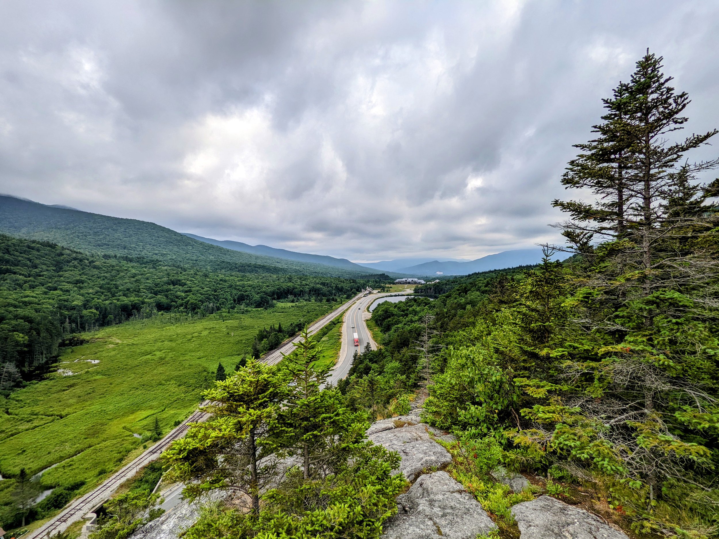
Northerly View from Elephant Head, White Mountain National Forest

View of Crawford Notch from Elephant Head, White Mountain National Forest

LaFonda Ready to Rock;-)

Split to Bugle Cliff, White Mountain National Forest

Northerly Views from Bugle Cliff, White Mountain National Forest

Mt. Willard from Bugle Cliff, White Mountain National Forest

Webster-Jackson Split - Left for Jackson, Right for Webster

AMC Trail Crew Making Drainage Adjustments on Webster-Jackson Trail

Morning Vibes from an Eight Legged Friend

Alpine Zone Rules, White Mountain National Forest

Lord Colonel Bork Makin’ Moves

Lord Colonel Bork Making Bigger Moves

Mt. Willard from the Summit of Mt. Jackson with Mounts Willey, Field, and Tom in the Background

Webster-Jackson/Webster Cliff Trail Split at the Top

Mounts Willey, Field, and Tom with Willard Shining in the Fore

Clouds Starting to Break

LaFonda and Bork Looking at the Terrain Ahead

Crossing a Highland Bog

Incredibly Lush Greenery Between the Peaks

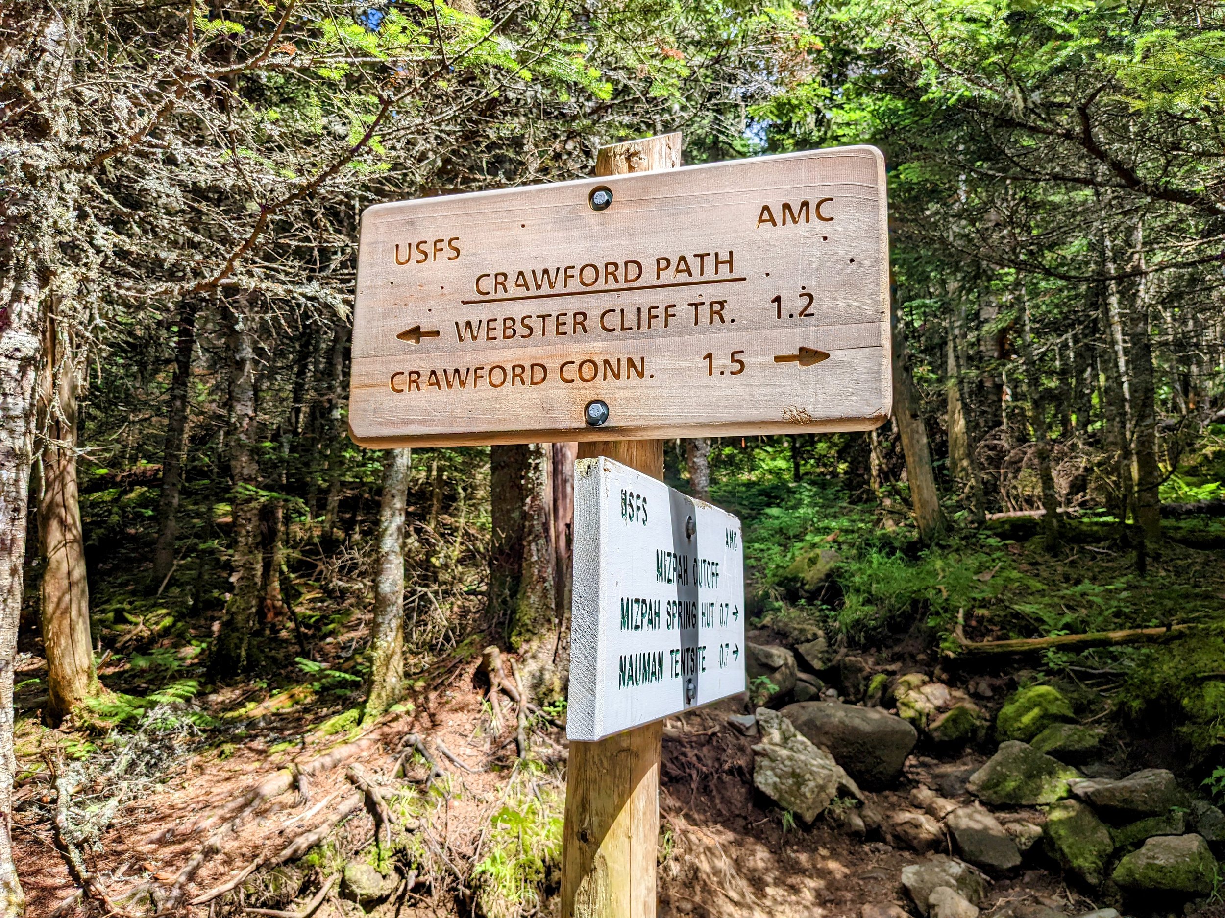
Split to AMC Mizpah Hut
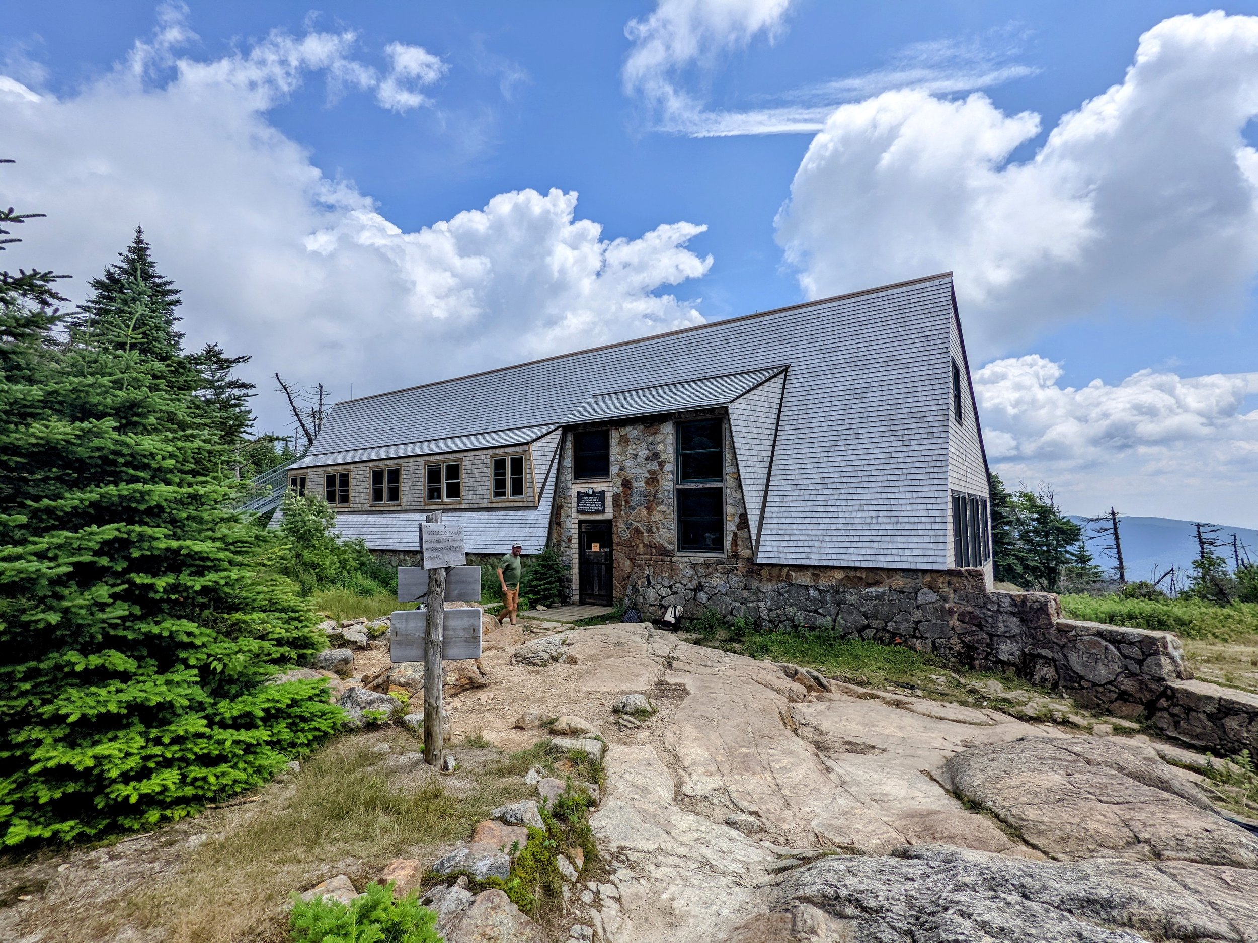
Mizpah Hut - Mizpah is Hebrew for Watchtower

Hot Split Pea Soup and Bread at AMC Mizpah Hut

Trail Signs Outside the Hut
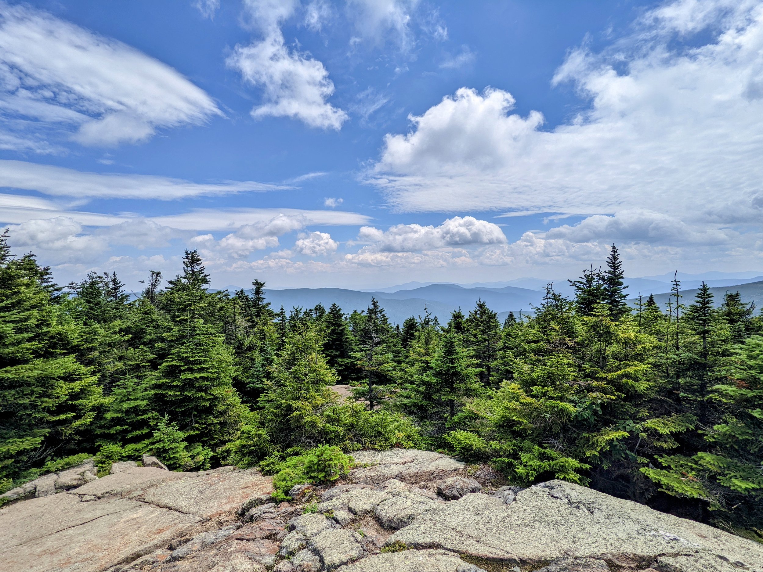
Views Along the Ridgeline
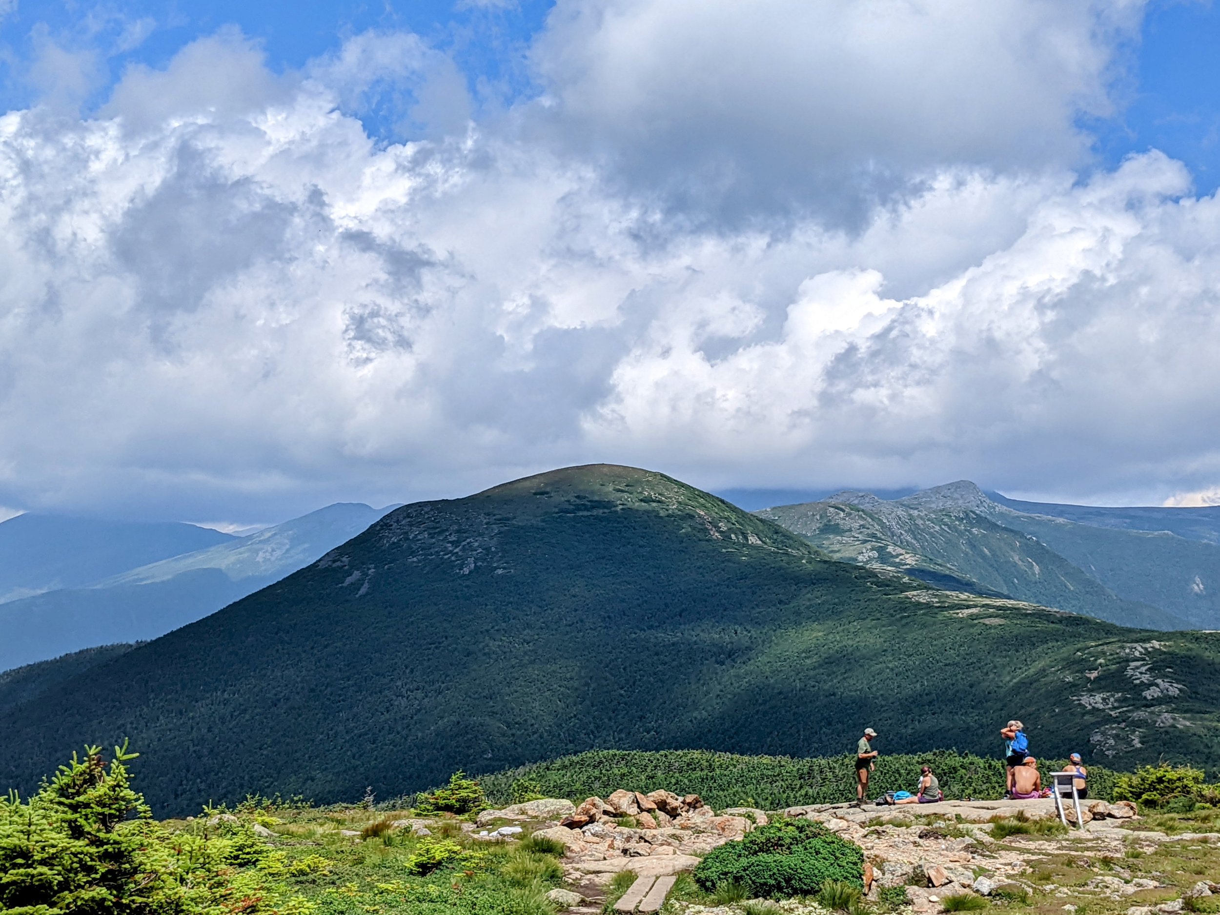
Mt. Eisenhower from Mt. Pierce

The Crawford Path in the Presidential Range

Trail Split Near the Top of Mt. Pierce

Looking Out to Our Post-Hike Destination - The Omni Mount Washington Hotel

Views of the Presidential Range and Forest Expanse
Crawford Path-Mizpah Cutoff Low Split

AMC Hut Resupply on a Wood Frame Pack

Turn to Gibbs Falls

Gibbs Falls

Split to Parking Lot or US-302

Trailhead Sign for Mizpah Spring Hut

Crawford Path - the Oldest Trail in America

Crawford Path Trailhead

Stairs to Crawford Path Trailhead

Saco Lake and US-302